 Tuesday February 6 2018
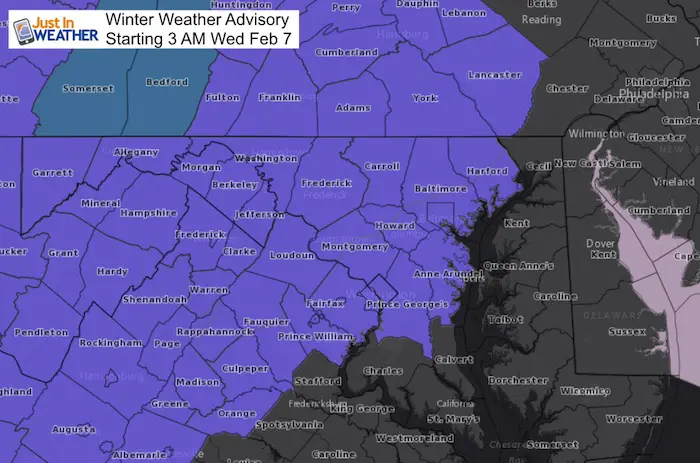
A Winter Weather Advisory has been issued for Wednesday February 7 starting at 3 AM. One thing for sure this winter is that we have been seeing repeating patterns with weather events and this is going to try and repeat what we had this past Sunday. That is not to suggest an exact duplicate, but we will have snow and ice arrive in the morning with cold ground that will support stickage and icing. The toughest part of ice events is pinning down the thaw time. The best suggest now is the we can plan on an icy morning and improvement from noon and beyond. So this will be a challenge for the call on school delays, but it may be best to air on the side of caution just in case this starts after the normal call for the busses (5 AM). See the radar simulation and temperature break down below:
Stats For February 6
Normal High: 43ºF
Record High: 72ºF in 2008
Normal Low: 25ºF
*Former Record Low: +1ºF in 1895
Snow Record: 16.0″ in 2010
Seasonal Snow To Date (at BWI): 6.5″
Sunrise: 7:08 AM
Sunset 5:32 PM
*Daylight = 2:12 longer than yesterday
*Bay Water Temperature = 34ºF at Thomas Pt. Light House
Keep In Touch All Winter
Click here to sign up for email alerts…. Just in case you don’t get the post on your social media feed
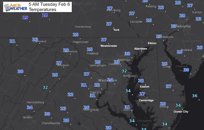
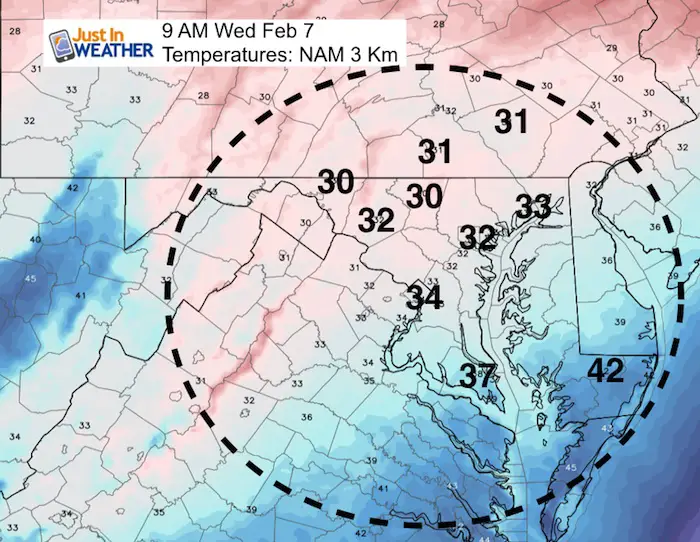
Temperatures at 5 AM
Storm Set Up
Cold air is flowing in today along with some flurries far west and north. That will feed in some cloud cover and limit the solar warming on the roads….
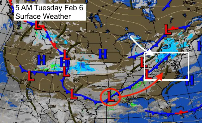
The storm we are watching is along the Texas/Louisiana border and will feed needed Gulf moisture our way. Warmer air will try to win, but will have to fight the fresh cold air mass.
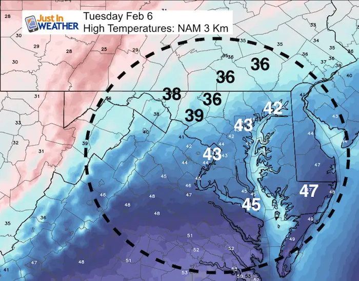
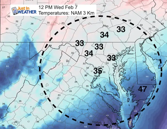
High Temps Today
While we will rise above freezing, there will not be enough heat to warm the ground substantially today.
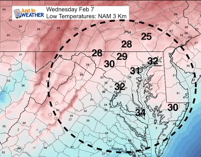
Low Temperatures Tonight
Overnight temperatures will drop below freezing and enhance the cold ground to support stickage and icing when the next event arrives.
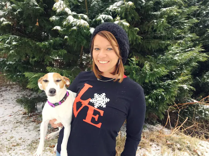
L❄️Ve Snow ❤️
My Fiancée Shannon is showing our L❄️VE Shirt. Order this week and these will arrive in your hands before Valentines Day. Proceeds help the start-up of our new program for Pediatric Oncology Patients. The big announcement is just two weeks away. Click here or on the photo to see more…
Radar Simulation- Timing the Snow and Ice Wednesday
The Winter Weather Advisory begins at 3 AM, but the suggestion here is to watch for 5 and 6 AM for the arrival of the first wave of snow and sleet. Then the wintry mix will develop during the morning and last through noon. This is the tough timing for the thaw like we just saw… Sunday. Cold tends to hold longer for inland valleys. That is why the thaw time is a broad brush around and after ‘noon’.
—> slider
[metaslider id=57687]
Track The Temperatures
Snow Potential
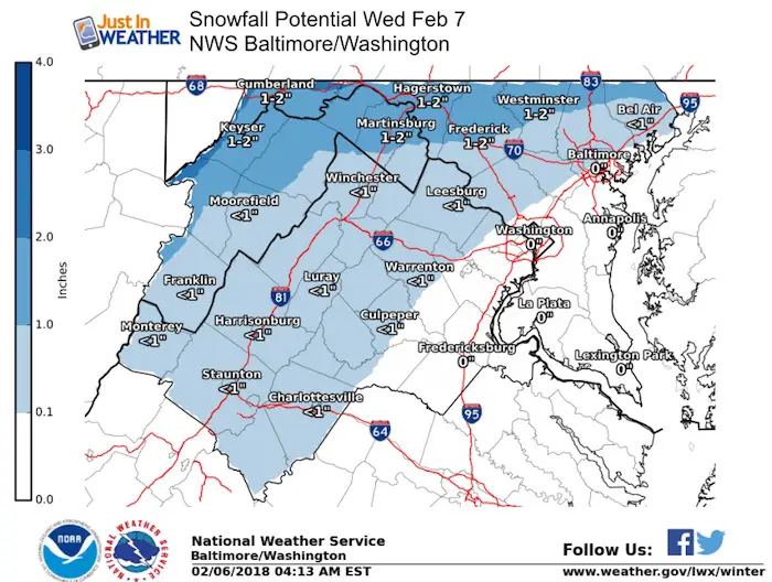
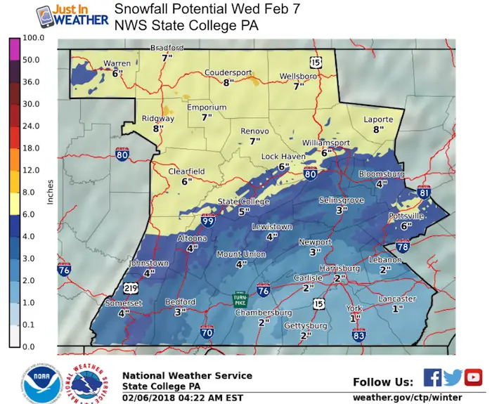
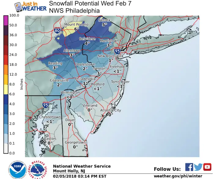
This will NOT be a heavy snow event, but the colder locations could once again get between 1 and 2 inches…. The icing is going to be the main problem
I will post my map later, but here are the NWS Regional Forecast Maps
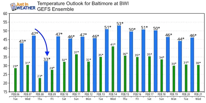
Temperature Outlook
We do have a warmer pattern for mid month… But I see another chance of cold air arriving for the last week of February and into March. Winter is not done yet…
Please share your thoughts, best weather pics/video, or just keep in touch via social media
-
Facebook: Justin Berk, Meteorologist
-
Twitter: @JustinWeather
-
Instagram: justinweather
Keep In Touch All Winter
Click here to sign up for email alerts…. Just in case you don’t get the post on your social media feed
 Get the award winning Kid Weather App I made with my oldest son and support our love for science, weather, and technology. Our 3 year anniversary of the release and our contribution to STEM education is this November. It has been downloaded in 60 countries, and works in both temperature scales. With your support we can expand on the fun introduction to science and real weather.
Snowstix- We Need You To Measure Snow Too
We are giving 10% of each sale to programs that benefit pediatric oncology patients.

FITF Gear

Keep In Touch All Winter
Click here to sign up for email alerts…. Just in case you don’t get the post on your social media feed
Also See:
My Winter Outlook 2017-2018 for more snow
La Nina Formed: What it could mean to our winter
NOAA Winter Outlook: Not The Best But Not The Worst For Snow
Two Farmers Almanacs Winter 2018 Outlooks
Winter Weather Folkore: Suggestions from Animals and Crops
First Frost and Freeze Dates For Maryland (southern PA and northern VA)
My Preliminary Winter Outlook Notes
Low Snow Winters In Baltimore: To Repeat Or Not Repeat
NOAA Ranks Blizzard 2016 4th Worst Snowstorm On Record
Blizzard 2016 Record Top Snowstorm: Area Totals
Extreme Weather of 2015 balanced out on both ends