 Monday February 5 2018
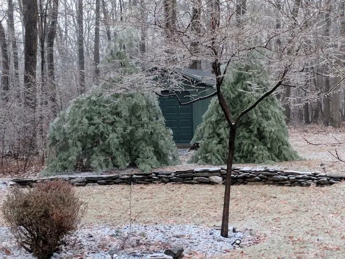
I hope you saw my report before the Super Bowl because it became obvious that the temperatures were staying cold and the big thaw was not going to happen. Ice build up enough for some trees and power lines to drop and there have been power outages. In addition the road surfaces are colder than the air, which is right around freezing in many areas. The coldest happened to be Anne Arundel County Maryland since they cleared out sooner, but many areas are catching up.
Many area schools have delayed their openings. Please be careful if you have to drive to work. Even if your car thermometer is above 32ºF, there may be bridges and overpasses that are icy.
A push of arctic air is on the move, so in addition to the cooling that took place with some clearing skies, we will all get into an air mass that will drop into the 20s today.
Stats For February 5
Normal High: 43ºF
Record High: 73ºF in 1991
Normal Low: 25ºF
*Former Record Low: -1ºF in 1996
Snow Record: 9.0″ in 2010
Seasonal Snow To Date (at BWI): 6.5″
Sunrise: 7:09 AM
Sunset 5:31 PM
*Daylight = 2:12 longer than yesterday
*Bay Water Temperature = 34ºF at Thomas Pt. Light House
Keep In Touch All Winter
Click here to sign up for email alerts…. Just in case you don’t get the post on your social media feed
County Temperatures at 5 AM
—> slider
[metaslider id=57642]
Hourly Temperature Forecast
The big question is where we will thaw in daylight. This may take longer than normal due to the thick ice and widespread reports in the 20s. It’s going to be a COLD DAY!
—> slider
[metaslider id=57664]
L❄️Ve Snow ❤️
My Fiancé Shannon is showing our L❄️VE Shirt. Order this week and these will arrive in your hands before Valentines Day. Proceeds help the start-up of our new program for Pediatric Oncology Patients. The big announcement is just two weeks away. Click here or on the photo to see more…

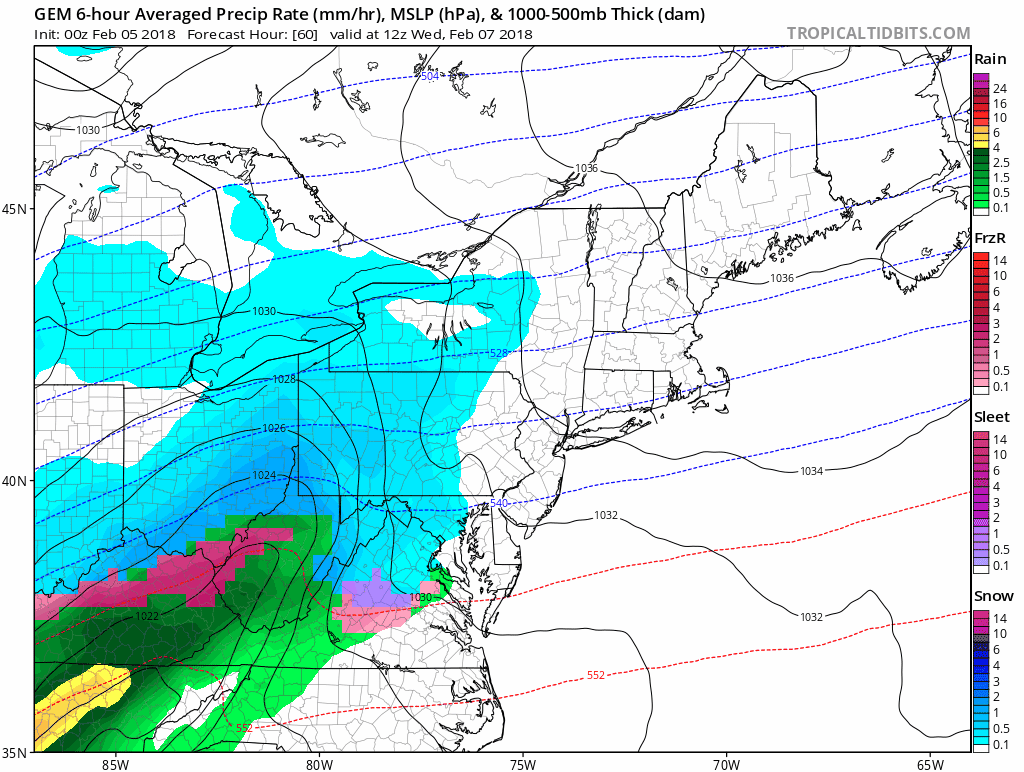
Note: We may have a chance of snow on Wednesday based on the same models that did a better job with today’s event…
Canadian Model Forecast
Wednesday Morning Snow?
Keep In Touch All Winter
Click here to sign up for email alerts…. Just in case you don’t get the post on your social media feed
Please share your thoughts, best weather pics/video, or just keep in touch via social media
-
Facebook: Justin Berk, Meteorologist
-
Twitter: @JustinWeather
-
Instagram: justinweather
Keep In Touch All Winter
Click here to sign up for email alerts…. Just in case you don’t get the post on your social media feed
 Get the award winning Kid Weather App I made with my oldest son and support our love for science, weather, and technology. Our 3 year anniversary of the release and our contribution to STEM education is this November. It has been downloaded in 60 countries, and works in both temperature scales. With your support we can expand on the fun introduction to science and real weather.
Snowstix- We Need You To Measure Snow Too
We are giving 10% of each sale to programs that benefit pediatric oncology patients.

FITF Gear

Keep In Touch All Winter
Click here to sign up for email alerts…. Just in case you don’t get the post on your social media feed
Also See:
My Winter Outlook 2017-2018 for more snow
La Nina Formed: What it could mean to our winter
NOAA Winter Outlook: Not The Best But Not The Worst For Snow
Two Farmers Almanacs Winter 2018 Outlooks
Winter Weather Folkore: Suggestions from Animals and Crops
First Frost and Freeze Dates For Maryland (southern PA and northern VA)
My Preliminary Winter Outlook Notes
Low Snow Winters In Baltimore: To Repeat Or Not Repeat
NOAA Ranks Blizzard 2016 4th Worst Snowstorm On Record
Blizzard 2016 Record Top Snowstorm: Area Totals
Extreme Weather of 2015 balanced out on both ends