 Monday January 29 2018
Colder air is on the way and the pattern that is about to change will bring some snow. But before that word gets you excited or bring anxiety, we need to consider two things: First: The snow expected will be light. Overall the potential is for nearly 1 inch, with a little more in the colder spots west and north of I-95. Second: The ground is warm, so not all flakes will stick. Timing will be key to chill the ground before daylight solar energy can warm the pavement. The one thing for sure is that it will get colder and there will be more surges of cold air into mid February.
Stats For January 28
Normal High: 42ºF
Record High: 75ºF in 1975
Normal Low: 25ºF
*Former Record Low: -7ºF in 1963
Snow Record: 9.1″ in 1966
Seasonal Snow To Date (at BWI): 6.5″
Sunrise: 7:16 AM
Sunset 5:24 PM
*Daylight = 1:59 longer than yesterday
*Bay Water Temperature = 36ºF at Thomas Pt. Light House
Keep In Touch All Winter
Click here to sign up for email alerts…. Just in case you don’t get the post on your social media feed
Today:
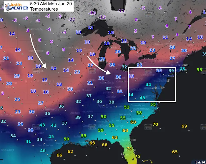
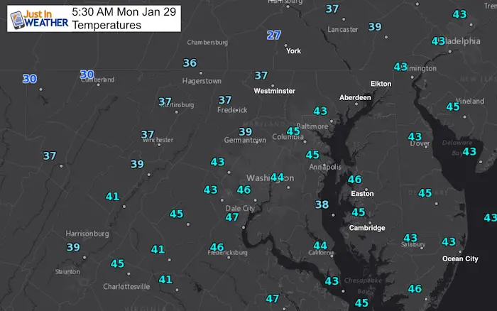
Morning Temperatures
Afternoon
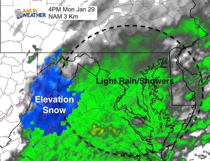
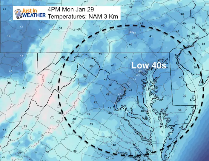
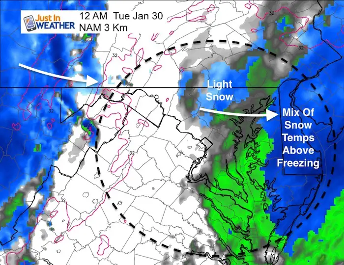
The NAM Model insists on the push back north of rain… with some high elevation snow. Even if flakes mix in locally as I showed last night, the surface temperatures will be above freeing.
Tonight
The reason I showed the NAM model is because it is most aggressive with snow developing tonight as a second system approaches from the west. These two systems are missing each other by 12 hours, which would have cranked up a larger storm. But both will feed off of each other….
May The Flakes Be With You- Limited Edition Shirt
A Portion of the proceeds will go to Integrated Wellness programs for Pediatric Oncology Patients

Tuesday Snow Timeline
This is just one model to use as a guide, not a promise. Timing will determine if the snow can stick, but the ground is still warm. I expect the best chance for the worse conditions will be in the normally colder suburbs west and north of Baltimore near and north of the PA line.
Snow falling after 9 AM is not likely to stick on the roads.
Support For Morning Snow
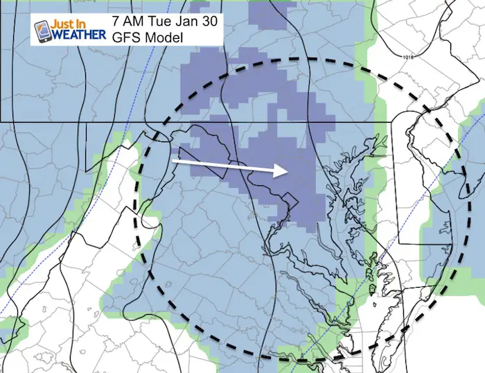
The GFS Model shows the burst of snow just before sunrise Tuesday reaching Washington and Baltimore.
NAM 3 Km Model —> slider Radar Simulation
[metaslider id=57299]
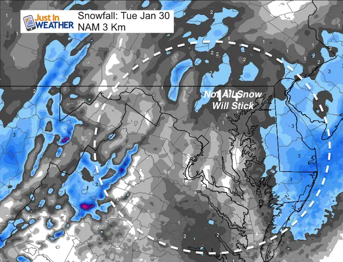
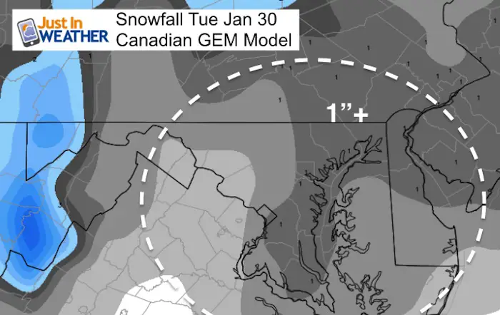
Snow Potential
This will be a light event. Totals generally around 1 inch. More north and west between Carroll County and York County PA. But the warm ground will battle stickage.
*Eastern Shore totals on the NAM likely to not all stick. This just shows what may fall from the clouds.
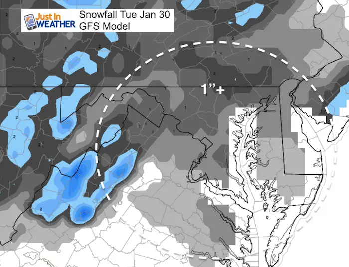
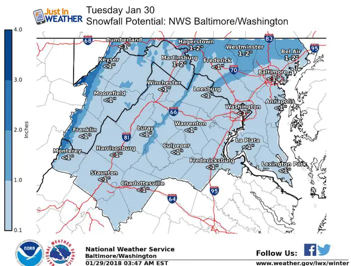
National Weather Service Snow Potential
This matches the typical colder snow zones getting over 1 inch from Mount Air to Westminster to northern Carroll, Baltimore, Harford Counties and York/Lancaster in PA.
Snowstix- We Need You To Measure Snow Too
We are giving 10% of each sale to programs that benefit pediatric oncology patients.

Friday Snow?
As of now, the GFS and Canadian Models have lost the storm. Both only show rain turning to light snow with a cold front passes. The European Model still has our stronger event. I will wait to show any update on this until this evening. But, we have a few chances for light snow through next week.
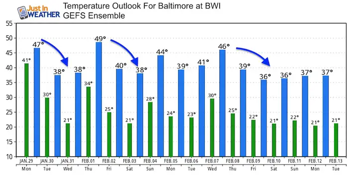
Cold Surges Through Mid February
Jet Stream
Temperature Outlook
FITF Gear

Please share your thoughts, best weather pics/video, or just keep in touch via social media
-
Facebook: Justin Berk, Meteorologist
-
Twitter: @JustinWeather
-
Instagram: justinweather
Snowstix- We Need You To Measure Snow Too
We are giving 10% of each sale to programs that benefit pediatric oncology patients.
 Get the award winning Kid Weather App I made with my oldest son and support our love for science, weather, and technology. Our 3 year anniversary of the release and our contribution to STEM education is this November. It has been downloaded in 60 countries, and works in both temperature scales. With your support we can expand on the fun introduction to science and real weather.
Keep In Touch All Winter
Click here to sign up for email alerts…. Just in case you don’t get the post on your social media feed
Also See:
My Winter Outlook 2017-2018 for more snow
La Nina Formed: What it could mean to our winter
NOAA Winter Outlook: Not The Best But Not The Worst For Snow
Two Farmers Almanacs Winter 2018 Outlooks
Winter Weather Folkore: Suggestions from Animals and Crops
First Frost and Freeze Dates For Maryland (southern PA and northern VA)
My Preliminary Winter Outlook Notes
Low Snow Winters In Baltimore: To Repeat Or Not Repeat
NOAA Ranks Blizzard 2016 4th Worst Snowstorm On Record