 Wednesday January 17 2018
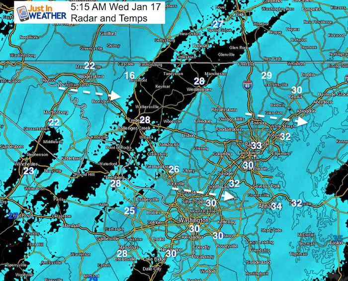
The timing of the snow is on schedule but the intensity is lighter. That was the suggestion I wrote on social media last night, along with the mention in multiple reports that the temperatures were the big story. All it takes is a dusting on roads that start wet, but ice up. That is the situation now as temperatures will be dropping into the 20s. The colder air is filtering in the northern counties now… and the freezing mark is moving through metro Baltimore and I-95 at this hour (5 AM).
Snow: There have been some breaks on the radar that will fill back in for a few hours. The simulation slider is below showing that. Overall, most places will end up with around 1 inch or less of snow. That fits the metro area. There may be some higher amounts in northern Maryland and southern Pennsylvania where some places will get up to 2 inches of snow. It truly is about the icing of roads underneath that apply to all of our region.
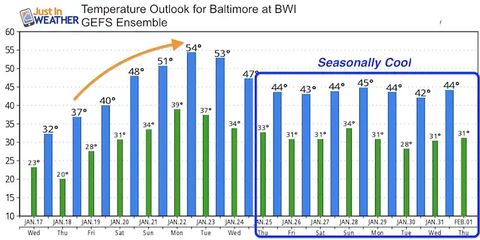
For what it’s worth, I had a school visit in Baltimore County planned today that is postponed for the school delay. So I feel first hand the impact of a little event. There are plenty of schools delaying opening this morning. Here is a look at the radar simulation and the timing of the temperature drop in two sliders below. After this event, we warm back to the 50s by the weekend and have a quiet set up for then next week or two ahead.
Stats For January 17
Normal High: 41ºF
Record High: 68ºF in 1913
Normal Low: 24ºF
*Former Record Low: -7ºF in 1982
Snow Record: 2.5″ in 1985
Seasonal Snow To Date (at BWI): 5.2″
Sunrise: 7:24 AM
Sunset 5:10 PM
*Daylight = 1:31 longer than yesterday
*Bay Water Temperature = 32ºF at Thomas Pt. Light House.
Keep In Touch All Winter
Click here to sign up for email alerts…. Just in case you don’t get the post on your social media feed

Radar Simulation
Light snow will continue along this slow moving front. Not much accumulation expected after sunrise, but enough to keep icing up roads that are untreated.
—> slider
[metaslider id=57050]
Hourly Temperatures
—> slider
[metaslider id=57038]
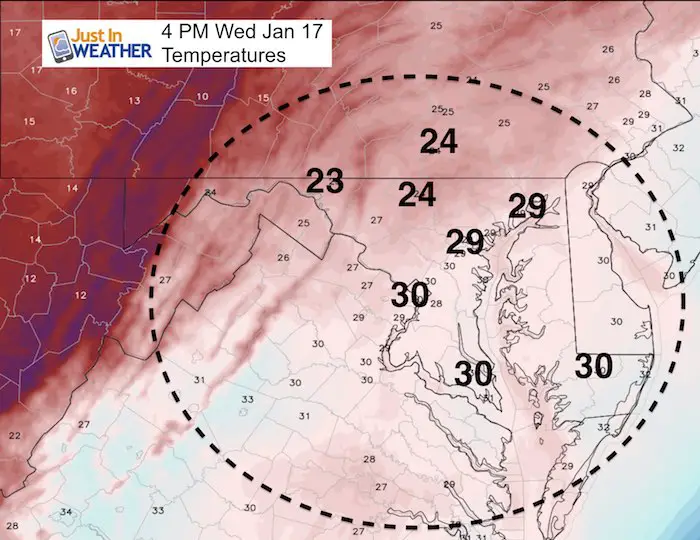
Afternoon Temps Still Below Freezing
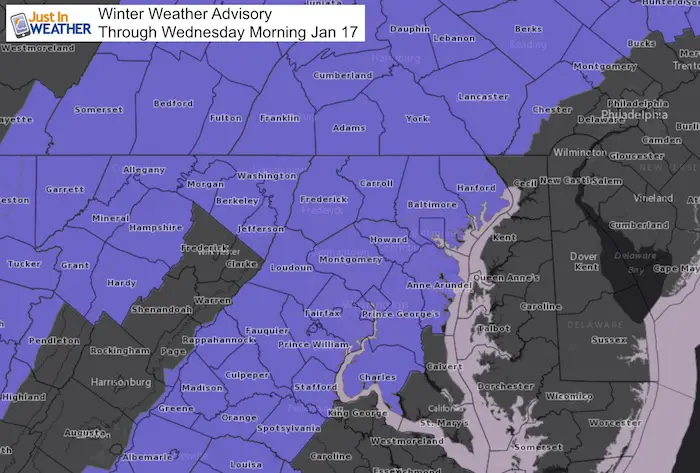
Winter Weather Advisory
Temperature Outlook
Shirts
A Portion of the proceeds will go to Integrated Wellness programs for Pediatric Oncology Patients
May The Flakes Be With You- Limited Edition Shirt

FITF Gear

Please share your thoughts, best weather pics/video, or just keep in touch via social media
-
Facebook: Justin Berk, Meteorologist
-
Twitter: @JustinWeather
-
Instagram: justinweather
Snowstix- We Need You To Measure Snow Too
We are giving 10% of each sale to programs that benefit pediatric oncology patients.

 Get the award winning Kid Weather App I made with my oldest son and support our love for science, weather, and technology. Our 3 year anniversary of the release and our contribution to STEM education is this November. It has been downloaded in 60 countries, and works in both temperature scales. With your support we can expand on the fun introduction to science and real weather.
Keep In Touch All Winter
Click here to sign up for email alerts…. Just in case you don’t get the post on your social media feed
Also See:
My Winter Outlook 2017-2018 for more snow
La Nina Formed: What it could mean to our winter
NOAA Winter Outlook: Not The Best But Not The Worst For Snow
Two Farmers Almanacs Winter 2018 Outlooks
Winter Weather Folkore: Suggestions from Animals and Crops
First Frost and Freeze Dates For Maryland (southern PA and northern VA)
My Preliminary Winter Outlook Notes
Low Snow Winters In Baltimore: To Repeat Or Not Repeat
NOAA Ranks Blizzard 2016 4th Worst Snowstorm On Record