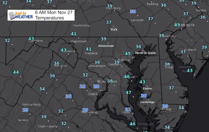
 Monday November 27
After a mild end to the holiday weekend, our weather pattern is uneventful. The initial cold surge has come and gone. Temperatures are seasonable, but colder in southern Maryland and west of Washington where it was clear overnight. Some clouds around central Maryland had kept us closer to 40ºF. We have a have a few afternoons ahead that will be slightly warmer. If you are heading to the Ravens first home Monday night football game in five years, it will be chilly. The main action for the weather will be rain at the end of the week, and then we wait for the pattern to turn colder. At this point that looks like it will be the second week of December, but we are still on pace for that early start to winter. So before we see snow and the weather report below, please understand I need to do my part on Cyber Monday and remind you where to find FITF gear and SnowStix. Thank you for sharing my obsession with snow and supporting my charity work. A portion of all sales will go to programs for pediatric oncology patients.
Faith in the Flakes Online Store
PJ bottoms still inside out- They have to be to help bring on the snow.

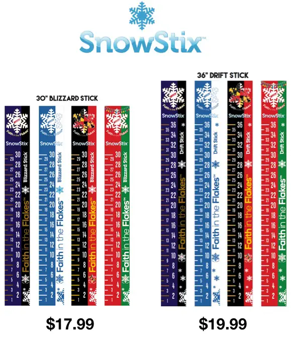
Snowstix- Ready For Delivery
We are giving 10% of each sale to programs that benefit pediatric oncology patients.
Stats For November 27
Normal High: 52ºF
Record High: 74ºF in 1896
Normal Low: 33ºF
Record Low: 18ºF in 1991
Sunrise: 7:03 AM
Sunset 4:45 PM
Keep In Touch All Winter: Sign up for email updates on new posts
Since you may miss some posts via social media, click here for email alerts as a way to make sure you don’t miss any. *You may have to refresh that page once for your browser to clear out the images.
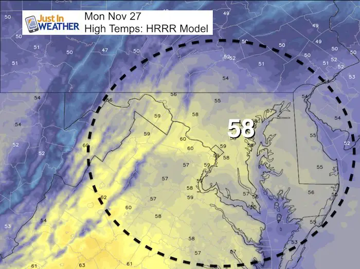
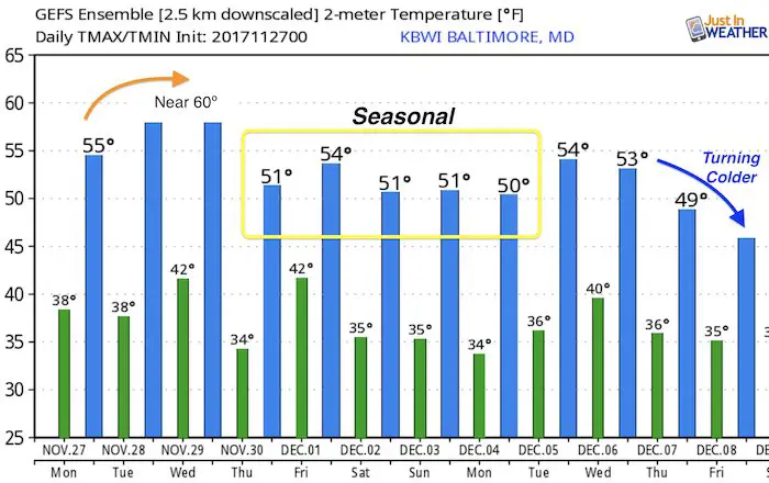
Afternoon Highs
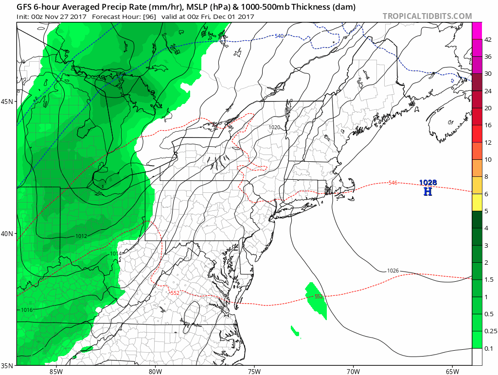
Skipping Ahead
Most of this week will be quiet until Friday. That is our next chance for rain. Here is the forecast animation from the GFS Model
In case you missed it…. See My Winter Outlook 2017-2018 for more snow
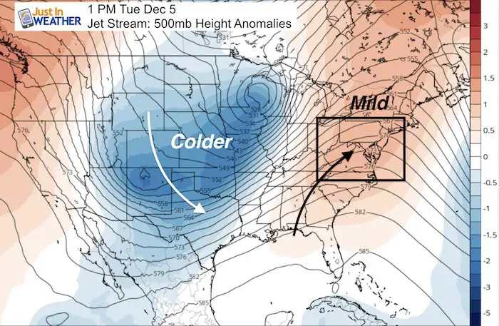
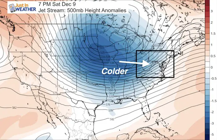
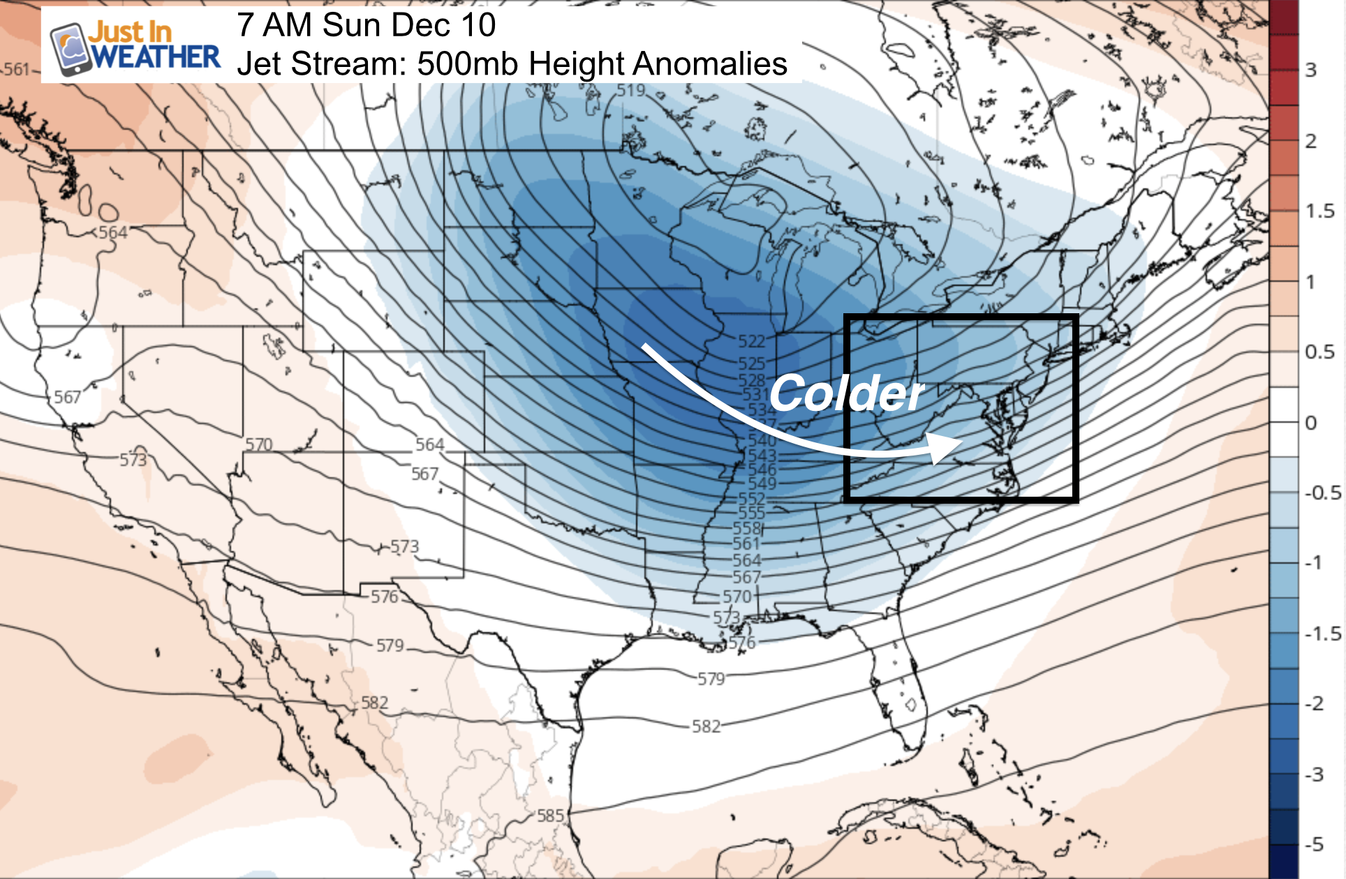
Pattern Change: Second Week of December
The jet stream will be relaxing for a bit, allowing us to have near seasonal temperatures for the next 2 weeks. The pattern includes a mild December 5th, so that date last decade that routinely brought us our first snow will not be this the case this year. But we will start to notice the change. It will take all of next week to get the pattern to shift to the east coast. Then we can start looking for snow.
Temperature Outlook
The really cold air does not show up here on this model product, but it will be there. Overall, while not excessively cold, most of the next 10 days will be near ‘normal’
 Get the award winning Kid Weather App I made with my oldest son and support our love for science, weather, and technology. Our 3 year anniversary of the release and our contribution to STEM education is this November. It has been downloaded in 60 countries, and works in both temperature scales. With your support we can expand on the fun introduction to science and real weather.
Please share your thoughts, best weather pics/video, or just keep in touch via social media
-
Facebook: Justin Berk, Meteorologist
-
Twitter: @JustinWeather
-
Instagram: justinweather
Also See:
My Winter Outlook 2017-2018 for more snow
La Nina Formed: What it could mean to our winter
NOAA Winter Outlook: Not The Best But Not The Worst For Snow
Two Farmers Almanacs Winter 2018 Outlooks
Winter Weather Folkore: Suggestions from Animals and Crops
First Frost and Freeze Dates For Maryland (southern PA and northern VA)
My Preliminary Winter Outlook Notes
Low Snow Winters In Baltimore: To Repeat Or Not Repeat
NOAA Ranks Blizzard 2016 4th Worst Snowstorm On Record