Tuesday November 14
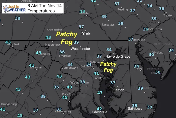
Happy National Pickle Day! Temperatures this morning are down in the 30s with areas of frost and patchy fog. There could be some spots that are a little slippery, mainly on bridges and overpasses. The fog is thanks to the moisture ground from yesterday’s rain. Otherwise it will be a quiet and mild day getting back to near 50ºF. Next up will be some rain showers Wednesday night, and a larger storm this weekend. At this point it looks like rain on Saturday that will end with colder air and possible flurries or snow showers on Sunday. More below….
Stats For November 14
Normal High: 57ºF
Record High: 77ºF in 1989
Normal Low: 37ºF
Record Low: 18ºF in 1986
Sunrise: 6:49 AM
Sunset 4:53 PM
Keep In Touch All Winter: Sign up for email updates on new posts
Since you may miss some posts via social media, click here for email alerts as a way to make sure you don’t miss any. *You may have to refresh that page once for your browser to clear out the images.
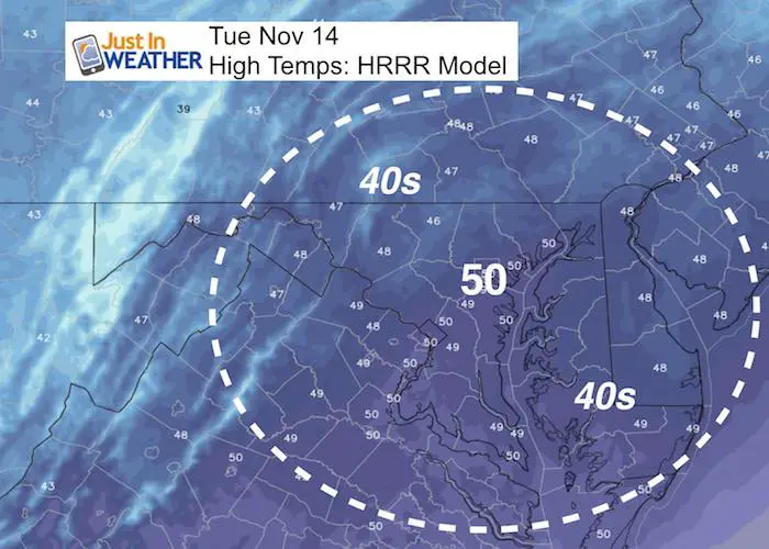
Afternoon High Temps
Still below average but mild….
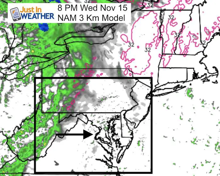
Rain Showers Wednesday Evening
Here is another system showing showers tomorrow evening that should move out Thursday morning. Mostly overnight.
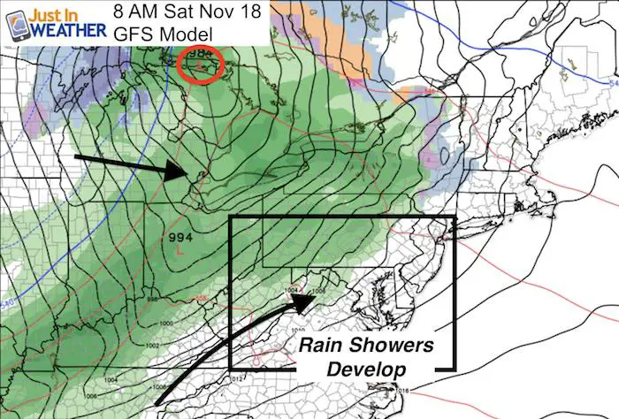
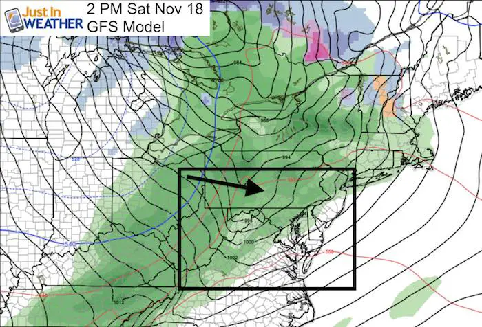
Weekend Storm
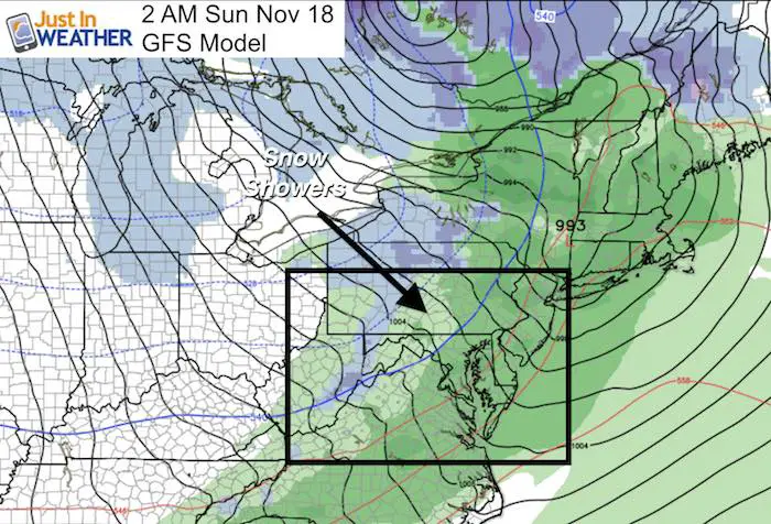
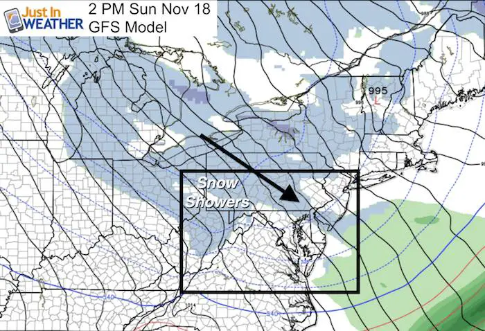
This brings in rain on Saturday. The GFS Model is faster that some other models, but I am sticking with this to focus on the accuracy or continued error. The trend shows Saturday turning wet in the afternoon with steady, moderate rain. But colder air will spill in on the back side. This will open up the Lake Effect Snow, and some showers or flurries could reach the norther suburbs Sunday.
Extended Outlook
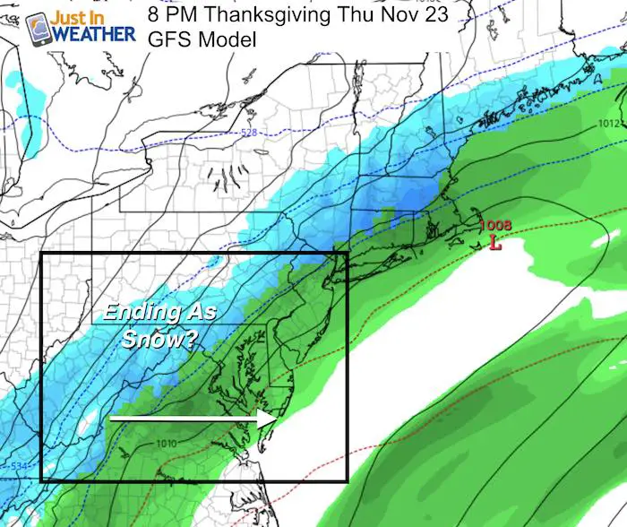
Thanksgiving Storm
I do NOT like to lock in on a forecast a week away, but we should pay attention since it is a holiday. There will be rain that might end with a period of snow. Notice, there is a question mark highlighted in there…
Note that the error I have noticed in the modeling has been to shift storms east and run a little faster. So I will reference this plot as we get close to track the trend.
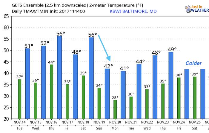
Temperatures:
In case you missed it…

NOT Repeating Last Winter
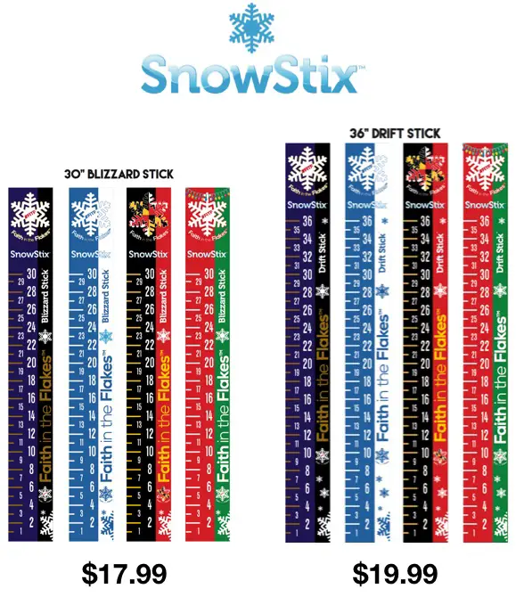
Snowstix- Ready For Delivery
We are giving 10% of each sale to programs that benefit pediatric oncology patients.
Faith in the Flakes Online Store Is Back Open By Popular Demand
PJ bottoms still inside out- They have to be to help bring on the snow.

 Get the award winning Kid Weather App I made with my oldest son and support our love for science, weather, and technology. Our 3 year anniversary of the release and our contribution to STEM education is this November. It has been downloaded in 60 countries, and works in both temperature scales. With your support we can expand on the fun introduction to science and real weather.
Please share your thoughts, best weather pics/video, or just keep in touch via social media
-
Facebook: Justin Berk, Meteorologist
-
Twitter: @JustinWeather
-
Instagram: justinweather
Winter Stuff
NOAA Winter Outlook: Not The Best But Not The Worst For Snow
Two Farmers Almanacs Winter 2018 Outlooks
My Preliminary Winter Outlook Notes
First Frost and Freeze Dates For Maryland (southern PA and northern VA)
NOAA Ranks Blizzard 2016 4th Worst Snowstorm On Record
Extreme Weather of 2015 balanced out on both ends
Early Christmas Shopping? FITF Gear Is Here
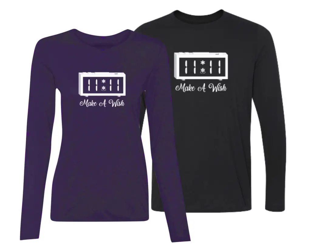
Limited Edition 11:11 FITF Clock
Make That Wish For Snow