 Sunday October 8
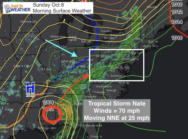
Nate made landfall last night as a hurricane but got knocked down to 45 mph winds and a tropical storm today. The forward speed of 25 mph will bring it in and out of are area a little faster. We already have rain this morning as this storm has interacted with a cold front. But that forward speed brings Nate farther north before the front can shift it east. The net track will take the core Low just west of Maryland but the strongest winds remain on the east or right side of the Low. Some local flooding is possible, but note the heaviest rain will be west of metro Baltimore and DC. Here is a breakdown of the timing for the rain and wind.
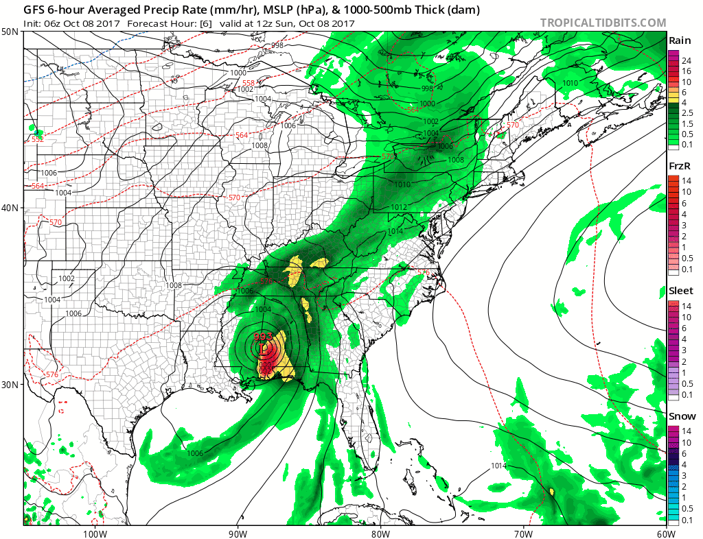
First the radar and the simulation for rain today. Below is more about Nate and the track our way Monday:
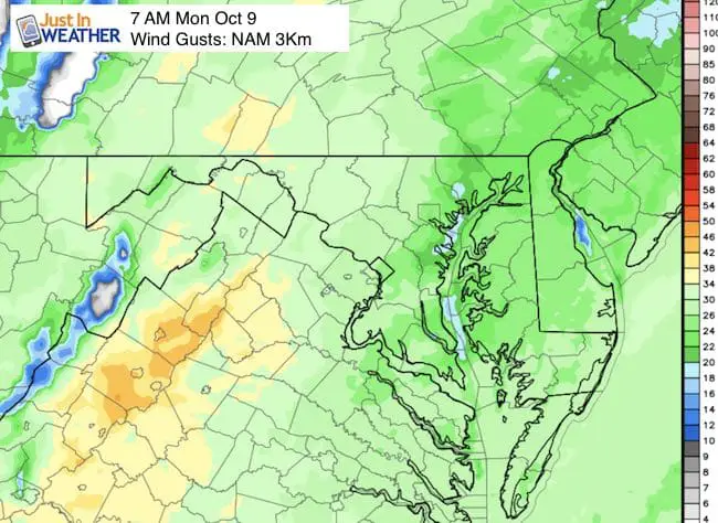
Radar Loop (4 Hours ending 7:30 AM)
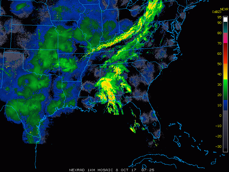
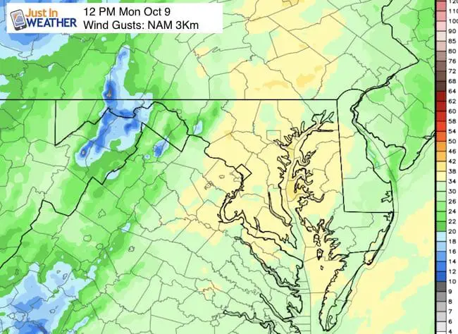
Radar Simulation: Today
[metaslider id=53580]
Tropical Storm Nate:
Stats from 8 AM
LOCATION…32.0N 88.0W
ABOUT 50 MI…80 KM ESE OF MERIDIAN MISSISSIPPI
ABOUT 95 MI…155 KM WSW OF MONTGOMERY ALABAMA
MAXIMUM SUSTAINED WINDS…45 MPH...75 KM/H
PRESENT MOVEMENT…NNE OR 25 DEGREES AT 23 MPH…37 KM/H
MINIMUM CENTRAL PRESSURE…994 MB…29.35 INCHES
Forecast Animation
Notice the Low tracks just west of Maryland and into New England. This shift to the west is due to the it moving so fast.
Notes:
- Worst conditions through noon Monday, improving after the Low passes
- A winter storm with heavy snow is expected in Denver, Co.
- As the front lingers, that system will send more rain our way by Thursday.
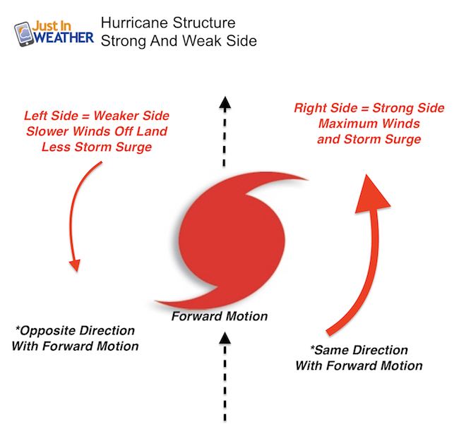
Strongest Winds On Right Side Of The Low
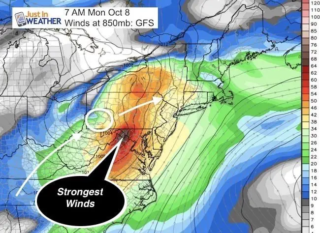
Remember This?
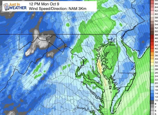
Local Winds: Strongest Sunrise To Noon Monday
Gusts will strongest Monday morning to mid day averaging between 20 and 40 mph.
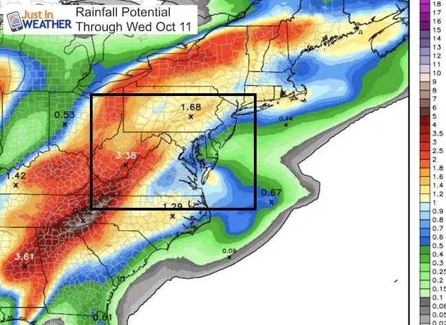
Rainfall
The Heaviest rain will be north and west of Baltimore with 1 to 3 inches. Southern Maryland will get less than 1/2 inch.
 Get the award winning Kid Weather App I made with my oldest son and support our love for science, weather, and technology. Our 3 year anniversary of the release and our contribution to STEM education is this November. It has been downloaded in 60 countries, and works in both temperature scales. With your support we can expand on the fun introduction to science and real weather.
National Hurricane Center Track
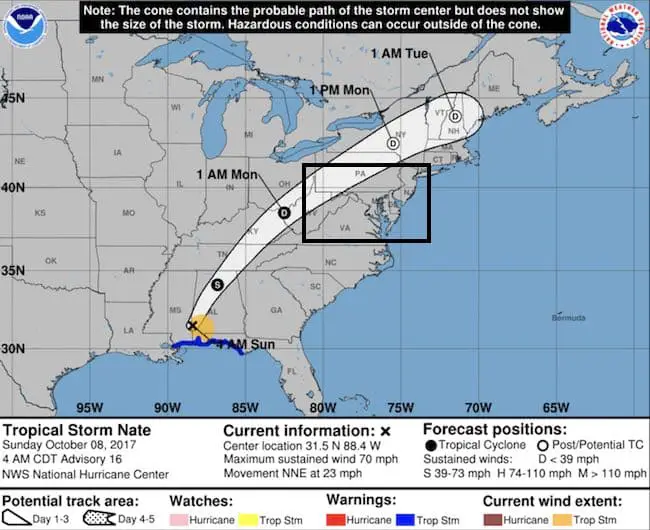
*This seems to be running along a path carved out by Harvey and Irma (not Cindy). Note this for future trends
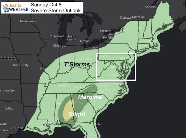
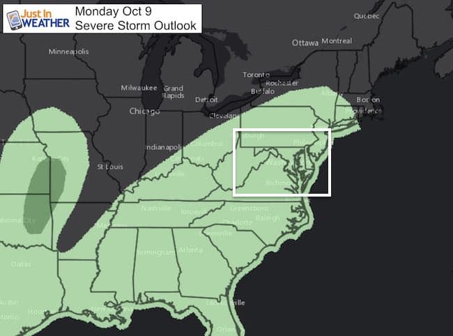
Severe Storm Outlook
There will be a chance for severe storms bringing gusts over 60 mph and idolater tornadoes over the next two days
Trust in this Bust- Limited Edition Shirt
This is not a forecast, but a fundraiser for breast cancer research at BCRF- the highest rated cancer research charity. This soft Bella T-Shirt is to promote the strength of the ‘good bust’ and the heart that beats strong beneath it. Proceeds will be donated in honor of my mother Linda Berk, a 3-time breast cancer survivor. Click on the shirt image to join us.

Sign up for email updates on new posts
Since you may miss some posts via social media, click here for email alerts as a way to make sure you don’t miss any. *You may have to refresh that page once for your browser to clear out the images.
Please share your thoughts, best weather pics/video, or just keep in touch via social media
-
Facebook: Justin Berk, Meteorologist
-
Twitter: @JustinWeather
-
Instagram: justinweather