 Tuesday October 3
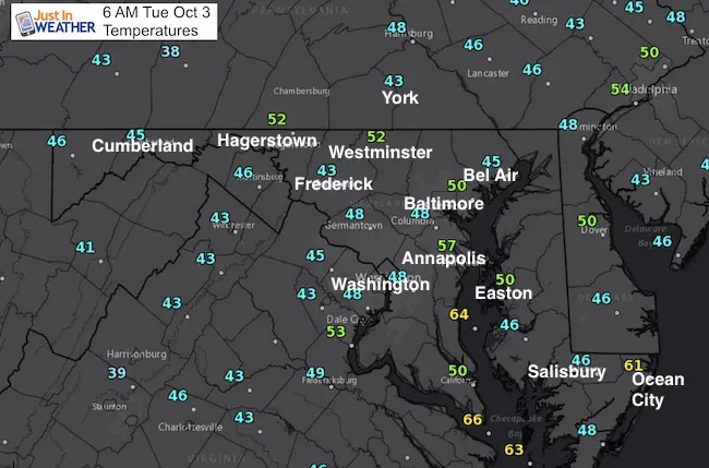
Chilly mornings and warm afternoons are typical early Autumn weather. Today will be nearly a repeat of Monday’s weather but we are about to have another warning trend that will bring our temperatures back to the 80ºF. The next cold front is forecast to arrive Thursday night with a very slim chance of rain. There is hope that we get rain to arrive, but the trade off will be that it arrives at the end of the weekend. I am a little skeptical of the long range modeling to promise the timing, but we are very dry and really could use the rain. Below is a look at the timeline.
Stats for today
Normal High : 71ºF
Record High: 92ºF in 1919
Normal Low: 50ºF
Record Low: 34ºF in 1974
Sunrise – 7:05 AM
Sunset – 6:46 PM
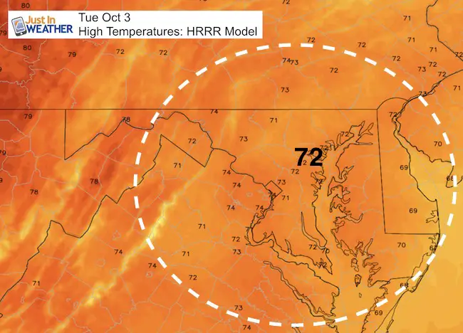
High Temperatures
Rainfall?
The last decent storm we had was September 5 and 6 when we had over 1 inch of rain. We haven’t had anything significant since September 10. So nearly 4 weeks later, the ground is getting pretty dry… even at the end of the growing season. Here is a look at the GFS Model showing the rain timeline. The cold front on Thursday appears to fizzle out in PA. Our next hope will be rain arriving from the south Sunday afternoon and into Monday.
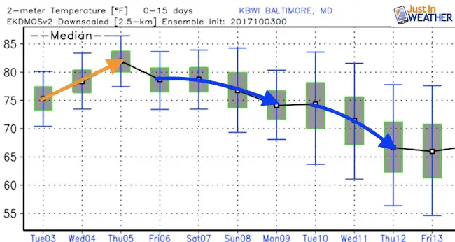
Temperature Outlook
Please share your thoughts, best weather pics/video, or just keep in touch via social media
-
Facebook: Justin Berk, Meteorologist
-
Twitter: @JustinWeather
-
Instagram: justinweather
 Get the award winning Kid Weather App I made with my oldest son and support our love for science, weather, and technology. Our 3 year anniversary of the release and our contribution to STEM education is this November. It has been downloaded in 60 countries, and works in both temperature scales. With your support we can expand on the fun introduction to science and real weather.