 Friday September 29
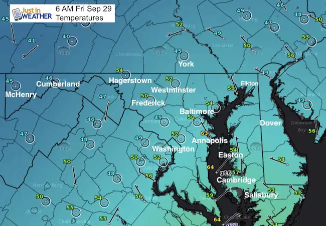
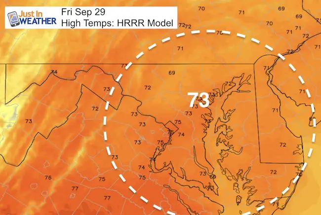
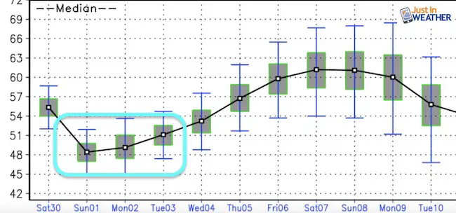
This is all about the temperatures. After hitting 80ºF on Thursday, today will be back to where we belong. In fact this morning temperatures have dropped cooler this morning with many in the lower 50s and even 40s showing up near and north of the PA line. BWI is down to 51ºF and York is down to 45ºF. If you live by the water, that has held temps up with Annapolis showing 63ºF. But the cooler air will win and keep building in through the weekend. By Sunday the highs will recover back to 70ºF for outdoor plans and the Ravens game.
Climate Data
- Normal High = 73ºF
- Record High = 91ºF in 1945
- Sunrise = 7:01 AM
- Sunset = 6:52 PM
Afternoon Highs
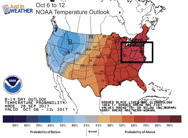
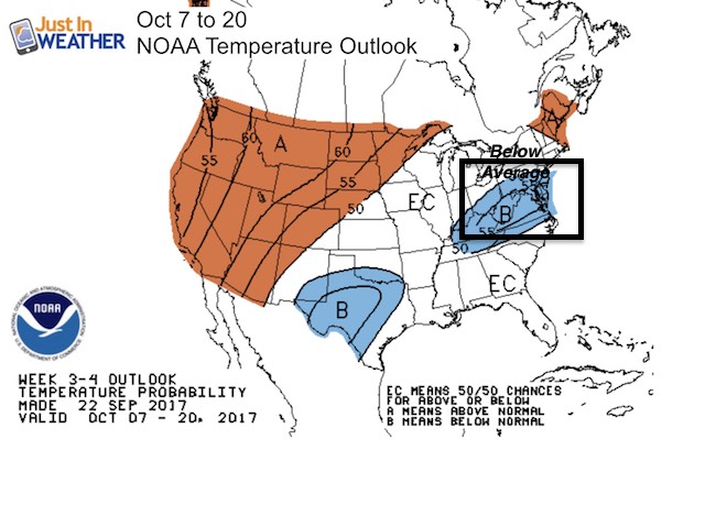
Temperature Outlook
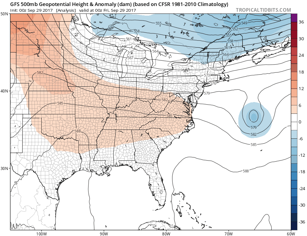
Source of more cool air
Forecast Highs
Forecast Lows
Climate Trends
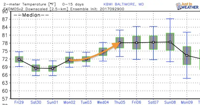
After this weekend, we will have another warm up next week and could see the lower 80s again. But mid October looks like another cool down
Rain?
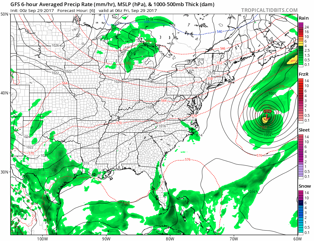
After a wet start to the month, we have dried out quite a bit. The rainfall at BWI is about half of where it should be with a deficit of 1.80″ for the month to date. There is no rain in sight for the next week. There is a hint of something after day 10. I have posted that model animation below to show that, but I do not put much stock in long range projections like that. But we need something to root on and hope for.
Please share your thoughts, best weather pics/video, or just keep in touch via social media
-
Facebook: Justin Berk, Meteorologist
-
Twitter: @JustinWeather
-
Instagram: justinweather
 Get the award winning Kid Weather App I made with my oldest son and support our love for science, weather, and technology. Our 3 year anniversary of the release and our contribution to STEM education is this November. It has been downloaded in 60 countries, and works in both temperature scales. With your support we can expand on the fun introduction to science and real weather.