 Sunday August 27
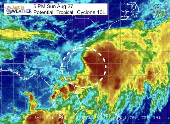
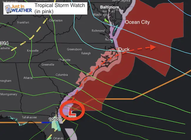
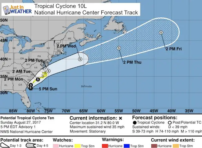
While Harvey is still stuck over east Texas causing historic flooding, a new tropical storm is expected to be named off of the east coast very soon. Identified as 10L, this Low Pressure has a 70% chance of developing into a tropical storm in the next 2 days. If the winds exceed 40 mph, this will be named Irma. The center is located 110 miles south of Charleston SC and has winds of 35 mph. Tropical Storm Watch has been issued for coastal South Santee River SC to Duck NC on the north end of the Outer Banks.
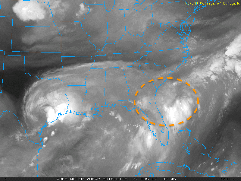
Here is the water vapor animation showing the circulation organizing east of Jacksonville FL.. and you can see Harvey on the left side of the view. This will NOT be the same type of storm as upper level winds will help steer this along the coastline and then out into the Atlantic. It should miss Ocean City MD but make for rough waves this week.
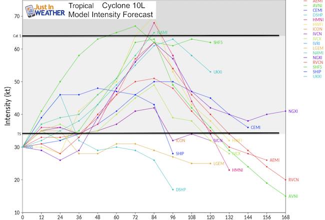
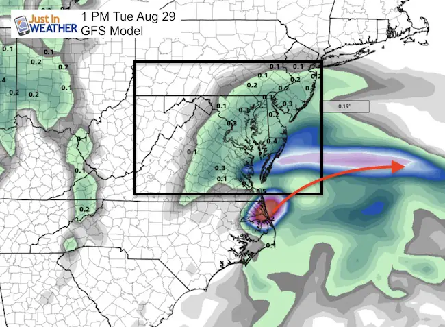
Tropical Model Forecast
The consensus is for a moderate tropical storm but that all hinges on the track. The small chance of this becoming a hurricane would only be if the center remains offshore But the track is likely to stay right along the coast or just inland through North Carolina.
Forecast
Tuesday will be the day we could see rain from Irma into central Maryland and southern PA. But the center of the storm should be passing off the coast from OBX
Storm Track
This storm should stay south of Maryland, but will be an issue for OBX through Tuesday. The waves and rip currents offshore will be an issue though Wednesday or Thursday up into Delaware.
Please share your thoughts, best weather pics/video, or just keep in touch via social media
-
Facebook: Justin Berk, Meteorologist
-
Twitter: @JustinWeather
-
Instagram: justinweather
 Get the award winning Kid Weather App I made with my oldest son and support our love for science, weather, and technology. Our 3 year anniversary of the release and our contribution to STEM education is this November. It has been downloaded in 60 countries, and works in both temperature scales. With your support we can expand on the fun introduction to science and real weather.