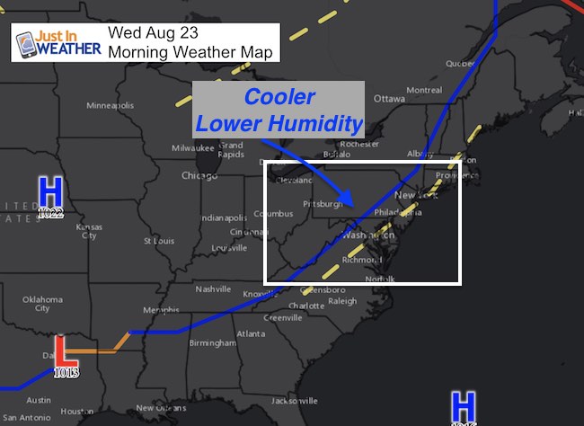
Wednesday August 23
The storms last night and cooler weather pattern on the the way reminded me of the classic Bob Seger song Night Moves. “Woke last night to the sound of thunder. How far off, I sat and wondered….” The storms that erupted were potent and a signal that the atmosphere was using up the built up energy as a new air mass is moving in. This one looks like the end of summer heat and early autumn arriving. We will still have warm days, but less heat and cooler nights will take us into the weekend just as some areas kids are starting up their school year.
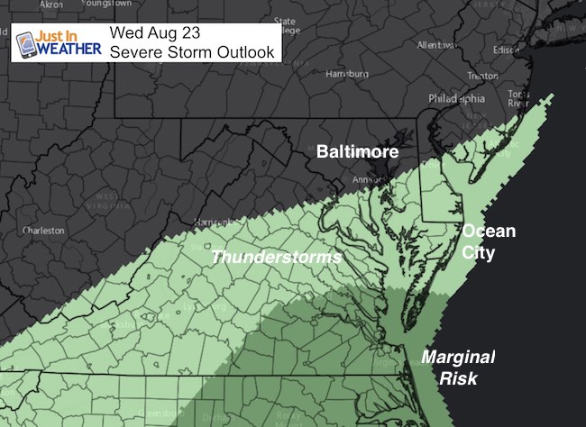
The cold front is not fully through yet, and will take all day to move out of our region. Some showers may pop up in central Maryland along it, but the best chance for storms will be farther south today. The risk of severe weather is very low, but we have a guarantee if a quiet and cooler weather pattern to take us into the weekend.
—> slider: Radar Simulaiton
There is a small chance for a mid day shower around Baltimore/I-95. But farther south is where the front will be active today. Southern Maryland to the beaches will have the afternoon showers and some storms,
[metaslider id=51326]
Outlook
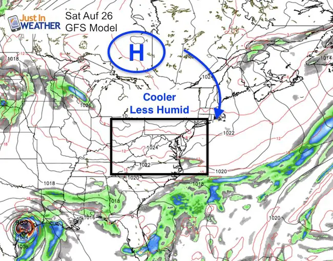
This large Canadian air mass will lock us into dry weather with temps dropping below average for a few days into next week.
Temperatures
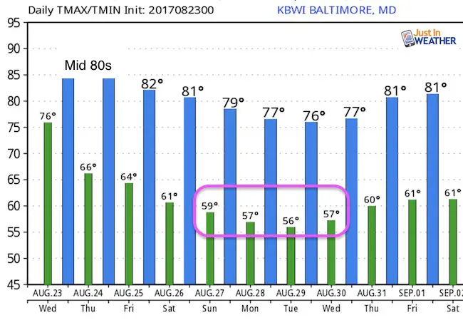
“With Autumn closing in….”
Notice the night in the 50s… around Baltimore! Temps will be cooler inland from the cities… So is you have a pool, its’ time to dust off the solar cover.
Please share your thoughts, best weather pics/video, or just keep in touch via social media
-
Facebook: Justin Berk, Meteorologist
-
Twitter: @JustinWeather
-
Instagram: justinweather
 Get the award winning Kid Weather App I made with my oldest son and support our love for science, weather, and technology. Our 3 year anniversary of the release and our contribution to STEM education is this November. It has been downloaded in 60 countries, and works in both temperature scales. With your support we can expand on the fun introduction to science and real weather.

Wear our cool cycle jersey from Hill Killer
Click the image…