 1 PM Monday June 19
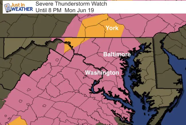
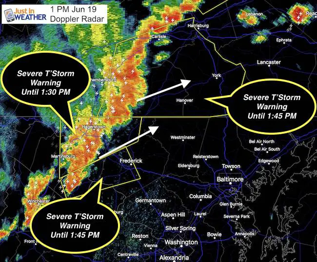
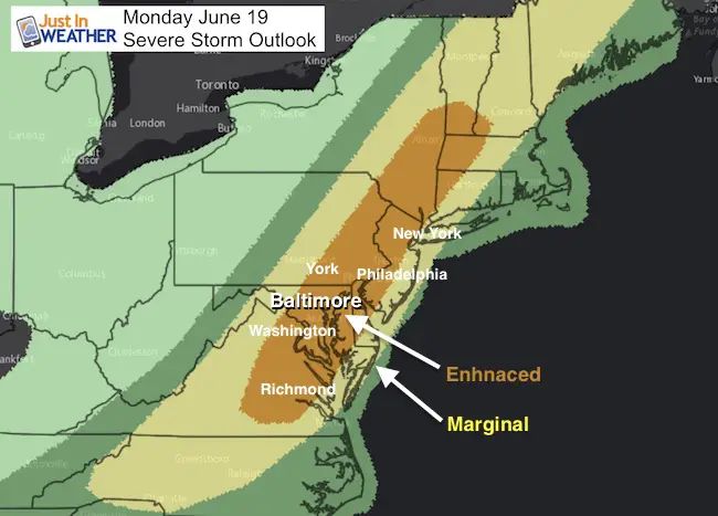
A Severe Thunderstorm Watch has been issued and now includes Pennsylvania and Maryland through this evening. Warnings have been issued and as off post time we are tracking a band into Adams and York County PA until 1:45 PM. Remember that a watch means it is possible, and this one goes to 8 PM. If a warning is issued, that means it is happening and being tracked in specific counties. I think the threat is still very likely in central Maryland into the evening. Storms may contain winds to 70 mph, large hail, and there is enough wind sheer to produce possible tornadoes.
Compare the Doppler Radar to the NAM 3 KM and HRRR Models. The image already shows the leading edge of the storm line well east of the modeling… And the timing is faster than this morning’s projection.
Also note that there may be two surges on the cold front. The initial line of storms and then a second wave this evening. The energy should weaken as it crosses the Bay into southern Maryland and the beaches… arriving by midnight.
Doppler Radar

Radar Simulation Slider —>
Note: The HRRR Model is much more aggressive and shows the line into Baltimore at 3 PM. This model tends to be over sensitive, so that is the time frame I will be using to see if this has a handle on the rest of the evening. The NAM model on the other hand is running slow. It shows the initial line breaking up at 3PM and well west of Baltimore, but then resurges around 6-7 PM
NAM 3 KM Model
[metaslider id=48999]
HRRR Model
[metaslider id=49023]

 Get the award winning Kid Weather App I made with my oldest son and support our love for science, weather, and technology. Our 3 year anniversary of the release and our contribution to STEM education is this November. It has been downloaded in 60 countries, and works in both temperature scales. With your support we can expand on the fun introduction to science and real weather.
Get $1000 Off LASIK
Plus enter to win free sunglasses
Maryland Trek 2017
Be part of my 4th annual hike and bike across Maryland this August. See my trek page and sign up for information to do one day, the whole week, or even sponsor this great event.
Milestones this year:
- I will do my 1000th mile
- We aim to reach $100,000 for Cool Kids Campaign
Please share your thoughts, best weather pics/video, or just keep in touch via social media
-
Facebook: Justin Berk, Meteorologist
-
Twitter: @JustinWeather
-
Instagram: justinweather
Faith in the Flakes
The store is closing for the season. Next week we wil be shifting back to spring mode. This will include a severe weather STEM assembly program.
-
Sign up for email updates on new posts
Since you may miss some posts via social media, click here for email alerts as a way to make sure you don’t miss any. *You may have to refresh that page once for your browser to clear out the images.
Also See:


