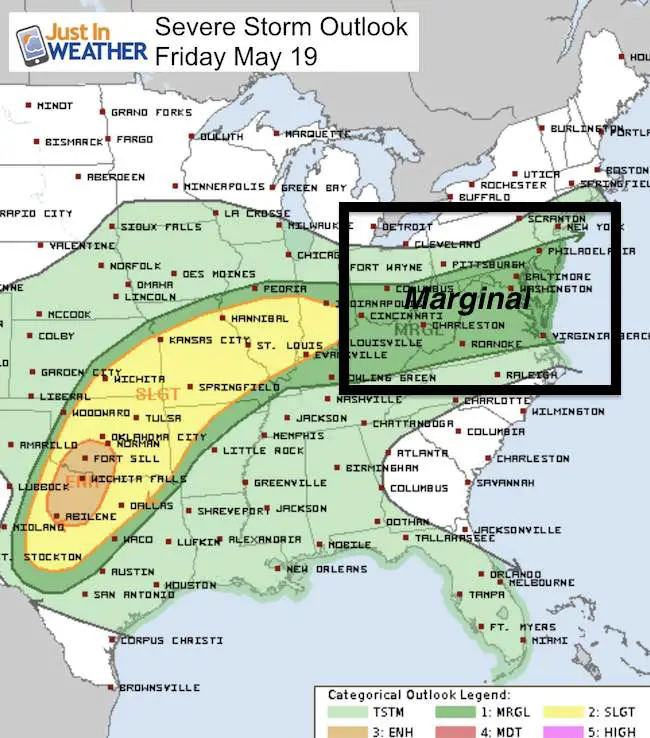
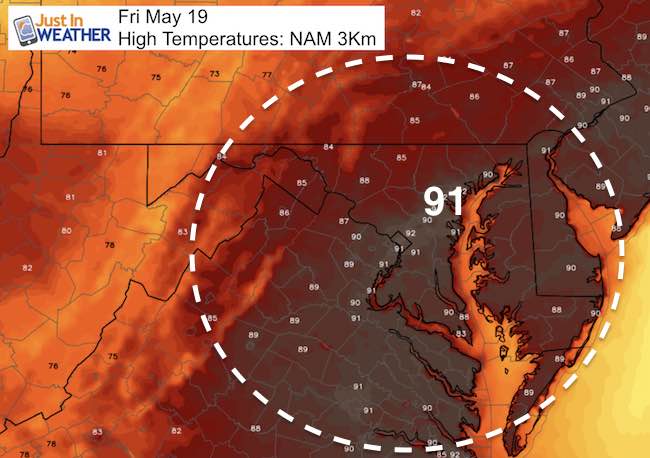
 Friday May 19 – We are in day three of this heat streak and may make a run for 90ºF again on this Black Eyed Susan Day. The thing you will noice most will be the humidity. The air will feel thick and you may want storms to help cool things down. We have a marginal risk for strong or severe storms, but they will be widely scattered. Like yesterday, the actual storms may not translate to exactly where the simulation shows. This is just a wait and see where the develop. But we have a cold front that will surely knock down the temps tomorrow and stay closer to reality next week.
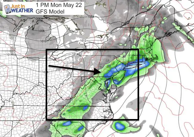
Preakness might still have some showers around early, while rain could linger to the north into early afternoon. The cooler east wind and clouds will hold temps closer to 70ºF. The overall pattern will stay cooler. Here’s a quick look:
—> slider: Simulated Radar
Today
[metaslider id=47904]
High Temperatures
—> Saturday Morning
[metaslider id=47921]
Next Rain Chance: Monday
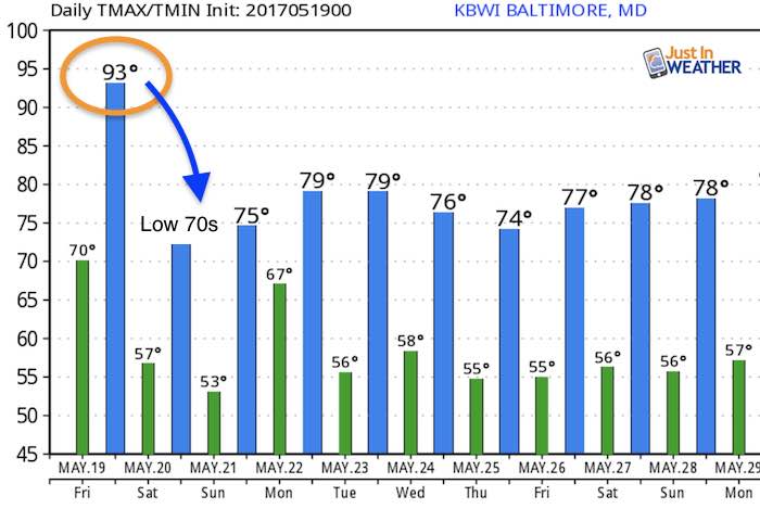
Temperature Outlook
Maryland Trek 2017
Be part of my 4th annual hike and bike across Maryland this August. See my trek page and sign up for information to do one day, the whole week, or even sponsor this great event.
Milestones this year:
- I will do my 1000th mile
- We aim to reach $100,000 for Cool Kids Campaign

 Get the award winning Kid Weather App I made with my oldest son and support our love for science, weather, and technology. Our 3 year anniversary of the release and our contribution to STEM education is this November. It has been downloaded in 60 countries, and works in both temperature scales. With your support we can expand on the fun introduction to science and real weather.
Please share your thoughts, best weather pics/video, or just keep in touch via social media
-
Facebook: Justin Berk, Meteorologist
-
Twitter: @JustinWeather
-
Instagram: justinweather
Faith in the Flakes
The store is closing for the season. Next week we wil be shifting back to spring mode. This will include a severe weather STEM assembly program.
-
Sign up for email updates on new posts
Since you may miss some posts via social media, click here for email alerts as a way to make sure you don’t miss any. *You may have to refresh that page once for your browser to clear out the images.
Also See: