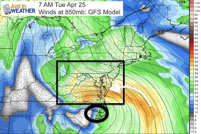
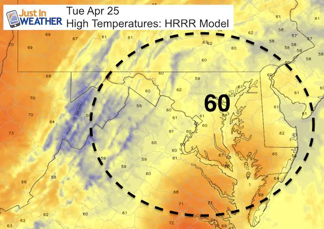
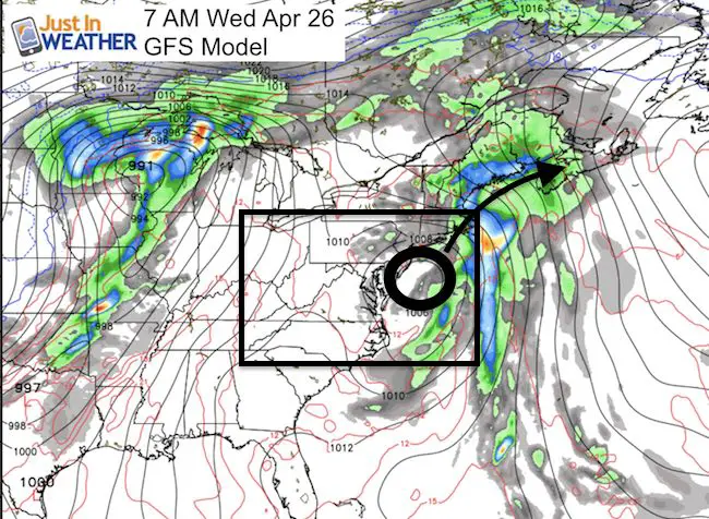
 Tuesday April 25 – The ground are damp this morning, but the next round of rain will arrive between 8 and 10 AM. This Low Pressure has an impressive circulation and will slowly be moving northward up the coast. Check out the water vapor satellite looping the flare up of moisture into North Carolina is impressive. The heaviest of rain will reach Maryland this afternoon, and chill winds will be gusty holding temps to near 60ºF. By this evening, the storm will start its departure, but drizzle may be left over. Then we will be left with areas drizzle and questionable fields for after school games. Tomorrow we begin to dry out and really heat up by this weekend.
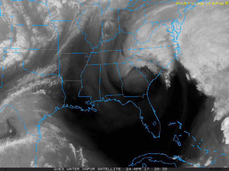
Satellite Loop
Notice the bright white flare up in North Carolina and southern Virginia. That is where the heaviest rain is falling this morning.
Rainfall Today
—> slider: Radar Simulation
[metaslider id=46951]
Temperatures Remain Cool
Improving Tomorrow
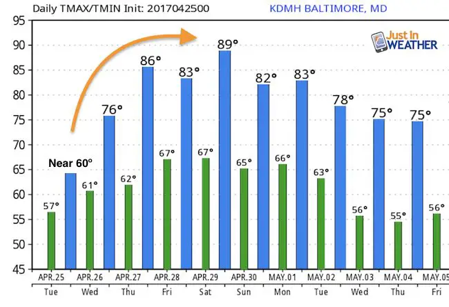
Temperature Outlook
Once this storm departs, a large dome of warm air will build in. As suggested last week, I expect we can see 90ºF in spots by the weekend
Storm Smart: My STEM Assembly Program
Click here to see the details and how this educational program is also a fundraiser for schools. We can start scheduling for May now.

 Get the award winning Kid Weather App I made with my oldest son and support our love for science, weather, and technology. Our 3 year anniversary of the release and our contribution to STEM education is this November. It has been downloaded in 60 countries, and works in both temperature scales. With your support we can expand on the fun introduction to science and real weather.
Please share your thoughts, best weather pics/video, or just keep in touch via social media
-
Facebook: Justin Berk, Meteorologist
-
Twitter: @JustinWeather
-
Instagram: justinweather
Faith in the Flakes
The store is closing for the season. Next week we wil be shifting back to spring mode. This will include a severe weather STEM assembly program.
-
Sign up for email updates on new posts
Since you may miss some posts via social media, click here for email alerts as a way to make sure you don’t miss any. *You may have to refresh that page once for your browser to clear out the images.
Also See: