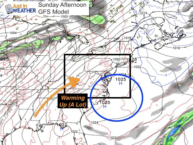
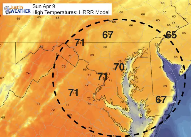
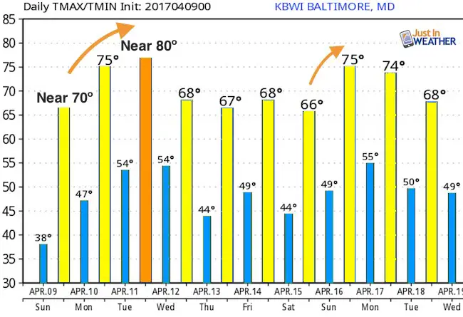
 Sunday April 9 – There was a Frost Advisory this morning and temperatures were widespread in the 30s at daybreak. This is where we bounce off of the bottom. The same High Pressure that followed our storm with cold winds, is sliding off of the coast. This will shift the winds (not as strong) from the southwest, allowing warmer spring air to flow in to our region. The first step will be this afternoon as we approach 70ºF. Next up will be the aim for 80ºF early in the week. If you haven’t cut your grass yet this season, you will need to by the end of this week.
This Afternoon:
Temps will approach 70ºF in central Maryland. But 60s will prevail inland and along the water.

Mostly Dry
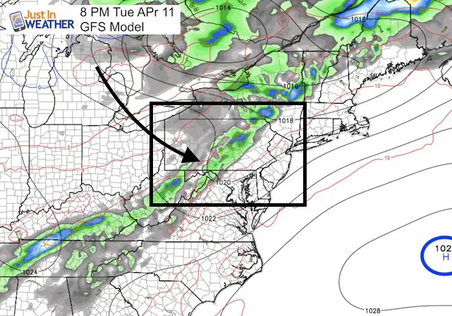
There is a chance of some showers Tuesday evening. This will bring in slightly cooler air but keeping us mild for the rest of the week.

Warm Week

Storm Smart: My STEM Assembly Program
Click here to see the details and how this educational program is also a fundraiser for schools. We can start scheduling for May now.
 Get the award winning Kid Weather App I made with my oldest son and support our love for science, weather, and technology. Our 3 year anniversary of the release and our contribution to STEM education is this November. It has been downloaded in 60 countries, and works in both temperature scales. With your support we can expand on the fun introduction to science and real weather.
Please share your thoughts, best weather pics/video, or just keep in touch via social media
-
Facebook: Justin Berk, Meteorologist
-
Twitter: @JustinWeather
-
Instagram: justinweather
Faith in the Flakes
The store is closing for the season. Next week we wil be shifting back to spring mode. This will include a severe weather STEM assembly program.
-
Sign up for email updates on new posts
Since you may miss some posts via social media, click here for email alerts as a way to make sure you don’t miss any. *You may have to refresh that page once for your browser to clear out the images.
Also See:
Extreme Weather of 2015 balanced out on both ends

