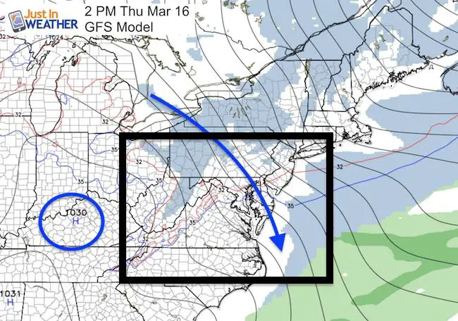
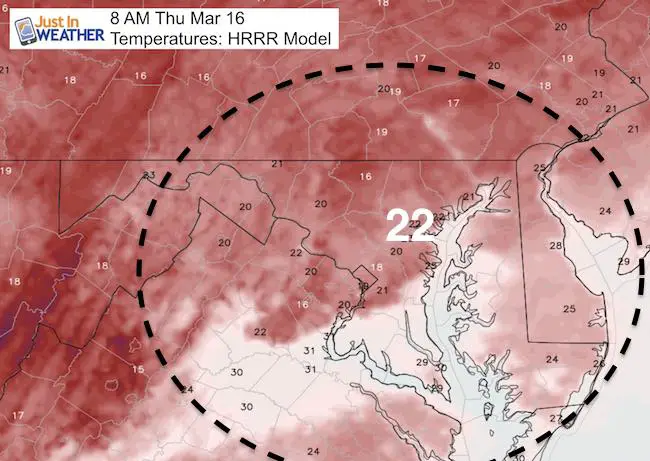
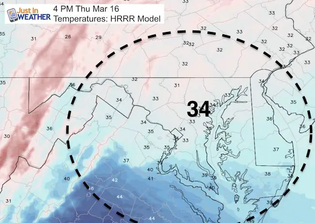
 Thursday March 16 – The warming trend will be slow, but this report will be quick. Temperatures this morning are in the deep freeze (teens and 20s). Freezing temperatures made it all the way into north central Florida today bringing potential crop damage. Many in our region will see plenty of sun and lighter winds, but they still provide cold and could produce clouds in the afternoon. But we are about to turn the corner. The next system should stay warmer as the secondary Low will develop overhead but take form well off of the coast. It wil bring mostly rain Saturday, but it will be light and scattered. Not a complete washout. Watch as it does build up off of the coast and bring snow to New England… For us, there could be some icy mix as it arrives Friday evening and departs Saturday evening… More like in the places that got over 5 inches of snow this week.
Today: Cold But Less Wind
Click here to see: Storm Recap: Snow reports and amazing ice photos
—> slider Rain Timeline
[metaslider id=45566]
Temperature Outlook
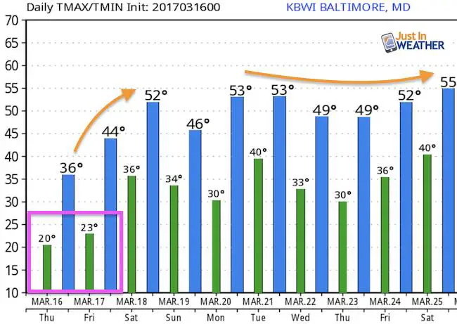
Gradually returning to ‘near normal’ next week
 Get the award winning Kid Weather App I made with my oldest son and support our love for science, weather, and technology. Our 3 year anniversary of the release and our contribution to STEM education is this November. It has been downloaded in 60 countries, and works in both temperature scales. With your support we can expand on the fun introduction to science and real weather.
Please share your thoughts, best weather pics/video, or just keep in touch via social media
-
Facebook: Justin Berk, Meteorologist
-
Twitter: @JustinWeather
-
Instagram: justinweather
Faith in the Flakes Online- Flannel PJs Printed Inside Out
Store Now Open

- We’ve added Flannel PJ Pants that will be printed inside out. They have to be, to make it snow ?
- Free Personal Delivery for orders of 20 items or more to schools and businesses.
- Click this image for the online store.
- Look for more items to be added soon.
- Also see the info for the STEM Assembly Spirit Wear program: Put your school name on the shirts and raise money for you PTO/PTA in the process.
Sign up for email updates on new posts
Since you may miss some posts via social media, click here for email alerts as a way to make sure you don’t miss any. *You may have to refresh that page once for your browser to clear out the images.
FITF SNOW STICKS
 Available in 2 Ft, 30 Inches, and 3 Ft Sizes. Also with Orange/Black or Purple/Black. Click on the image to see the options offered by my friend Thatcher at Signs By Tomorrow in Timonium.
Go to http://www.signsbytomorrow.com/timonium/ to order yours today! Click the ‘Request a Quote’ button at the top of the page. In comment box include color, size and payment information. Please indicate whether you’d like to have us UPS ship them to you or if you would like to pick up in our store. Snow Sticks will ship or will be ready for pick up in our store 48 hrs after order is placed, Mon-Fri.
Also See:
My Winter Outlook for 2016-2017: Colder with snow spread out more
NOAA Winter Outlook for 2016 to 2017
La Nina Formed: What it could mean to our winter
Farmers Almanacs Split On Cold And Snow
Extreme Weather of 2015 balanced out on both ends
Low Snow Winters In Baltimore: Records Might Surprise You