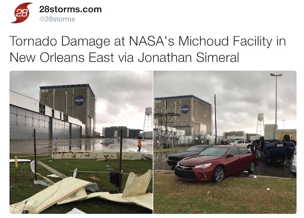
Tuesday – I know it seems hard to imagine with temperatures pushing the mid 60s and perhaps some 70s today, but the snow is still projected tomorrow night. The main storm still has us on the warm side with heavy rain to our wet and the Deep South. The New Orleans area was hit with a tornado, some reports of twin twisters at one time. One had damaged a NASA rocket making facility that made boosters for the Space Shuttle. The structure is intact, but the white facade was stripped away. This is is signal of the energy in the atmosphere and what abrupt changes are still very likely. Below are the latest images, including the forecast maps that still show a second Low and transition to snow for our region.
UPDATE: At least 3 tornadoes touched down injuring 16 people in Louisiana.
See additional coverage of this storm from 28Storms.com below the forecast.
I want to stress the point again that what snow may fall will not all stick and accumulate. Road and air temperatures as still a key factor in this forecast. Yes, it will snow for many of us, with the heaviest on Thursday morning and showers lasting into the evening. This will impact traveling with low visibility in addition to the areas with slush and real stickage. But, I will wait to post my first call for snowfall until tonight. I have the National Weather Service snow maps at the bottom of this post.
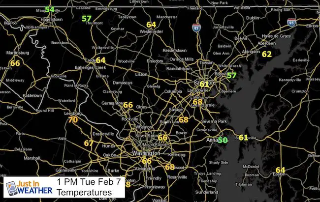
Temperatures: There has been an issue with local NWS Weather Station data reporting. So BWI is not on this list, but can be assumed that the record of 64°F will be broken. It should also be noted that it is much cooler (50s) right along the Chesapeake Bay.
Second Storm —> slider: GFS Model
SnapShot: 7 AM Thursday Morning

It is important to note that the modeling of the freezing line follows the typical boundary paralleling west and north of I-95. This follows the new split county advisory zones shown in this report.

Snow Forecast From NWS Regional Offices
Notice the northern MD snow from Sterling VA does not match the southern PA forecast from State College. This may be attributed in part to still factoring in the ground temperatures.


Follow the New Orleans tornado coverage with 28storms.com on Twitter
REMINDER: NO SNOW TOTAL MAP YET
I will make my first call map tonight.
Faith in the Flakes Online- Flannel PJs Printed Inside Out
Store Now Open

- We’ve added Flannel PJ Pants that will be printed inside out. They have to be, to make it snow ?
- Free Personal Delivery for orders of 20 items or more to schools and businesses.
- Click this image for the online store.
- Look for more items to be added soon.
- Also see the info for the STEM Assembly Spirit Wear program: Put your school name on the shirts and raise money for you PTO/PTA in the process.
Sign up for email updates on new posts
Since you may miss some posts via social media, click here for email alerts as a way to make sure you don’t miss any. *You may have to refresh that page once for your browser to clear out the images.
 Get the award winning Kid Weather App I made with my oldest son and support our love for science, weather, and technology. Our 3 year anniversary of the release and our contribution to STEM education is this November. It has been downloaded in 60 countries, and works in both temperature scales. With your support we can expand on the fun introduction to science and real weather.
FITF SNOW STICKS
 Available in 2 Ft, 30 Inches, and 3 Ft Sizes. Also with Orange/Black or Purple/Black. Click on the image to see the options offered by my friend Thatcher at Signs By Tomorrow in Timonium.
Go to http://www.signsbytomorrow.com/timonium/ to order yours today! Click the ‘Request a Quote’ button at the top of the page. In comment box include color, size and payment information. Please indicate whether you’d like to have us UPS ship them to you or if you would like to pick up in our store. Snow Sticks will ship or will be ready for pick up in our store 48 hrs after order is placed, Mon-Fri.
Also See:
My Winter Outlook for 2016-2017: Colder with snow spread out more
NOAA Winter Outlook for 2016 to 2017
La Nina Formed: What it could mean to our winter
Farmers Almanacs Split On Cold And Snow
Extreme Weather of 2015 balanced out on both ends
Low Snow Winters In Baltimore: Records Might Surprise You
NOAA Ranks Blizzard 2016 4th Worst Snowstorm On Record
Blizzard 2016 Record Top Snowstorm: Area Totals