Weather Collection Lab Thursday April 23
Thursday April 23 2020 Rain is on the way in this afternoon. This will last into Friday. Then a second storm will bring rain Saturday night into Monday. Here is
Thursday April 23 2020 Rain is on the way in this afternoon. This will last into Friday. Then a second storm will bring rain Saturday night into Monday. Here is
Wednesday April 22 Today is the 50th anniversary of Earth Day our small part of the planet almost hit a 145 year old record low. The temperature dropped to 35ºF
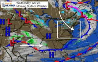
Wednesday April 22 2020 Earth Day begins quite chilly. Temperatures were close to a record low this morning. At 6 AM, BWI hit 35ºF, just shy of the 145 year
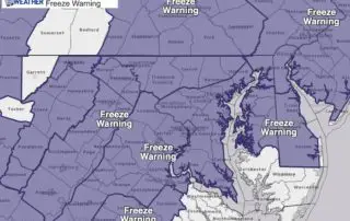
Tuesday April 21 2020 We have another Freeze Warning in effect for tomorrow morning. This is nothing new lately. In fact we've had a few of these a week. But
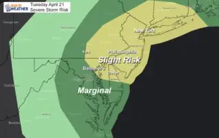
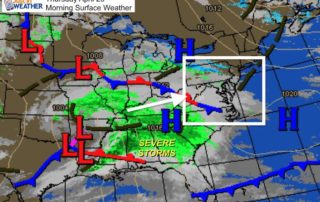
Tuesday April 21 2020 A quiet start this morning is not going to last. A strong cold front will provide some strong lines of storms that may turn severe mid
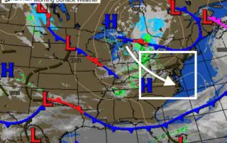
Tuesday April 21 2020 A strong cold front will swing down and bring us a round of strong to severe storms. Then colder air will follow overnight, bringing another chance

Monday April 20, 2020 Every year the Lyrid meteor shower peaks in the third week of April. There is a wide window between the 16th and 28th, but the most
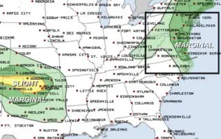
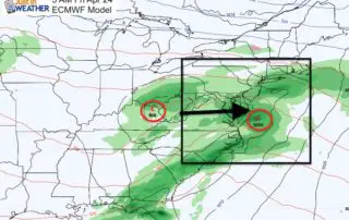
Monday April 20 Yesterday brought over 100 severe storm reports to the southern US. Today, rain will be passing through southern Maryland today, along with some severe storms in the
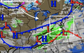
April 20 2020 Rain will be passing through Southern Maryland and the southeast US today. Another system will bring in a chance for strong thunderstorms to the eastern US on

April 18 2020 Another cold night ahead that is unfavorable for sensitive vegetation. Another Frost Advisory has been issued for Sunday morning April 19. Temperatures are expected to drop into