Monday October 4
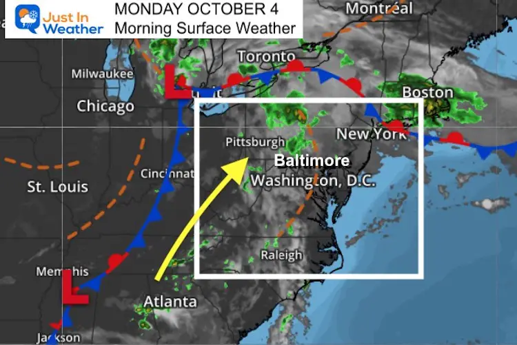
After summer heat and an onslaught of stinkbugs on Sunday, we start Monday with that hint of summer still in the air. Some showers passed by overnight, so the pavement may be damp. But most of the morning rain is well north and west.
Today will be warm, with another round of showers late in the day and evening.
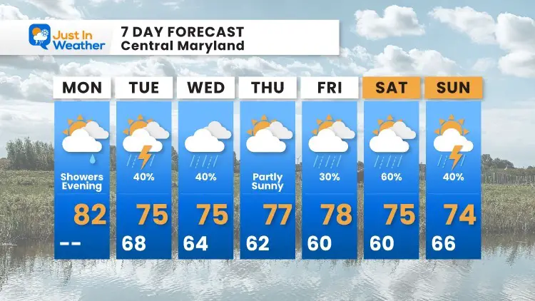
The rest of the week will show showers almost every day, but will not be a washout.
Morning Surface Weather
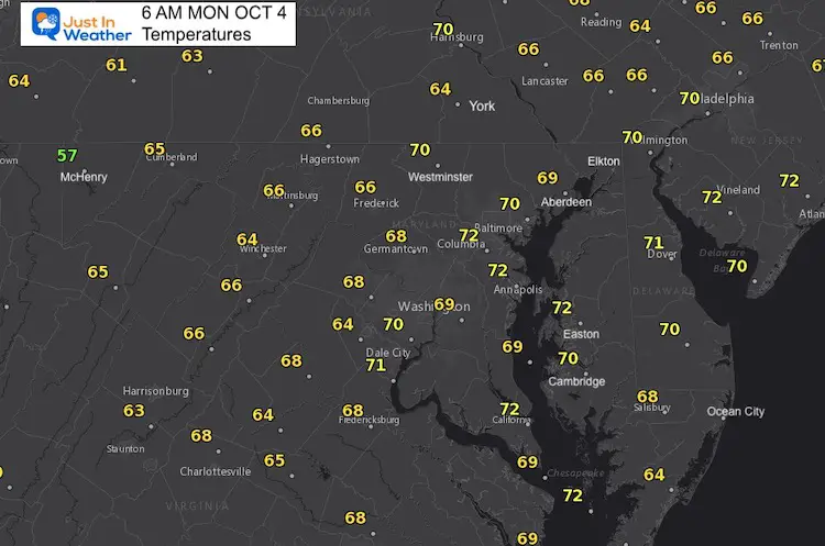
Morning Temperatures
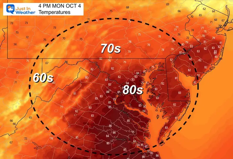
Afternoon Temperatures
Note: Our local Offical recording station at BWI tends to be warmer than models and surroundings.
My 7-Day forecast below is based on this location… So temps for most locations will be a little cooler.
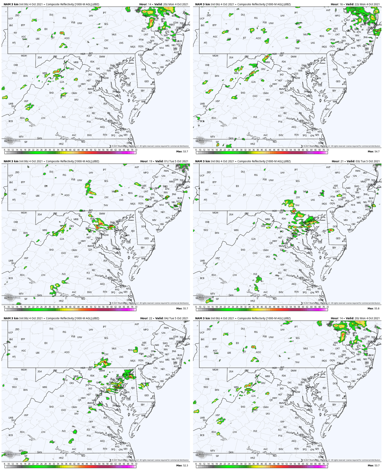
Showers This Evening
4 PM to Midnight- NAM 3 Km Model
Weather Almanac: Climate Data
TODAY October 4
Normal Low in Baltimore: 50ºF
Record 31ºF in 1974
Normal High in Baltimore: 71ºF
Record 92º F 1954
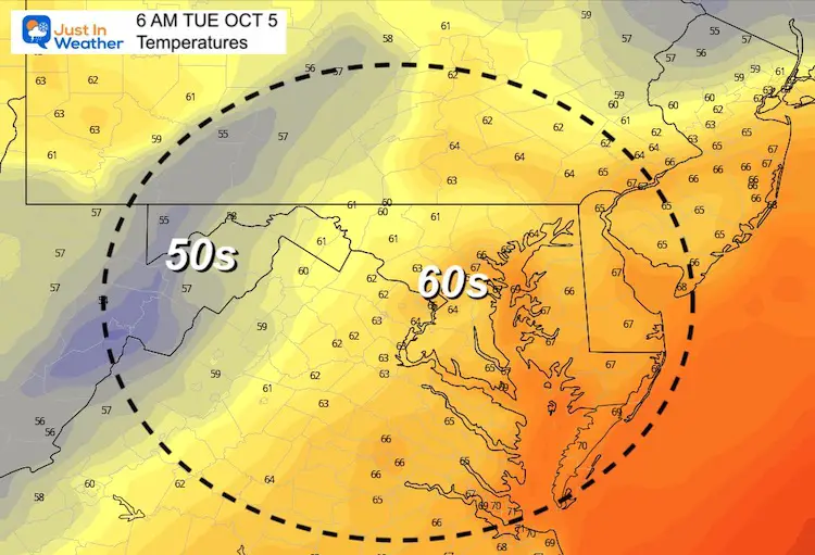
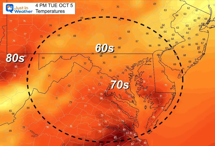
Temperatures Tuesday
Morning
Afternoon
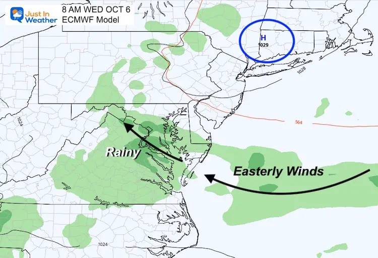
Week Long Rain?
Not exactly… High Pressure in New England will help keep an easterly wind across the Mid Atlantic. We will be on the edge, and models meander the location of that High. So the influence of the banding showers shifts as well.
This is not a washout. It is a chance of showers, which is more scattered with shorter duration.
7 Day Forecast
14 Local Maryland Pages (and York PA)
We have made a page for Maryland Weather which gives you the current conditions for 14 present area locations.
Maryland Trek Gear
Maryland Trek 8 Says THANK YOU!
Running Total Raised $116,438
During 329 Miles From Wisp To Ocean City
To Honor Kids In Cancer Treatment and Support FREE Programs At Just In Power Kids
Please share your thoughts, best weather pics/video, or just keep in touch via social media

