Wednesday September 29
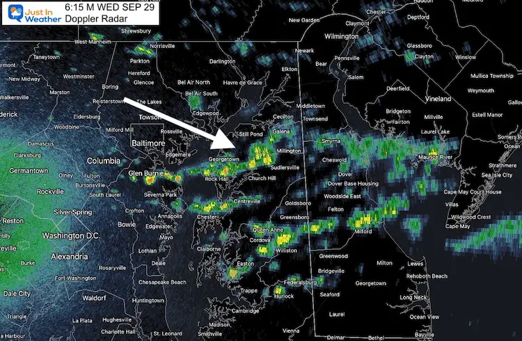
We got through yesterday with minimal storms, in part because of the delayed arrival of our cold front. It is moving through this morning with some showers that are already pushing across Delmarva.
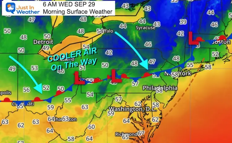
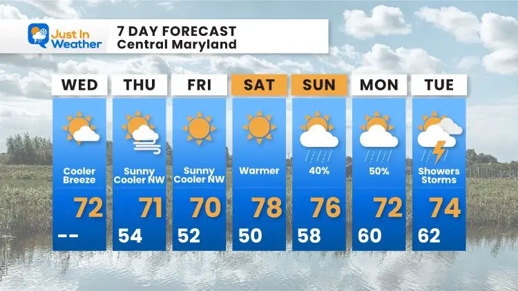
This is the leading edge of a new cooler air mass. Winds will shift to the north, and we will feel it with moderate breezes this afternoon. It will feel like Fall for a few days, warming up Saturday. Then we bring showers back.
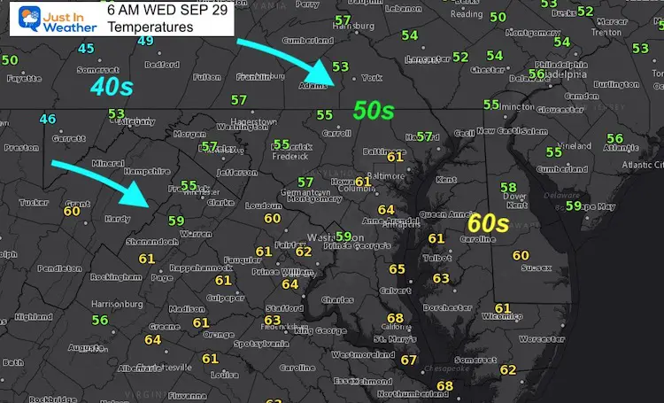
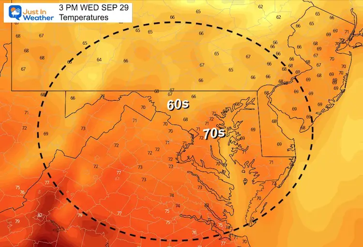
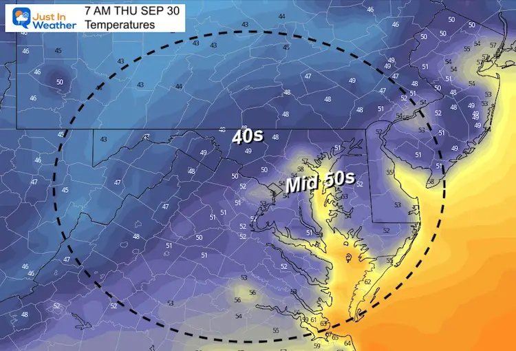
It is important to highlight the variation of temperatures in our region. My 7 Day Forecast below is based on the official report at BWI. But NO ONE lives at the airport, right? I am very aware. This is also a warm spot for our region, which is representative of the dense urban areas. But head a few miles away to the west and north, and temperatures are often much cooler.
The mornings ahead will be warmer by the water, but much cooler inland. The difference can be 10 degrees or greater.
Morning Doppler Radar Snapshot
Morning Surface Weather
Morning Temperatures
Afternoon Temperatures
Weather Almanac: Climate Data
TODAY September 29
Normal Low in Baltimore: 54ºF
Record 38ºF in 1951
Normal High in Baltimore: 75ºF
Record 90º F 1954
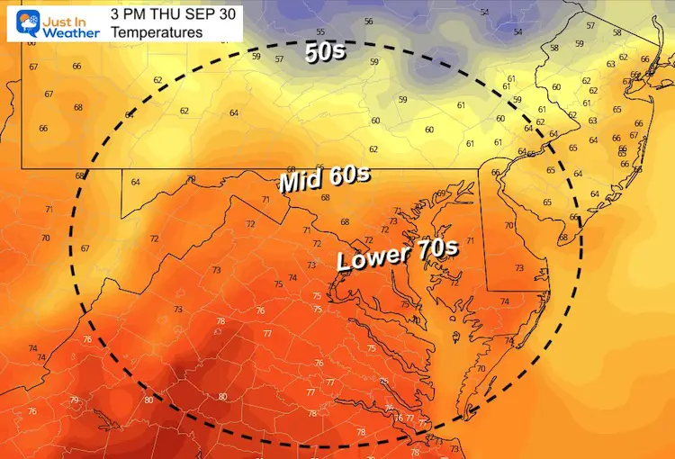
Temperatures Thursday
Morning
Notice the widespread 40s inland
Afternoon
Inland will be in the 60s, while cities and by the water will hold the lower 70s.
Looking Ahead:
The chance of showers will return on Sunday, the build through Tuesday and Wednesday next week.
7 Day Forecast
14 Local Maryland Pages (and York PA)
We have made a page for Maryland Weather which gives you the current conditions for 14 present area locations.
Maryland Trek Gear
Maryland Trek 8 Says THANK YOU!
Running Total Raised $116,438
During 329 Miles From Wisp To Ocean City
To Honor Kids In Cancer Treatment and Support FREE Programs At Just In Power Kids
Please share your thoughts, best weather pics/video, or just keep in touch via social media


