Tuesday September 28
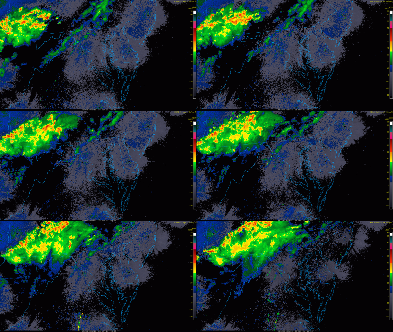
Today will be the last (somewhat) warm day for a while. A cold front will be passing through with a few rounds of showers. The first push this morning will be mainly north of Baltimore.
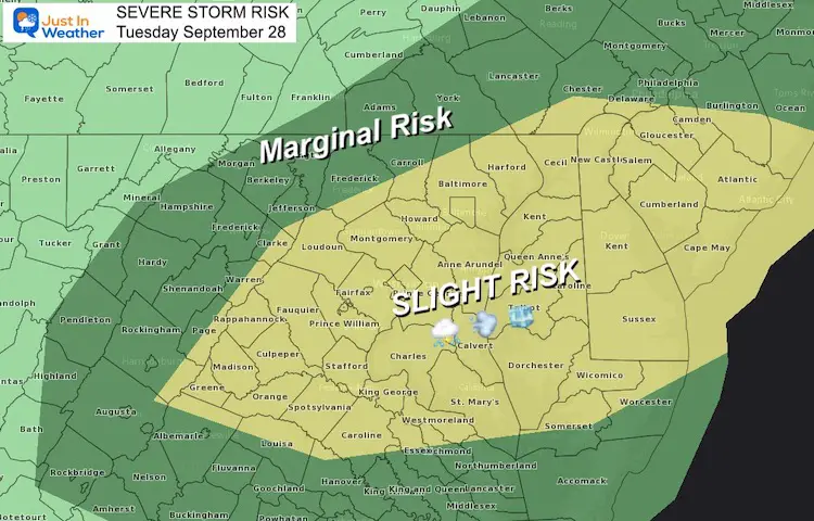
During the day into the evening, strong thunderstorms will be developing. These have a ‘slight risk’ to turn severe. This will bring central to southern Maryland and Delmarva the chance for damaging winds, large hail, and an isolated tornado.
Severe Storm Risk
Morning Radar Loop
2 Hours Up To 6:45 AM
Radar Simulation —-> slider
- Morning showers will be north.
- Metro areas mainly mid day and afternoon.
- The strong to severe storms will develop after 2 PM and slide south.
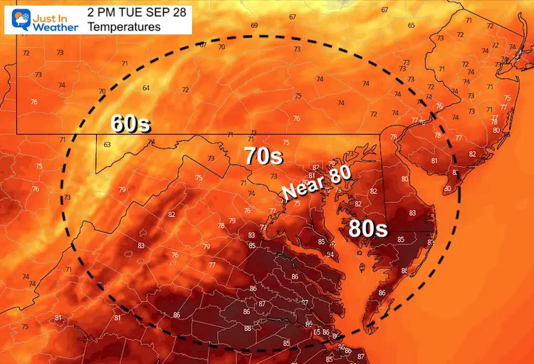
Afternoon Temperatures
Weather Almanac: Climate Data
TODAY September 28
Normal Low in Baltimore: 54ºF
Record 40ºF in 1989
Normal High in Baltimore: 75ºF
Record 89º F 2019
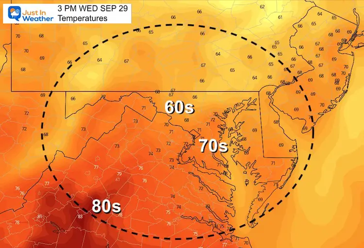
Temperatures Wednesday: Cooler
Morning
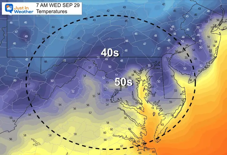
Afternoon
Tropical Weather
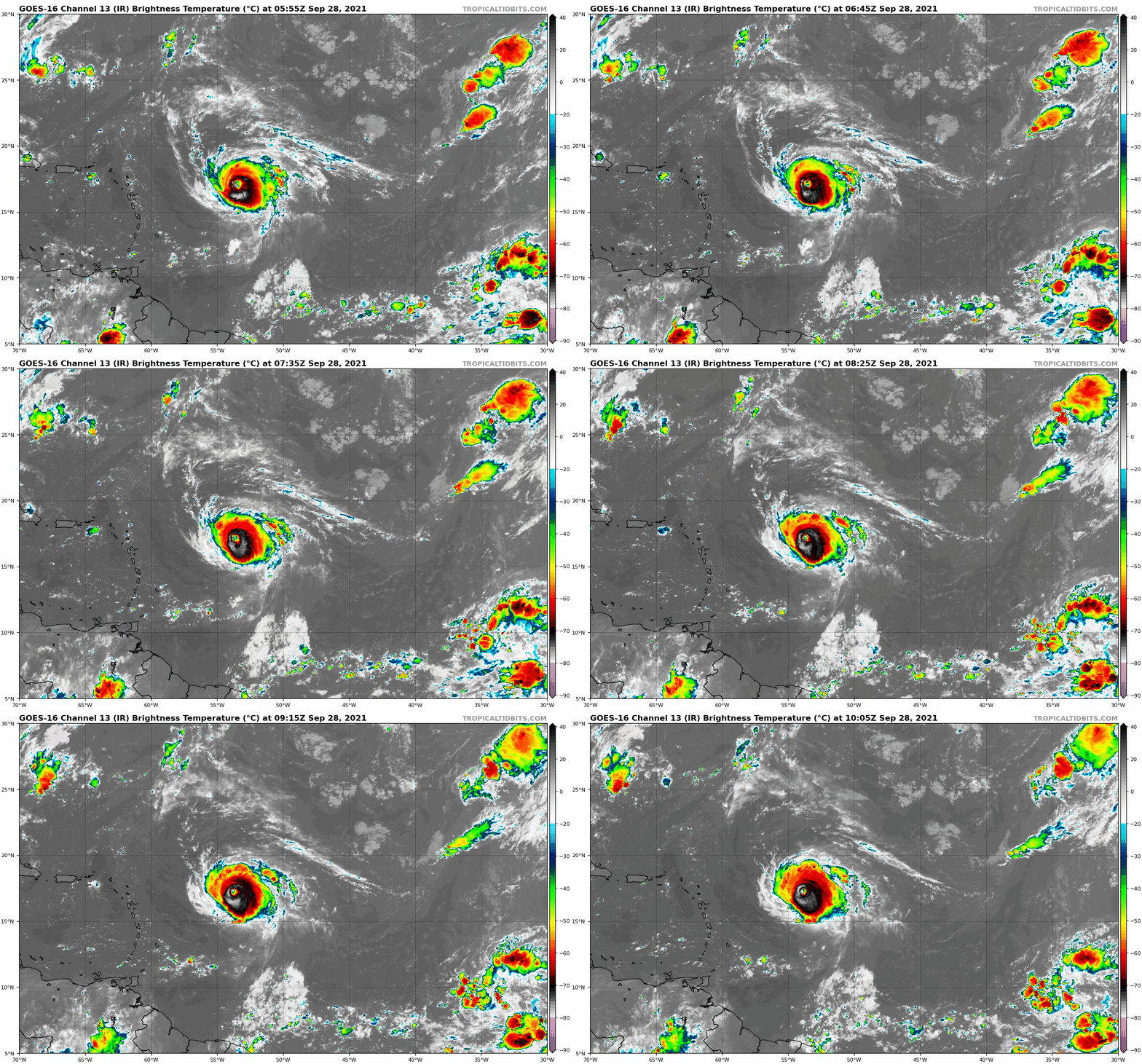
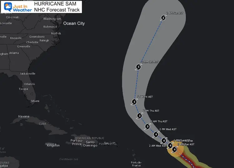
Hurricane Sam Satellite Loop
SUMMARY OF 500 AM AST...0900 UTC...INFORMATION
----------------------------------------------
LOCATION...17.2N 53.9W
ABOUT 610 MI...980 KM E OF THE NORTHERN LEEWARD ISLANDS
MAXIMUM SUSTAINED WINDS...130 MPH...215 KM/H
PRESENT MOVEMENT...NW OR 310 DEGREES AT 9 MPH...15 KM/H
MINIMUM CENTRAL PRESSURE...953 MB...28.15 INCHES
Forecast Track/Cone
Forecast plots from the National Hurricane Center for the next 5 days.
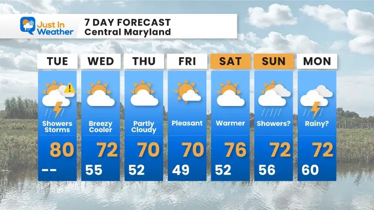
7 Day Forecast
14 Local Maryland Pages (and York PA)
We have made a page for Maryland Weather which gives you the current conditions for 14 present area locations.
Maryland Trek Gear
Maryland Trek 8 Says THANK YOU!
Running Total Raised $116,438
During 329 Miles From Wisp To Ocean City
To Honor Kids In Cancer Treatment and Support FREE Programs At Just In Power Kids
Please share your thoughts, best weather pics/video, or just keep in touch via social media

