Wednesday September 15 2021
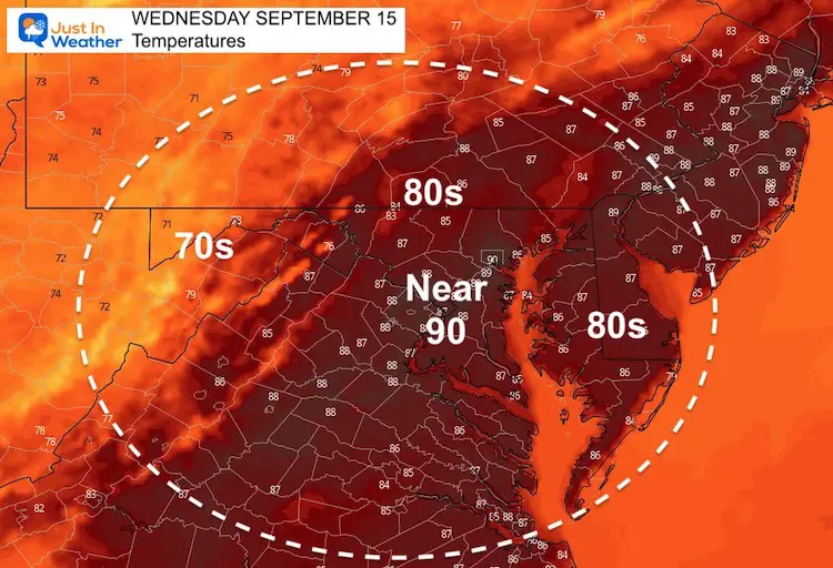
Still quite humid as we start another hot day. This time a cold front should help to stir up some more wind, which may help how it feels.
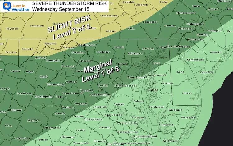
Storms will develop in the mountains where a Slight Risk (level 2 of 5) for storms to turn severe. This will be mainly in the mountains west and north of Baltimore.
Severe Storm Risk
The Slight Risk region may see large hail and damaging wind.
Part of this is a timing issue. While one or two cells may arrive late afternoon in north central Maryland, the bulk of the line reaches central after dark. Thus, losing the daytime heating. That is why the risk is only ‘marginal’, but still could have some boomers and downpours overnight.
Radar Simulation —-> slider
Afternoon Temperatures
Weather Almanac: Climate Data
TODAY September 15
Normal Low in Baltimore: 59ºF
Record 43ºF in 1985
Normal High in Baltimore: 80ºF
Record 94º F 1970
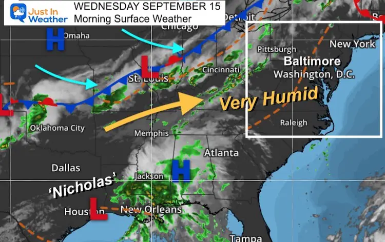
Morning Surface Weather
Storm Outlook
This GFS Model plot shows the widespread moisture with the remnants of Nicholas along the Gulf to our cold front.
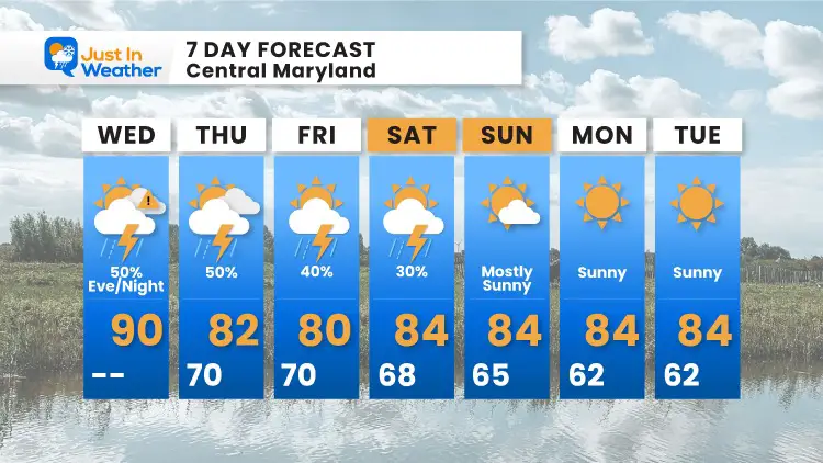
We will need to watch Low Pressure off of the east coast over the next few days. This may keep the risk of showers around into Saturday, then we clear out Sunday into early next week.
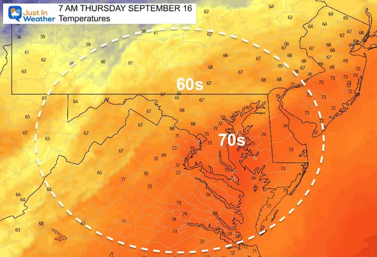
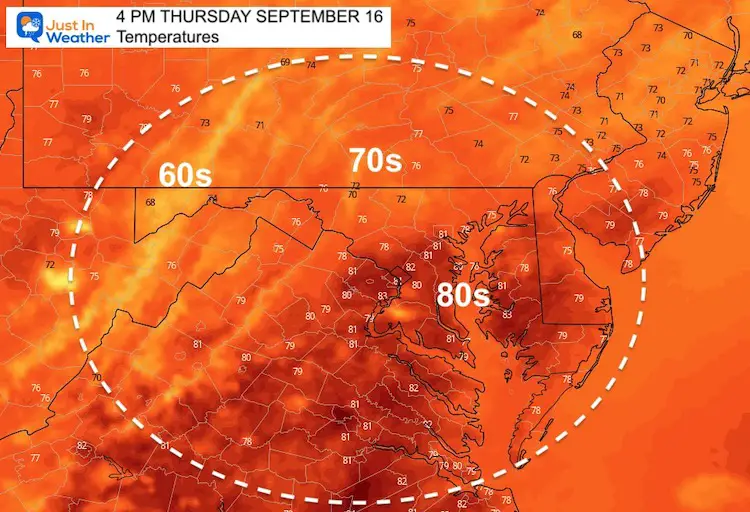
Temperatures Thursday
Morning
Afternoon
7 Day Forecast
14 Local Maryland Pages (and York PA)
We have made a page for Maryland Weather which gives you the current conditions for 14 present area locations.
Maryland Trek Gear
Maryland Trek 8 Says THANK YOU!
Running Total Raised $116,438
During 329 Miles From Wisp To Ocean City
To Honor Kids In Cancer Treatment and Support FREE Programs At Just In Power Kids
Please share your thoughts, best weather pics/video, or just keep in touch via social media

