Monday September 13 2021
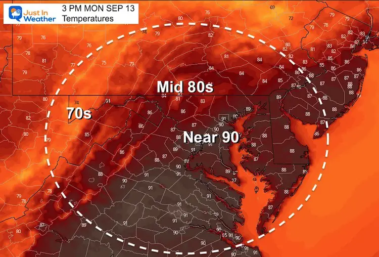
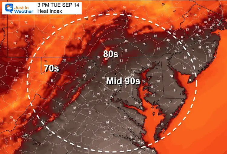
We will pick up on the heat from yesterday and add in some more humidity. The net result will make it feel like mid summer and less comfortable with heat index values approaching the mid 90s.
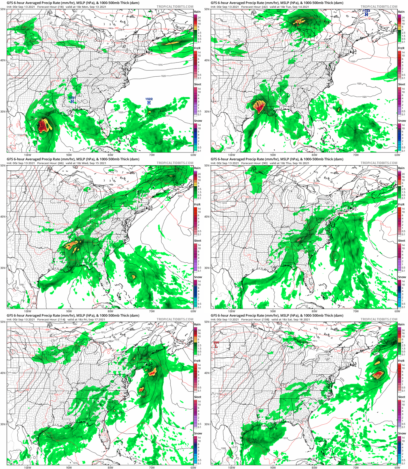
Tropical Storm Nicholas is another headline and not our storm. It will hit Texas, however that moisture is expected to get pulled up our way later in the week.
Morning Surface Weather
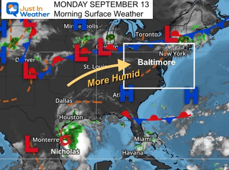
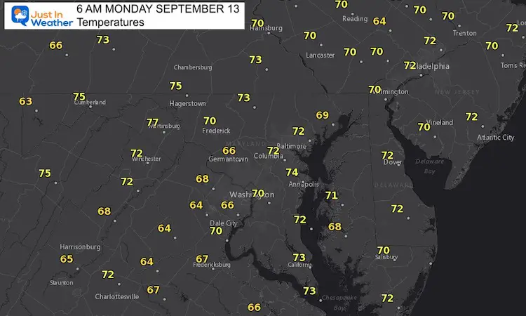
Morning Temperatures
Afternoon Temperatures
Heat Index
Weather Almanac: Climate Data
TODAY September 13
Normal Low in Baltimore: 60ºF
Record 42ºF in 1958
Normal High in Baltimore: 81ºF
Record 97º F 1952
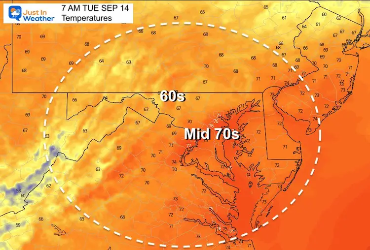
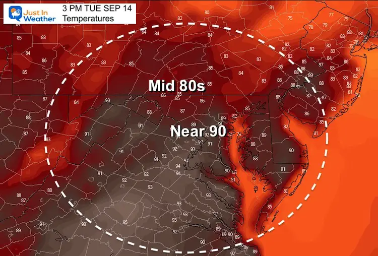
Tuesday Temperatures
Morning
Afternoon
Tropical Storm Nicholas
This storm is located in the western Gulf of Mexico and has been intensifying, but also running out of room.
This may reach hurricane strength before making landfall.
It will be running up against land along the Texas coast, and primarily remaining a Gulf Coast event.
However, remnant moisture may reach us by the end of the week.
Satellite Loop
Morning Conditions From NHC
LOCATION...25.5N 96.6W
ABOUT 45 MI...75 KM SE OF MOUTH OF THE RIO GRANDE
ABOUT 200 MI...325 KM S OF PORT OCONNOR TEXAS
MAXIMUM SUSTAINED WINDS...60 MPH...95 KM/H
PRESENT MOVEMENT...NNW OR 345 DEGREES AT 14 MPH...22 KM/H
MINIMUM CENTRAL PRESSURE...1001 MB...29.56 INCHES
Forecast Animation:
The GFS Model is showing the moisture dumping across southeast Texas to Louisiana. After being downgraded, the moisture will get pulled up along a cold front and enhance our storms Thursday and Friday.
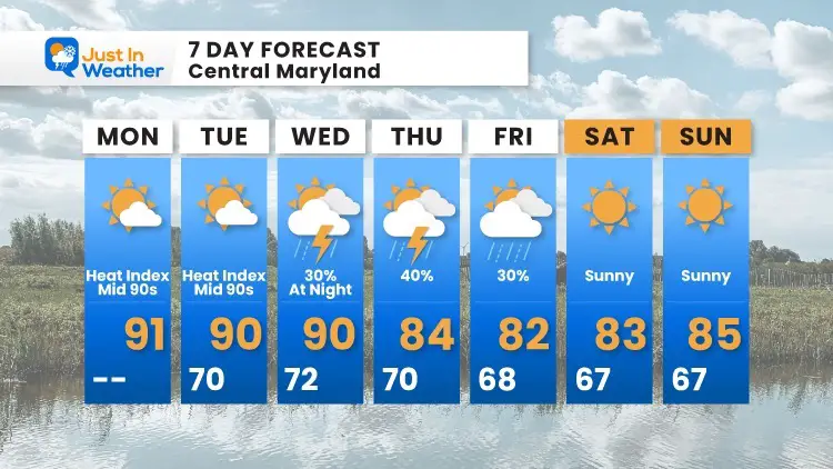
7 Day Forecast
14 Local Maryland Pages (and York PA)
We have made a page for Maryland Weather which gives you the current conditions for 14 present area locations.
Maryland Trek Gear
Maryland Trek 8 Says THANK YOU!
Running Total Raised $116,438
During 329 Miles From Wisp To Ocean City
To Honor Kids In Cancer Treatment and Support FREE Programs At Just In Power Kids
Please share your thoughts, best weather pics/video, or just keep in touch via social media


