Thursday September 2 2021
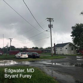
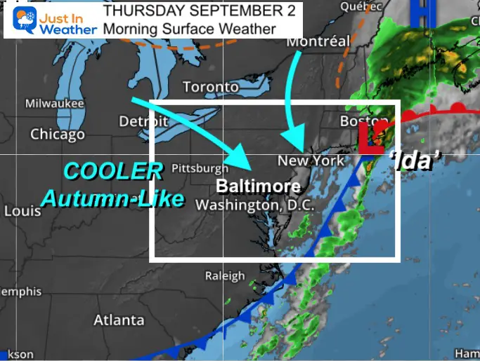
The remains of former Hurricane Ida will be exiting New England this morning. The swath of heavy rainfall, flooding, and tornado damage has been historic.
Today will be a day to gather more information on the tornado paths and intensity. Also the completion of rainfall today and flood damage. However water levels on continue to rise on rivers, where additional flooding remains a threat.
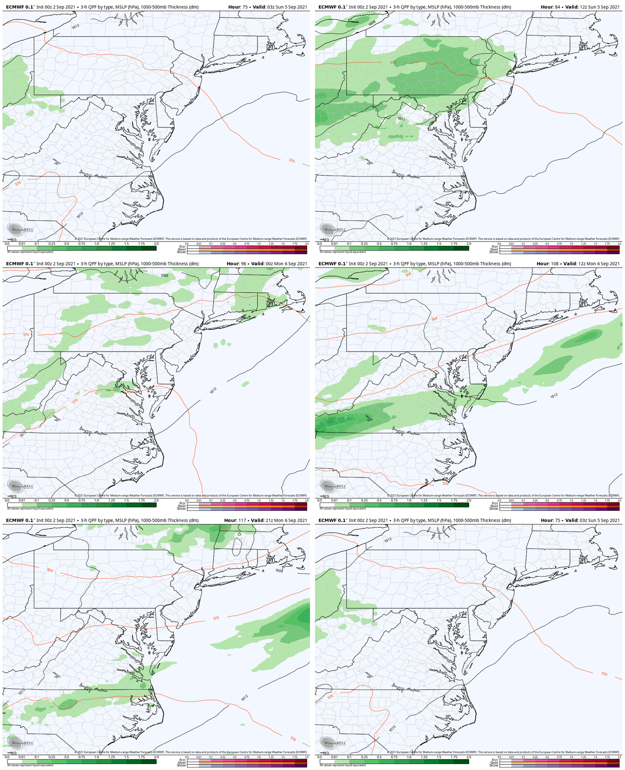
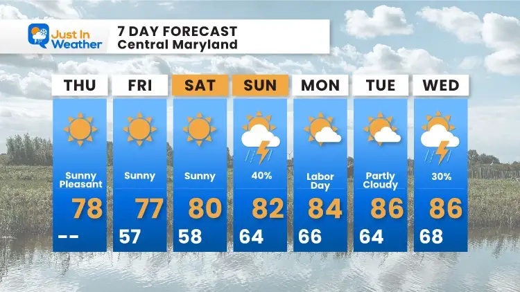
Our weather outlook below shows a hint of autumn, with a mostly nice holiday weekend, with one day that may bring showers.
Rainfall: Storm Total Estimate
Many areas received 5 inches or more of rain from central Maryland northward.
A typical September would bring 4.44 inches of rain to Baltimore at BWI.

River Flood Monitoring
Click image to see the morning update for The Monocacy and Susquehanna at Conowingo Dam.
Also See:
Tornado Video and photo collection
Morning Surface Weather
Satellite Loop
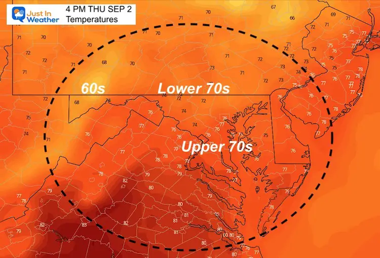
Afternoon Temperatures
Weather Almanac: Climate Data
TODAY September 2
Normal Low in Baltimore: 63ºF
Record 51ºF in 1991
Normal High in Baltimore: 83ºF
Record 99º F 1953
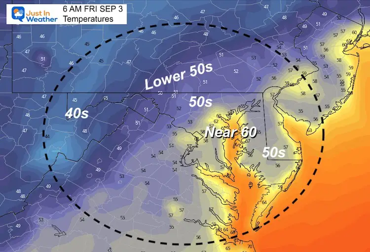
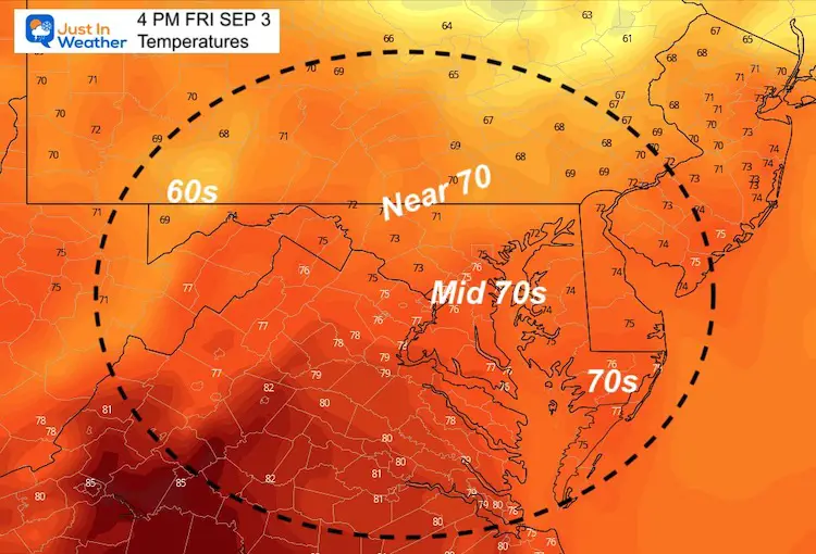
Friday Temperatures
Morning
Afternoon
Weekend Outlook:
The chance of showers will be with us on Sunday, then improving on Labor Day Monday.
7 Day Forecast
14 Local Maryland Pages (and York PA)
We have made a page for Maryland Weather which gives you the current conditions for 14 present area locations.
Maryland Trek Gear
Maryland Trek 8 Says THANK YOU!
Running Total Raised $116,438
During 329 Miles From Wisp To Ocean City
To Honor Kids In Cancer Treatment and Support FREE Programs At Just In Power Kids
Please share your thoughts, best weather pics/video, or just keep in touch via social media


