Monday August 23 2021
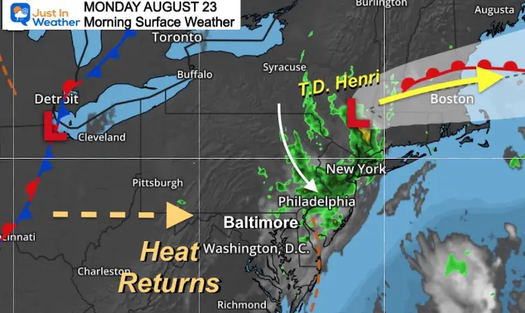
Henri has been downgraded to a Tropical Depression and now sitting in the Hudson Valley of New York. The last round of showers has moved through Northeast Maryland and Delmarva. The clouds will break and heat returns today.
Isolated showers may developed late afternoon, but the main theme this week will high temps and humidity, meaning even the nights and morning remain muggy.
Morning Surface Weather
Headlines:
- Early showers and clouds east of Baltimore.
- Sun and heat returns.
- Isolated showers will pop after 4 PM
- Muggy air means very warm and uncomfortable nights.
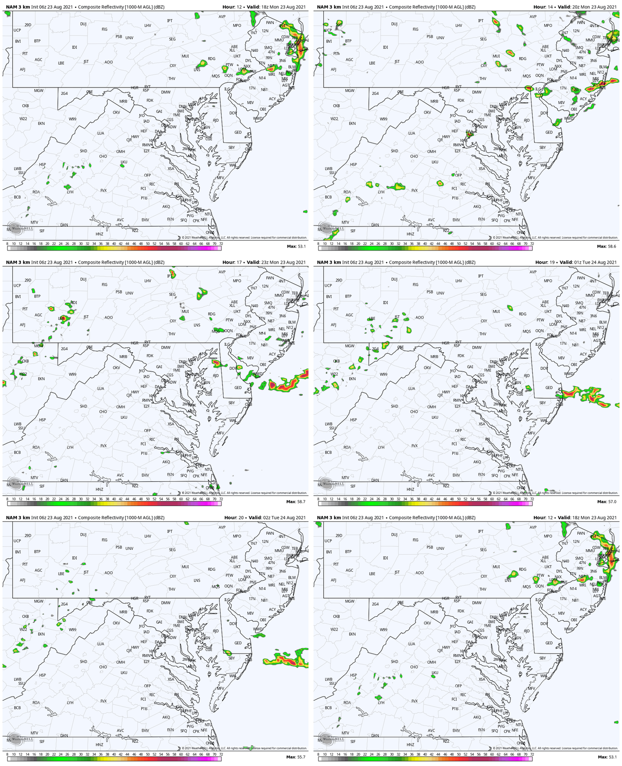
Radar Simulation 4 PM to 2 AM
Weather Almanac: Climate Data
TODAY August 23
Normal Low in Baltimore: 65ºF
Record 50ºF in 1952
Normal High in Baltimore: 85ºF
Record 98º F 1968
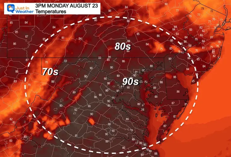
Temperatures
This Afternoon
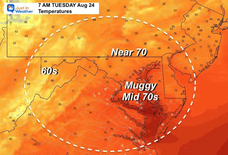
Tuesday Morning
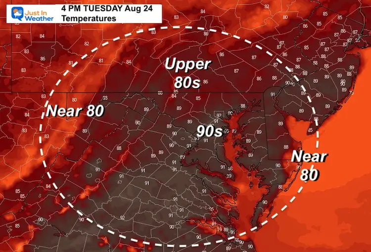
Tuesday Afternoon
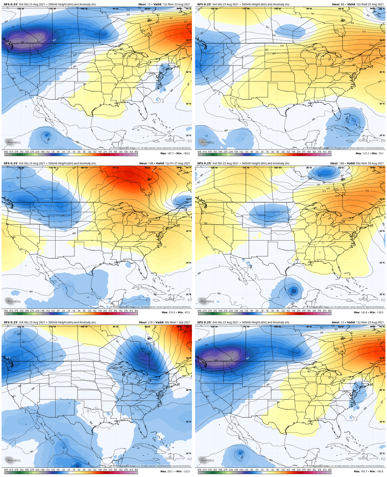
Jet Stream: Today Through Next Tuesday Evening
We remain under the influence of this ridge, meaning heat continues.
The first break will be this weekend, then a more significant cooling trend is expected to arrive by next Tuesday.
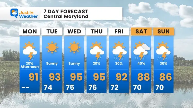
7 Day Forecast
14 Local Maryland Pages (and York PA)
We have made a page for Maryland Weather which gives you the current conditions for 14 present area locations.
Maryland Trek Gear
Maryland Trek 8 Says THANK YOU!
Running Total Raised $116,098
During 329 Miles From Wisp To Ocean City
To Honor Kids In Cancer Treatment and Support FREE Programs At Just In Power Kids
Please share your thoughts, best weather pics/video, or just keep in touch via social media

