Saturday June 26 2021
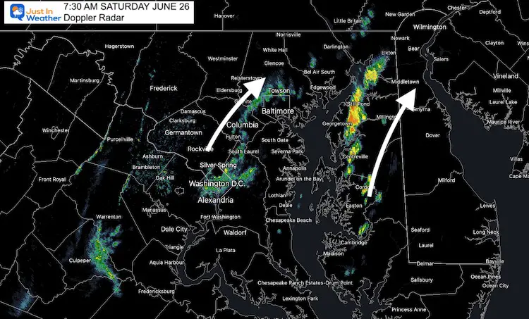
A few spotty showers have developed this morning. Radar has indicated a few lines of rain, one near I-95 and metro Baltimore, the other on the Eastern Shore
Radar Snapshot
The showers are moving to the Northeast, but are very narrow. A heavier line is located along the upper Eastern Shore from Centreville to Elkton.
If you miss the rain, you should still get more clouds through mid day to early afternoon.

Surface Weather
High Pressure is still controlling our weather with mostly dry conditions. Flooding rain likely to our west with that weather pattern blocked.
The wind shift for us will allow more humidity and eventually more heat over the next week. Starting tomorrow, we should see afternoon temps in the 90s through most of next week.

Radar Simulation
Noon: Fading line on the Eastern Shore

Late Afternoon: Showers reforming in the mountains.

In case you missed it
Earthquake in Woodlawn, MD on Friday
TEMPERATURES
Weather Almanac Today:
Climate Data For Baltimore
Normal Low in Baltimore: 64ºF; Record 52ºF in 1986
Normal High in Baltimore: 85ºF, Record 99º F 1954
Afternoon Temperatures

Sunday Temperatures
Morning

Afternoon: HOT

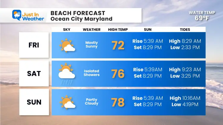
Beach Forecast

7 Day Forecast

Sunshine State Of Mind
I am done with the cold and snow (for the season). I am embracing my wife’s mantra of Sunshine State of Mind.
This was designed by Shannon Berk and we will be wearing it through spring and to the beach.
Double Benefit: Proceeds will be split between our nonprofit Just In Power Kids and the development of my new weather website. That has been scheduled to be ready to launch in May.
14 Local Maryland Pages (and York PA)
We have made a page for Maryland Weather which gives you the current conditions for 14 present area locations.
Please share your thoughts, best weather pics/video, or just keep in touch via social media


