Wednesday May 12 2021
We all know that age old expression: If you don’t succeed, then try, try, try, try, try again. NASA was set to attempt for a 6th time to launch a rocket launch tonight at 8:06 PM from Wallops Island, VA. I figured The Colonial Pipeline resumed operations today, so maybe the good luck will spread here?
The weather was improving there just recently after an overcast day. I have all the weather conditions here and still want you to see this amazing satellite loop. But something else got in the way. More on that below.
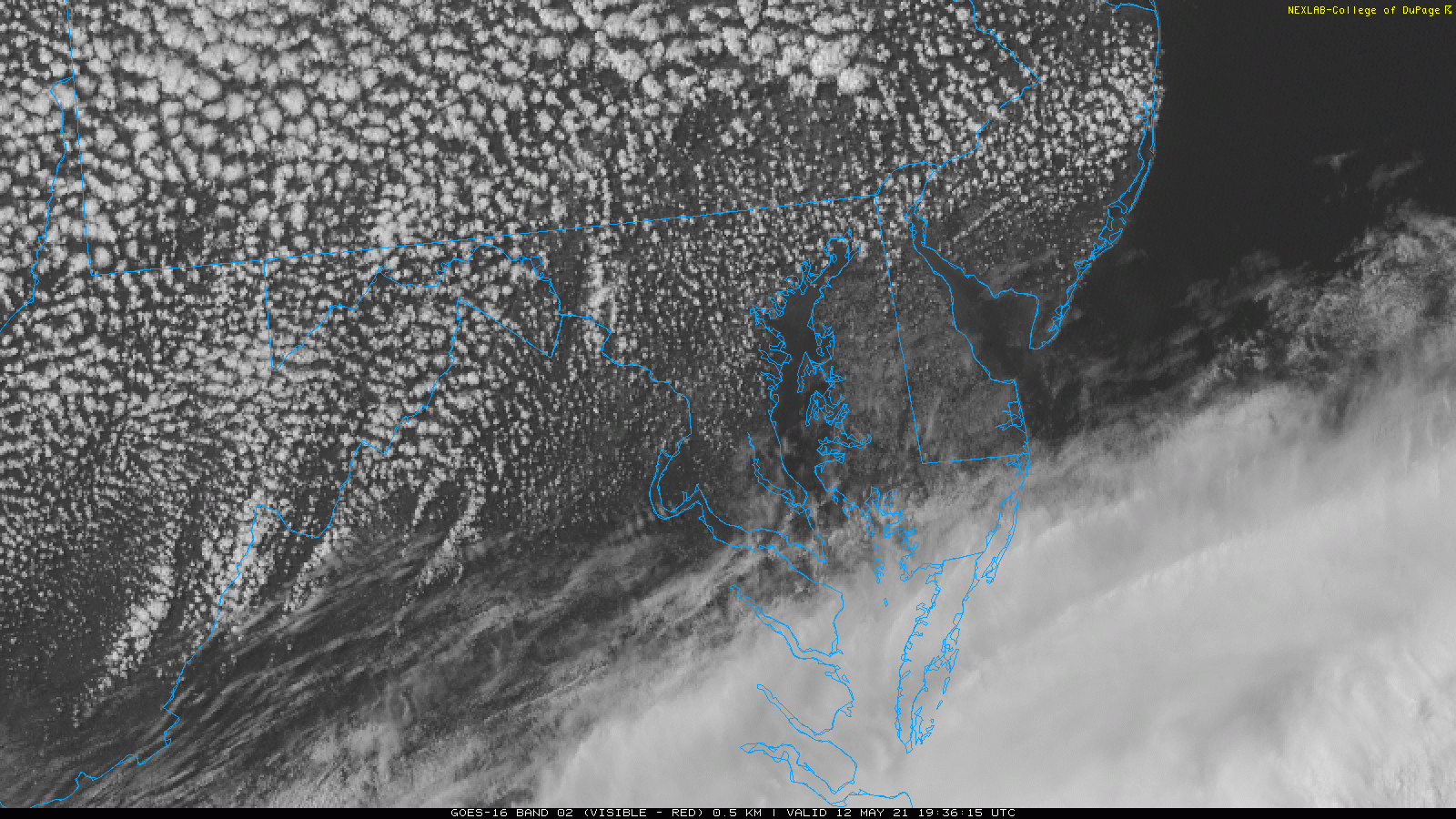
Satellite Loop: Wednesday Afternoon
3:36 PM to 5:36 PM – This was mesmerizing! The wind flow contrast showed up really well with the clouds.
- Most of us has a north wind with the speckled fair weather cumulus. These fade as the sun gets low.
- Coastal areas, including Wallops Island were on the edge of the overcast from the southern storm.
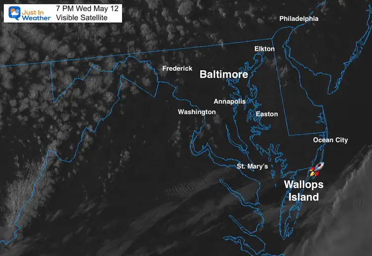
Satellite Snapshot at 7 PM
It really was looking so much better. But upper level winds and conditions upstream are still factored in.
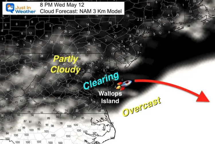
Launch Forecast Cloud Cover
It should be noted that the rocket will be heaving over Bermuda, so flying to the East-Southeast. This would be ‘over’ the cloud cover eventually. This forecast did match the conditions. See more on the weather below… After the Breaking News Update.
BREAKING UPDATE
All was looking good, as you can see below. However something else got in the way.
LAUNCH UPDATE❗ The Black Brant XII launch scheduled for May 12 has been postponed to provide time for inspection of the rocket after the vehicle came in contact with a launcher support during today’s preparations. The next launch opportunity is NET 8:02 pm ET, Friday, May 14.
— NASA Wallops (@NASA_Wallops) May 12, 2021
Upper Level Wind Forecast —> slider
I’ve included the flight path towards Bermuda.
- 700mb = 10,000 FT
- 500mb = 18,000 FT
- 300mb = 30,000 FT
- 250mb = 36,000 FT
This looks to be too fast again as well, but I do not know the limits for this mission.


Weather At Wallops Island Flight Facility
This map shows the surface winds and should let you display the weather conditions.
Tap the (v) for more details
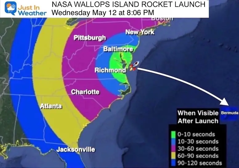
Rocket Viewing
Launch visible shorty after lift off.
Face East/Southeast: To the ‘right’ of where the sun has been rising recently.
If the sky is clear, then you may see a light streak within 1 minute across much of our region as presented in this map.
The high altitude light show will begin 9 minutes later.
This rocket is designed to created an artificial aurora high in the atmosphere to test high altitude conditions. Basically for us it will be a display of bright lights more than 200 miles above the ground.
This was postponed each day since Friday due to weather. Winds need to be light enough, along with clear skies for cameras in Wallops Island and Bermuda to observe the artificial aurora. When this occurs, the eastern US should have a chance to watch the rocket and the high altitude sky show.
Live Stream: NASA-TV Wallops
Live Coverage begins at 7:40 PM. There is a delay that can range from 20 seconds to up to 1 minute.
Vapor Tracers: What You May See
About 9 minutes after launch, the payload of vape tracers will be released,
217 to 249 miles above the ground of Bermuda.
This is made up of the dame material in fireworks.
Barium Vapor: This will form two green-violet clouds that may be visible for about 30 seconds.

Scientists use vapor tracers primarily to study atmospheric winds in upper atmosphere and ionosphere. When released after launch, the tracers make it possible to directly observe the winds.
Reminder:
If this does NOT occur tonight, they have more opportunities in the days ahead. We would want a clear sky for much of the Mid Atlantic (and East Coast) for more to be able to view this.
You May Also Be Interested In…
Morning Twilight Show Not A UFO March 14
Red Cloud Mystery Solved March 3
UFO or Meteor Captured on Security Cam Sep 22 2020
Meteor Fireball Bolide Video: March 21 2021
Sunshine State Of Mind
I am done with the cold and snow (for the season). I am embracing my wife’s mantra of Sunshine State of Mind.
This was designed by Shannon Berk and we will be wearing it through spring and to the beach.
Double Benefit: Proceeds will be split between our nonprofit Just In Power Kids and the development of my new weather website. That has been scheduled to be ready to launch in May.

14 Local Maryland Pages (and York PA)
We have made a page for Maryland Weather which gives you the current conditions for 14 present area locations.

Please share your thoughts, best weather pics/video, or just keep in touch via social media