4:40 PM Fri April 30
A squall line has been moving through the mountains as seen on radar this afternoon. This is a cluster of briefly heavy rain with enhanced wind thanks to some upper level energy. Winds in the event are pushing up to 60 mph.
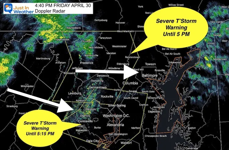
A Severe Thunderstorm Warning was issued by the National Weather Service, mainly for the wind associated with this cell.

Warning For Places Included until 5 PM
- Northeastern Washington County
- Carroll County
- Western Howard
- Montgomery County
- Frederick County
- West central Baltimore County
- Central Loudoun County in northern Virginia…
Warning For Places Included Until 5:15 PM
Metro Washington, Southern Howard and PG Counties in MD, and northern Virginia.
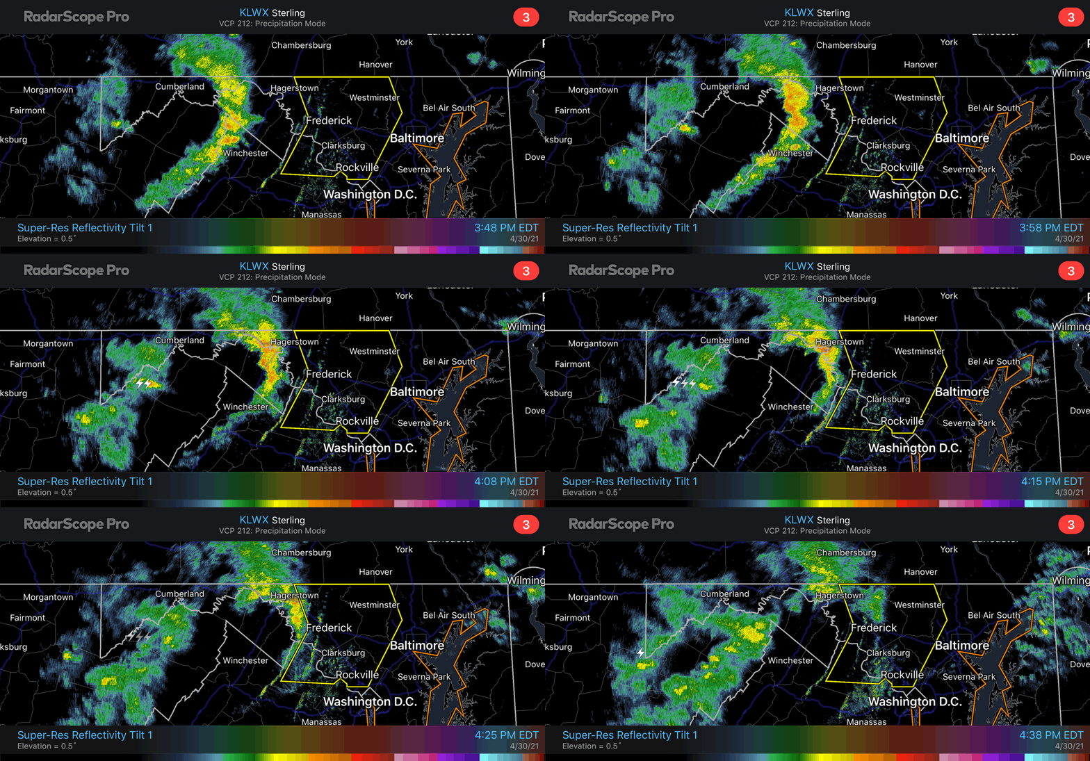
RADAR LOOP
As you can see in the loop below, this appears to be losing some rain while crossing the mountains near Frederick. This is a common occurrence with downscoping winds heading into lower elevation.
It is possible the rain diminishes further as it reaches metro areas.
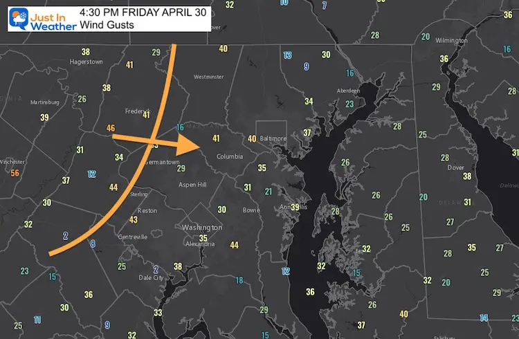
However, that can keep the winds alive or even build them stronger. Plan for strong winds in metro areas with this line (rain or no rain) through the 6 PM hour.
Wind Gusts

Sunshine State Of Mind
I am done with the cold and snow (for the season). I am embracing my wife’s mantra of Sunshine State of Mind.
This was designed by Shannon Berk and we will be wearing it through spring and to the beach.
Double Benefit: Proceeds will be split between our nonprofit Just In Power Kids and the development of my new weather website. That has been scheduled to be ready to launch in May.
14 Local Maryland Pages (and York PA)
We have made a page for Maryland Weather which gives you the current conditions for 14 present area locations.
Please share your thoughts, best weather pics/video, or just keep in touch via social media
Facebook: Justin Berk, Meteorologist
Twitter: @JustinWeather
Instagram: justinweather
Maryland Smoothie King Is Now Supporting Our Nonprofit Just In Power Kids


