Tuesday April 20 2021
An arctic front will arrive on Wednesday with a dramatic change in our weather. If this were in the winter season we could be talking about local snow and possibly record cold temperatures.
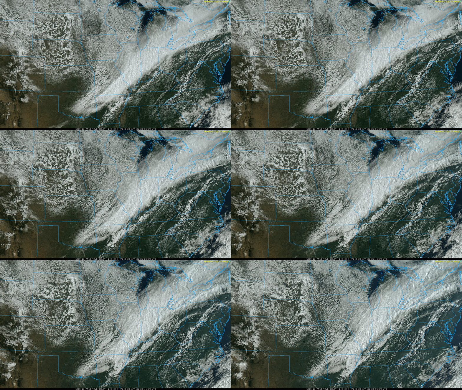
But first, check out this set up. There is a clear line of demarkation today seen on this satellite loop.
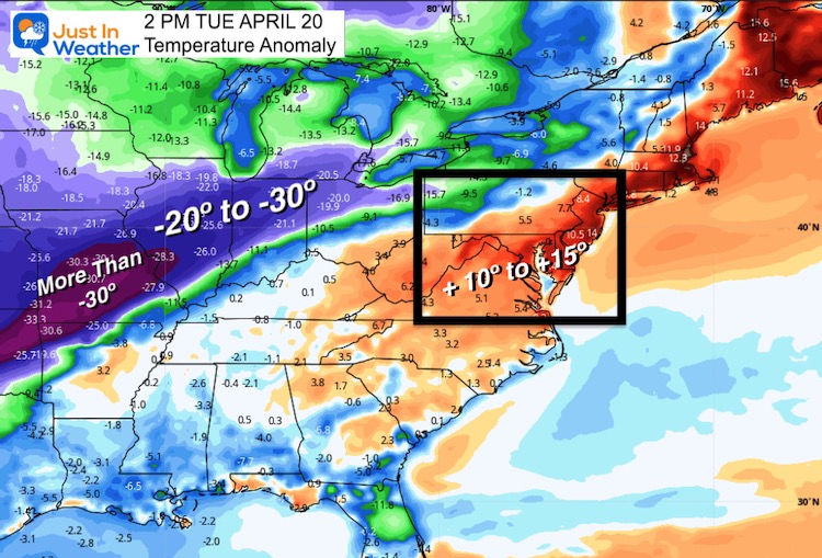
Temperature Spread
This afternoon, that line separated the warm air we had in the east versus the cold to the west. On the other side of that front, temperatures were running more than 30 degrees (F) below average. Our warm 70s will be replaced tomorrow.
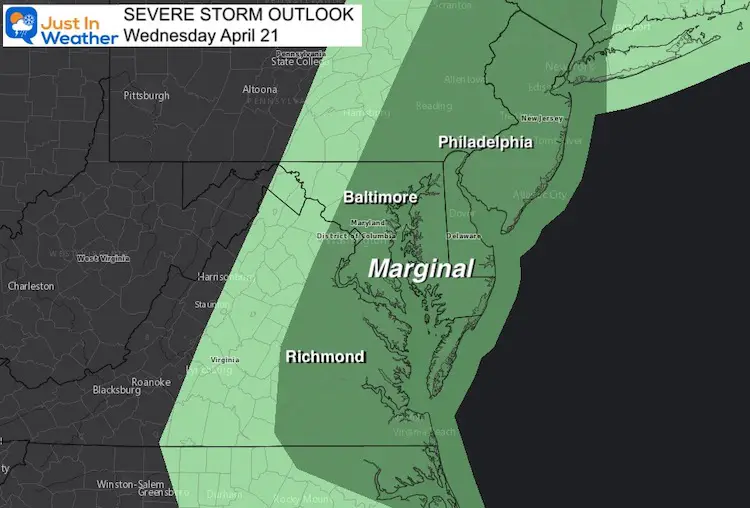
I want to focus on what it will bring us, so I placed timeline sliders below to track the cold and squall line to help you plan your day. Your kids may want to wear shorts in the morning, but may need a winter coat in the afternoon. If you are like me going to their evening baseball game (or other outdoor sport), you will need to dress in plenty of layers. Them and you!!!
Bring It On
Let’s take a look at the timeline sliders for when we expect this to pass through your area. I’ve included the forecasts for precipitation and temperatures.
Rain and Snow Simulation —-> slider
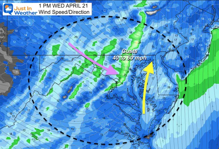
Wind Forecast
This snapshot is when the winds are expected to peak. It will be breezy before and after the front passes, but not nearly as intense.
Temperature Timeline —-> slider
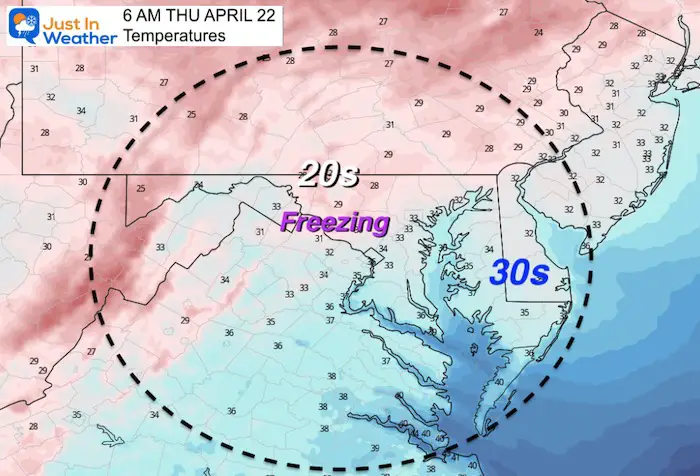
Thursday Morning
This will be a dramatic drop, with many areas just inland dropping below freezing. THIS is why we keep hearing to hold off on planting…
If we can sustain a strong breeze, it may limit frost formation. But a better chance of extensive frost is likely on Friday morning.
RECORD LOWs FOR BALTIMORE:
April 21 = 29ºF in 1956
April 22 = 32ºF in 1875
I will have a full report and extended forecast in my morning report.
Snow Forecast
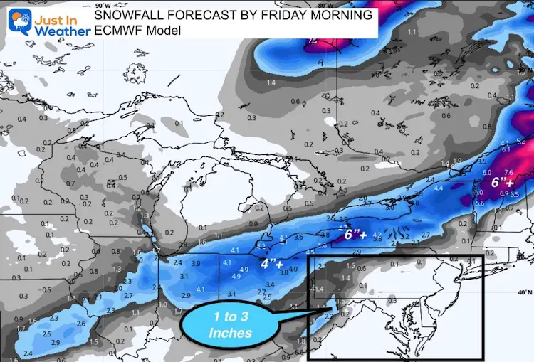
We are still talking about snow for a large path across the Midwest. Some cities will see their latest measurable snow. You will hear plenty about that on other outlets. I just wanted to share this ECMWF snow forecast to give some perspective.
Western Maryland may get 1 or 2 inches, and I have the LIVE Web Cams below for you to check at sunrise to see if it began.
Snow Cam 1
Snow is expected to be falling before sunrise on Wednesday… Keep checking back to see.
This webcam is positioned at The Greene Turtle Deep Creek Lake and shows Wisp Resort, including a zoomed-in view of Squirrel Cage, The Face, the terrain park, Boulder, the mountain coaster, the tubing park and a shot of McHenry Cove at Deep Creek Lake!
Snow Cam 2
This webcam is positioned at the very popular Lakeside Creamery and Copper Kettle Popcorn Factory.
Views of Deep Creek Lake, Deep Creek Lake State Park, the Glendale Road Bridge, and more!
Web Cams Provided By
Railey Realty and Railey Vacations
Local Forecast
Click here for full page and radar
Sunshine Sate Of Mind
I am done with the cold and snow (for the season). I am embracing my wife’s mantra of Sunshine State of Mind.
This was designed by Shannon Berk and we will be wearing it through spring and to the beach.
Double Benefit: Proceeds will be split between our nonprofit Just In Power Kids and the development of my new weather website. That has been scheduled to be ready to launch in May.
14 Local Maryland Pages (and York PA)
We have made a page for Maryland Weather which gives you the current conditions for 14 present area locations.
Please share your thoughts, best weather pics/video, or just keep in touch via social media
Facebook: Justin Berk, Meteorologist
Twitter: @JustinWeather
Instagram: justinweather
Maryland Smoothie King Is Now Supporting Our Nonprofit Just In Power Kids


