April 2 2021
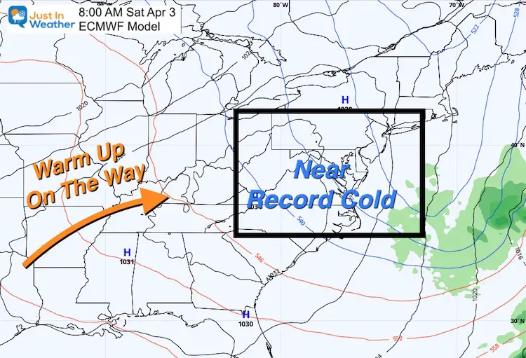
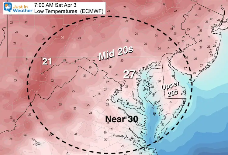
We are still in the grip of a winter-like weather pattern. This even brought snow showers to Kent Island and parts of the Maryland Eastern Shore this morning. The good news is that the winds are easing up, and the clouds will diminish tonight. The down side of that will be the core of the cold air early Saturdays morning that may challenge the record low temperatures at BWI.
Saturday Morning Surface Map
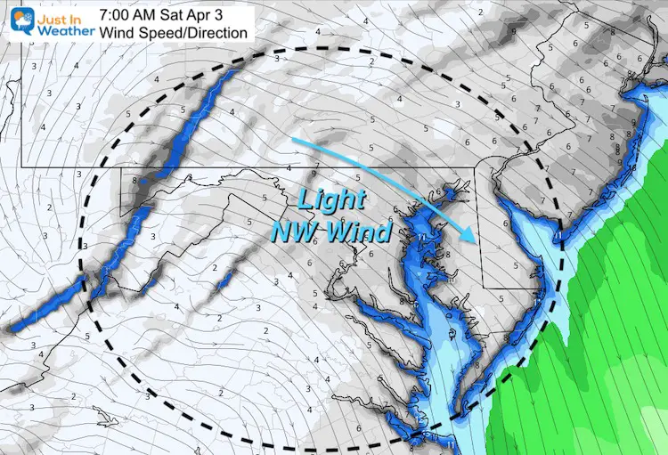
Wind Forecast Saturday Morning
Winds will be light to near calm at daybreak. This allows for maximum radiational cooling.
Weather Almanac: Baltimore at BWI
27ºF was the record low for April 3
*Recorded in 2013
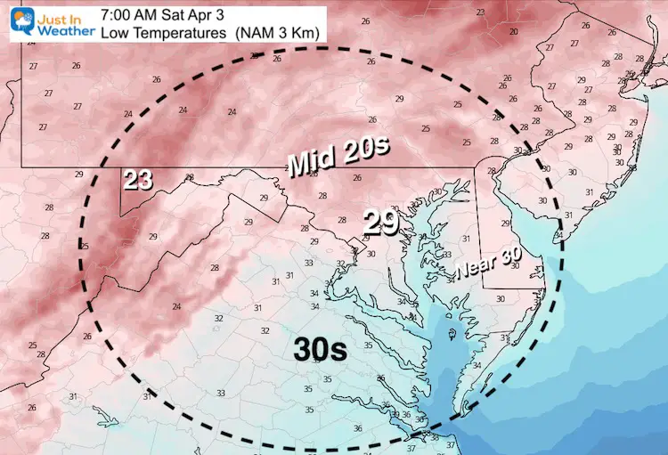
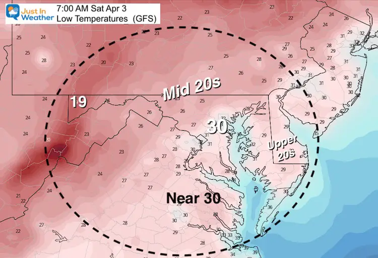
Compare Model Forecast Lows
These are pretty close to the mark.
European Model
NAM 3 Km Model
GFS Model
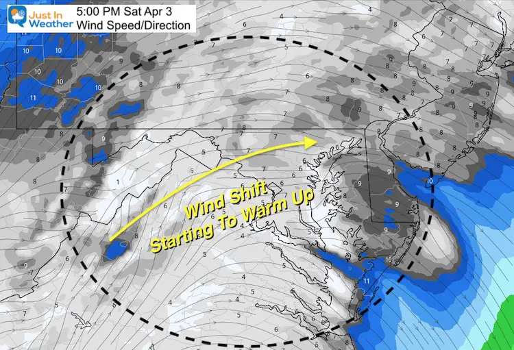
Turning The Corner
The shift of the winds to the west and southwest in the afternoon will help us warm up again.
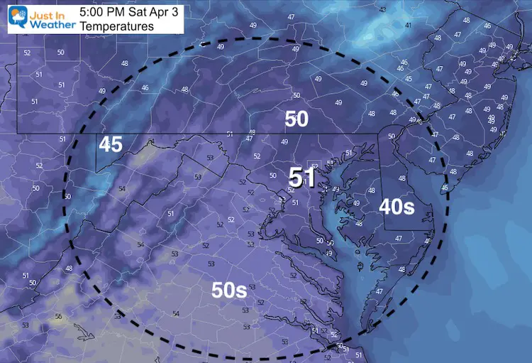
Saturday Afternoon Forecast Highs
Note: The typical high temperature shroud be near 60ºF. We will warm more on Easter Sunday.
Forecast Snapshot: Central Maryland
While we should get back to the 60s on Easter Sunday, it will come with more clouds. The really nice day appears to be Monday with more sunshine and a continued climb in the afternoon temperatures.

Jet Stream Outlook
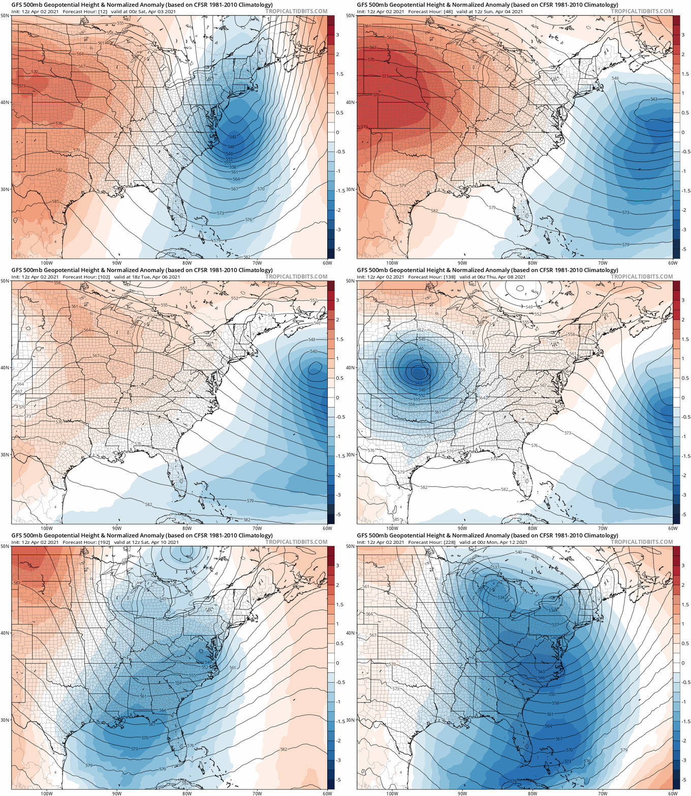
The little warm up next week may be replaced by another push of cold air next weekend. Here we see that next trough in the jet stream (blue) arriving Friday and Saturday.
Stay tuned as we continue to have active weather and a bumpy ride early in the season.
14 Local Maryland Pages (and York PA)
We have made a page for Maryland Weather which gives you the current conditions for 14 present area locations.
Please share your thoughts, best weather pics/video, or just keep in touch via social media

