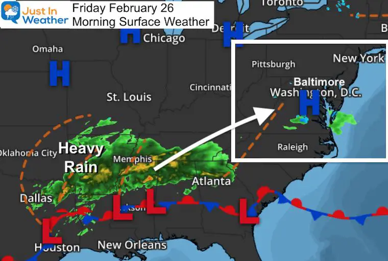
Friday February 26 2021
Today we continue our step down of temperatures back to near normal, only to once up again this weekend. This may sound familiar, but we have a few waves or two part weather system on the way.
I know I keep mentioning a start with inland snow, but that will be overnight and only to crest context of the contrast. We all wake up to rain Saturday morning, then have sun and a warmer afternoon. Sunday will bring part 2 which will have even more rain.
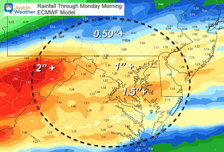
We have the potential region wide for over 1 inch of rain. Considering the soggy ground and snow melt, there could be some flooding.
Morning Surface Weather
Forecast Snapshot: Central Maryland
Click the image to see you local weather widget
Part 1 Tonight To Saturday —-> slider
ECMWF Model: Inland snow may bring a slugs coating, but turn to rain quickly. Rain will end by noon for most of the region.
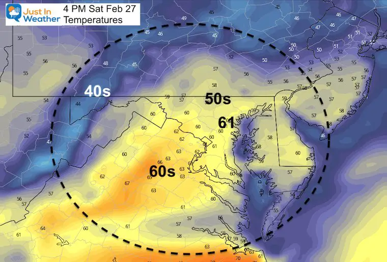
Saturday Afternoon: Sun Returns With Temperatures
This warm up is why I have mentioned the snow. Quite the contrast to take advantage of… Get outside if you can. Rain returns Sunday.
Part 2 Sunday —-> slider
Rain Returns
ECMWF Model
Rainfall Total Potential
Looking Ahead:
Jet Stream Animation
Sunday Night to Friday Night
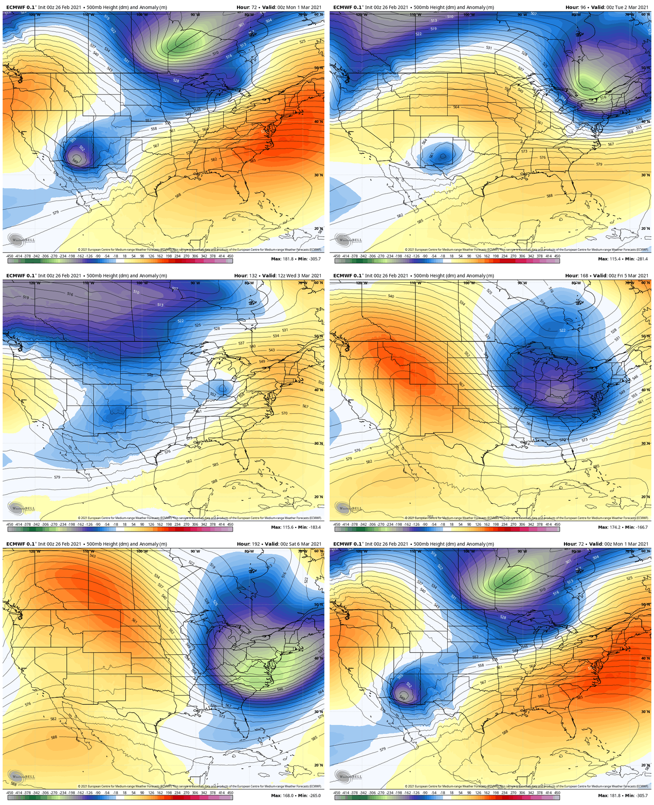
I know I mentioned snow again for Wednesday morning. But let’s focus on the Jet Stream. Here is the digging trough that will bring us back another taste of winter chill into the end of next week.
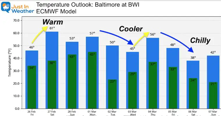
Temperature Outlook
*NEW* FITF TUMBLER
READY TO SHIP THIS WEEK
Please share your thoughts, best weather pics/video, or just keep in touch via social media
Facebook: Justin Berk, Meteorologist
Twitter: @JustinWeather
Instagram: justinweather
14 Local Maryland Pages (and York PA)
We have made a page for Maryland Weather which gives you the current conditions for 14 present area locations.
Winter Outlook Series
FITF Shop Open
My ‘bonus’ daughter Jaiden and wife showing off our popular Maryland Hoodies. Unisex and women’s items all produced in Maryland.
Click here to see this and many other new items.


