Friday February 19
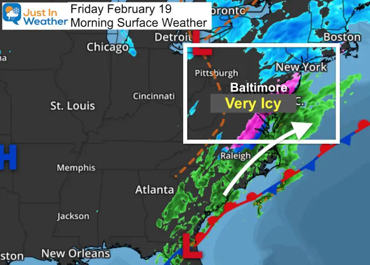
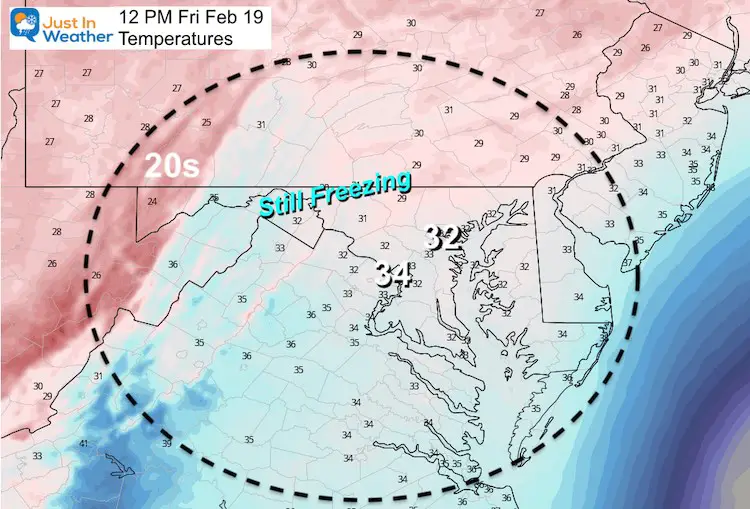
My morning began at 4 AM with client calls and texts. This includes schools and pavement snow/ice removal. The common theme is that everyone was caked in ice. Most of the region had freezing drizzle along with temps in the 20s to near 30ºF. That just froze everything!
Most schools I spoke with are closed or going virtual, with the larger universities attempting to open on a delay.
The Winter Weather Advisory continues this morning, not only for what may fall, but what is still icy on the ground.
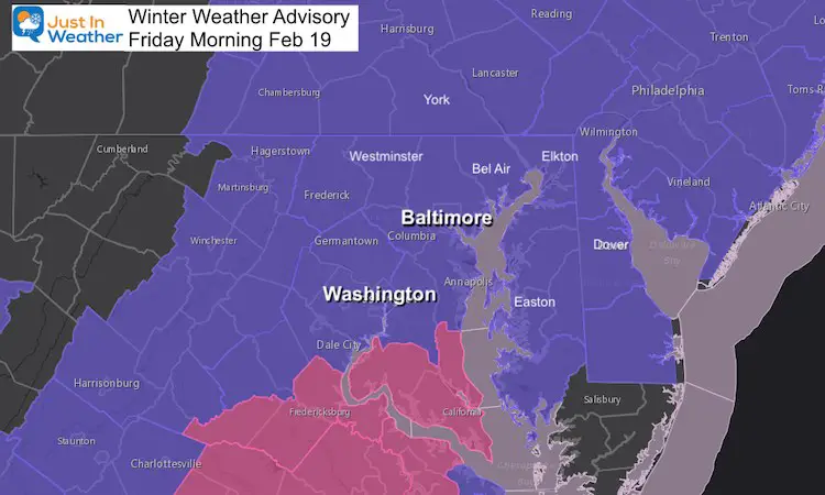
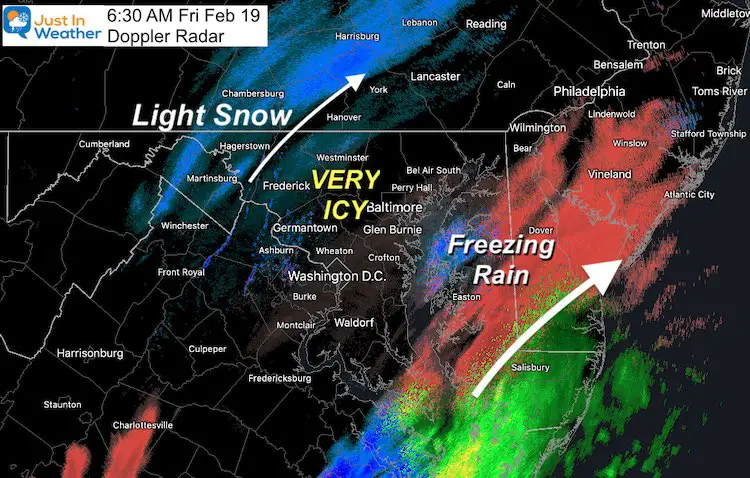
Two bands of moisture showed up on radar, one fading so we will focus on the line crossing Maryland and Delaware. This will be a mix of freezing rain and light snow. I do not expect accumulation other than a reinforcing coating. This keeps it slick at least through most of the morning.
Morning Surface Weather
Doppler Radar
It really does not matter what is falling, ice has covered most of our region. Light snow and flurries to the west, or freezing rain has the same result on the ground = ICY!
There are also many areas with fog and freezing drizzle that is not showing up on radar between these two bands. The light stuff is the worst since it forms a thin glaze on whatever it touches that might be hard to see.
Radar Simulation —> slider


Morning Temperatures
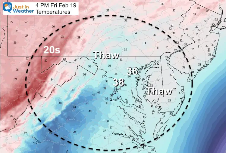
Temperature Forecast
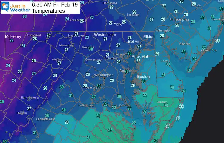
The attempt to thaw will get an assist from a higher solar angle and end of precipitation for most by noon.
Looking Ahead:
- This weekend will be quiet and cold. We get a few days to take a breather.
- Monday Morning is the next focus. This clipper type system will bring in a chance for snow turning to rain.
- Timing is critical!
- Here is a look at the GFS showing it moving in by 10 AM. The European Model is later.
- But our trend has been faster systems and earlier arrival. We should watch this simply for timing. If this speeds up to arrive before sunrise, that would be a mark for impact on travel
Snow/Rain Timeline —-> slider
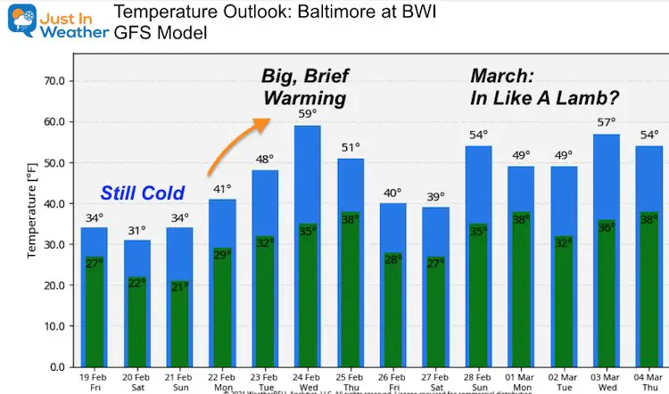
Temperature Outlook
After this cold weekend, that Monday weather maker will shift the jet stream. Look for a brief but big warm up next week. Upper 50s to near 60ºF…. This is not as warm as what I showed in my last report… which might be a result of the deep snow and ice to our west and southwest. But we will warm next week!
Please share your thoughts, best weather pics/video, or just keep in touch via social media
Facebook: Justin Berk, Meteorologist
Twitter: @JustinWeather
Instagram: justinweather
14 Local Maryland Pages (and York PA)
We have made a page for Maryland Weather which gives you the current conditions for 14 present area locations.

Winter Outlook Series


FITF Shop Open
My ‘bonus’ daughter Jaiden and wife showing off our popular Maryland Hoodies. Unisex and women’s items all produced in Maryland.
Click here to see this and many other new items.

