Monday January 18 2021
After all of the chatter about the Polar Vortex, it is nice to get more agreement about the temperatures over the next two weeks.
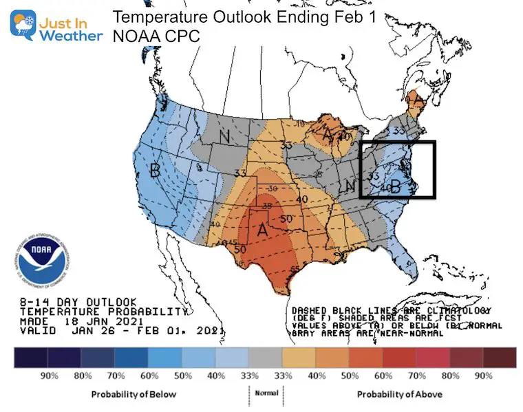
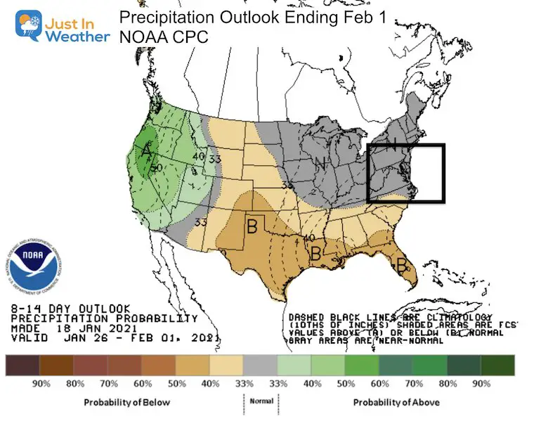
The NOAA Climate Prediction Center (CPC) posted their outlook through the end of January. They have the Mid Atlantic remaining below average with temperatures and average with precipitation. In a normal world for January you might conclude that has to bring snow, right? This is not a normal world, but there is ‘something’ in sight.
NOAA Temperature Outlook
This blue shading is not how cold it will be, rather the odds of temperatures being below average.
NOAA Precipitation Outlook
This product may not appear to show much, but the interpretation is ‘near average’ for us. But what does that mean?
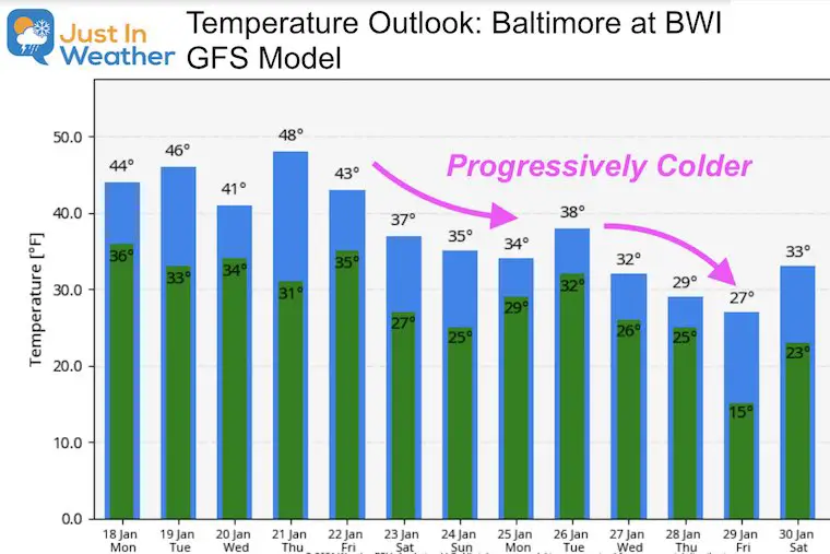
Temperature Forecast (GFS)
I must confess: This product did an about face with less cold on last night’s run. It seems to run warmer in the night package and colder for the dayt package. But the consistent trend has been to focus on cold through the end of January.
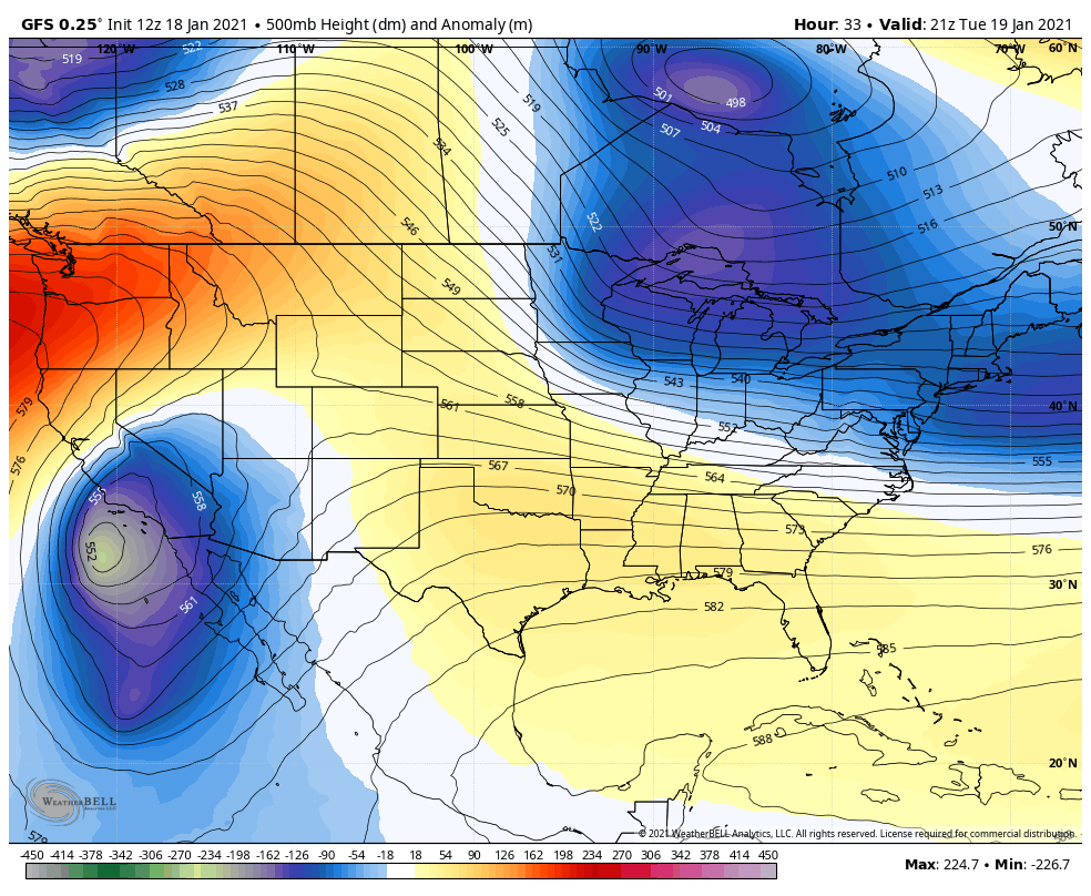
Jet Stream:
The upper level pattern shows an interesting leveling off, only to bring in a short wave by Tuesday.
In comparison, this may not appear as impressive, but that little feature at the end if the next ‘opportunity’.
Next Event: Next Week
Will is snow again? That is the common question I keep getting from readers and clients. I continue to be very hesitant to show any model plots more than 5 days away, so I am biting my tongue as I share these maps:
Please note that the energy to produce this is still well out in the Pacific Ocean. That is important because there is less data support there. It is why long range forecasts become more accurate for us in the 3 to 5 day period. That is when the energy reaches the USA and will be ‘on the grid’.
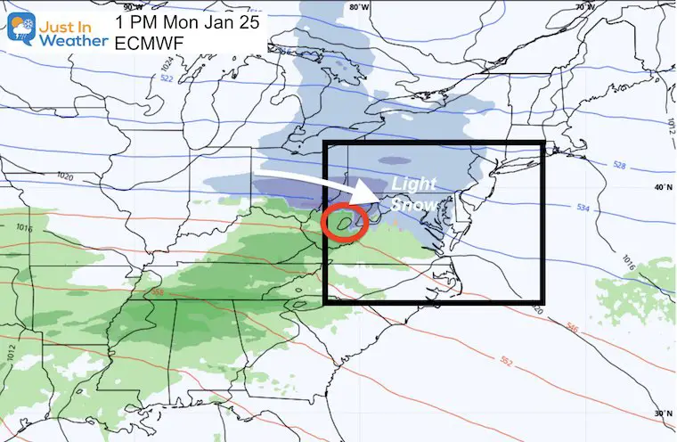
European View:
This shows the energy as two separate pieces spilt between next Monday and Tuesday.
I doubt this verifies as is shown here. The focus here is the trend. Here it shows the bulk of the second event passing in our southern sections. This will be our bench mark for the next few model runs to see if it is another phantom event that fades away, or shifts track/timing.
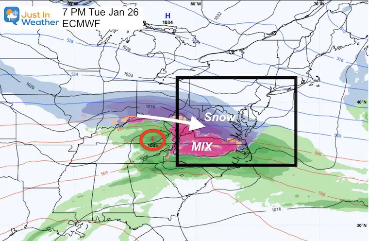
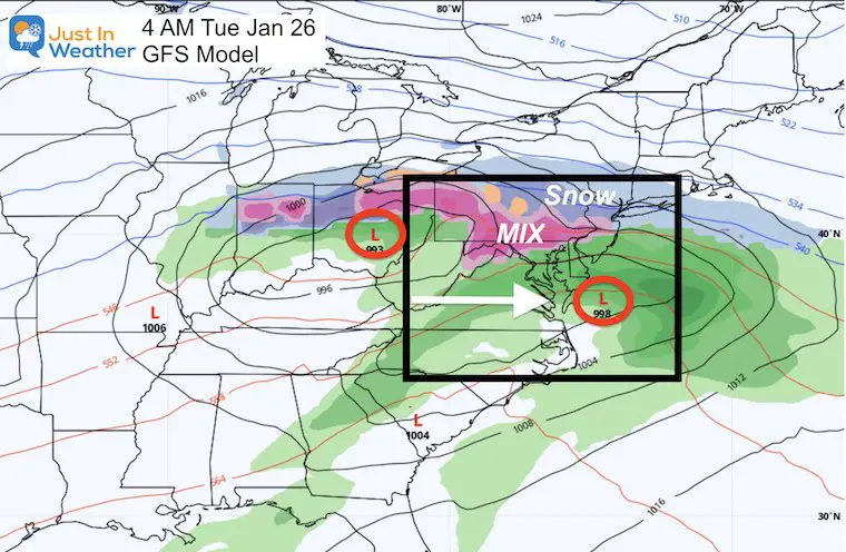
GFS View:
This has a very different perspective. Here we see one elongated event, but farther north.
That puts the icy mix in our northern half of the region and rain in the south.
My Take Away:
- It will be colder than average this week, and colder next week to complete the month.
- Any possible winter weather event for us is still one week away.
- I would give this a 40% chance of producing something for us. The odds go up each day we continue to see something.
- The specifics are likely to change. That is why I play this long range set ups with extensive caution. The good news is that there is ‘something’ in the pipeline for us snow lovers to watch.
Think of it as Justin Tucker going for a long Field Goal. He hits most of them, misses very few, and very rarely misses two in one game. Would you still put him out there to try? This 7 day outlook is like using him for a 55 yarder with some wind. Even after last weekend’s loss, if the game is close, I would still send him out there for it.
We will have to wait 8 months to see Tucker try again, but only a few days to see if this weather event plays out.
Faith in the Flakes
Please share your thoughts, best weather pics/video, or just keep in touch via social media
Facebook: Justin Berk, Meteorologist
Twitter: @JustinWeather
Instagram: justinweather
Winter Outlook Series


14 Local Maryland Pages (and York PA)
We have made a page for Maryland Weather which gives you the current conditions for 14 present area locations.

FITF Shop Open
My ‘bonus’ daughter Jaiden and wife showing off our popular Maryland Hoodies. Unisex and women’s items all produced in Maryland.
Click here to see this and many other new items.


Also see:
Maryland Weather Page
I wanted to keep it simple. Just the basics for a quick view at any time.

Just In Power Kids:
A portion of proceeds go to our programs Providing FREE holistic care for kids in cancer treatment and up to 5 years post treatment and caregivers.
![]()
New Caps and Hats

