Friday December 4 2020
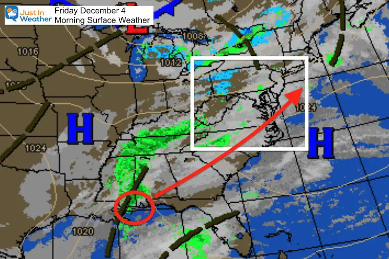
We have a storm developing along the Gulf Coast, but rain spread ahead of it will gradually build in today. It’s been tricky to plot the spotty showers during the day, but high confidence for the heavy rain mostly falling overnight. There is a new timeline slider below.
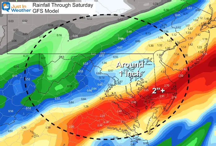
There will be a wide range of 1 to 2 inches of rain from central Maryland to the beaches, with less to the west.
Rainfall Total Forecast
Morning Surface Weather
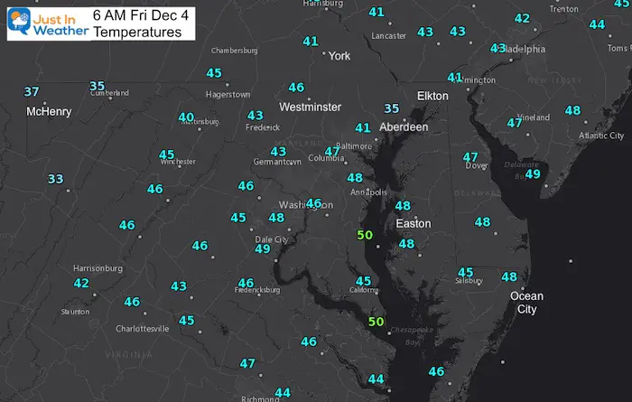
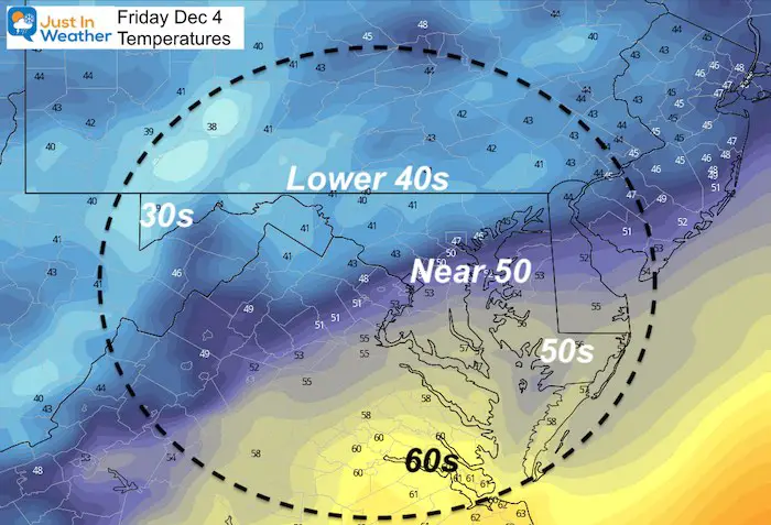
Morning Temperatures
UPDATE:
As of 9:30 AM, the rain was already developing in central Maryland.
This was *Earlier, *Heavier, and *Farther South than models indicated.
Will be noting these errors to apply for future weather events
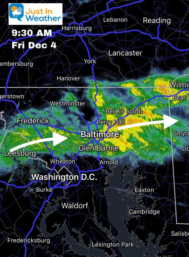
Live Radar And Simulation
Some showers will develop during the day and the models have had a hard time plotting where. If you head out, plan for possible showers, but you could miss out. Here’s the live radar to check quickly. The simulation supports the heavy rain overnight with the heaviest falling across southern Maryland.
RADAR
Simulation —> slider
Where’s the cold air?
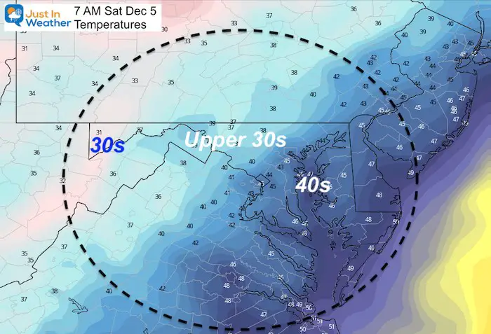
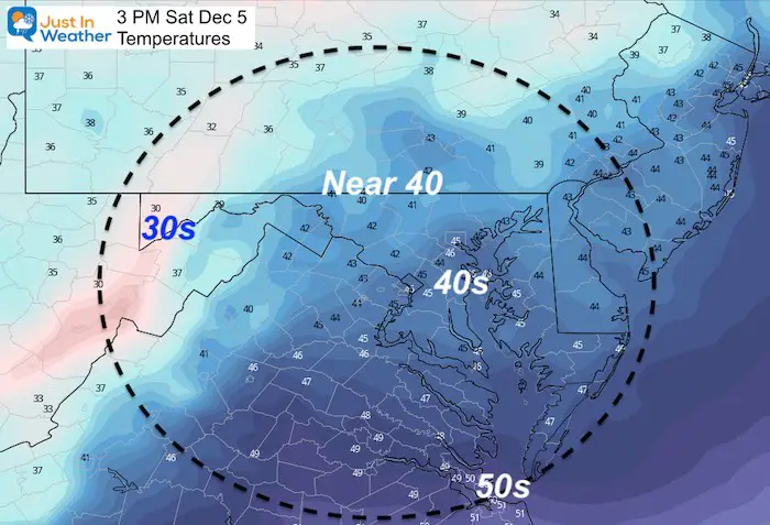
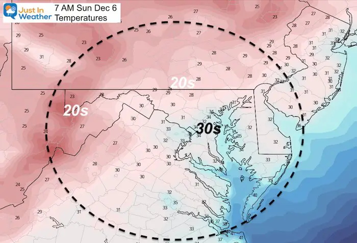
Earlier I mentioned the cold air (freezing temps) catching up to the storm. The timing of the cold air is still on point during Saturday. The speed of the storm is what has changed. The Low Pressure is now expected to be off of the Maryland Coast by daybreak on Saturday, brining an end to the main event for us. It will produce snow in New England.
Saturday afternoon and night could still bring some flurries or a snow shower. This was always just supposed to be a little ambience.
Temperature Forecast
Why Do I Keep Suggesting Flurries Or Snow Showers?
Here is a look at the vorticity/spin at around 18,000 Ft. aloft in the jet stream. This is what I showed to support the snow showers after the last storm. This is a favorite of mine in the winter time.
I’ve highlighted the Vort Max with a circle. Each one is energy that can help carry snow showers or flurries east of the mountains.
There will be a few chances for flakes to fly between Saturday afternoon and Sunday morning.
—> slider
What is that December 5th Magic?
Starting in 2002, this was the date of the first snow of the season in Baltimore almost every year for a decade. It is also the day in 2009 that started the very first Faith in the Flakes conversation with my son. This is something us Snowhounds celebrate and I named FITF Day. I will have more about all of this in a special report this afternoon.
If we get snow showers in Baltimore on Saturday, they will likely not amount to much. But the ambiance would bring back hope for a winter back to normal (or more).
Temperature Outlook
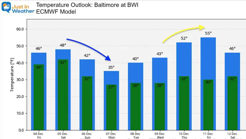
A cold weekend will be followed by a day stuck in the 30s on Monday.
This pattern is overall colder than all suggested (even me) but there will be some warm ups. Here we see a push to the 50s with the next storm. This is still subject to change depending on the storm track and timing.
FAITH IN THE FLAKES STORE OPEN
My ‘bonus’ daughter Jaiden is showing off our popular Maryland Hoodie. Click here to see this and many other new items.
Also See:
December Climate, Sun Data, Solstice, ISS Flyovers, Moon, Planets, and The Great Conjunction
14 Local Maryland Pages (and York PA)
We have made a page for Maryland Weather which gives you the current conditions for 14 present area locations.
Maryland Weather Page
I wanted to keep it simple. Just the basics for a quick view at any time.
Please share your thoughts, best weather pics/video, or just keep in touch via social media
-
Facebook: Justin Berk, Meteorologist
-
Twitter: @JustinWeather
-
Instagram: justinweather
Email Updates
Please make sure you sign up (above or click here to sign up for email alerts…. ) for my newsletter. This way you will get an email to make sure you are notified of each post.
Just In Power Kids:
A portion of proceeds go to our programs Providing FREE holistic care for kids in cancer treatment and up to 5 years post treatment and caregivers.


