Sunday March 22 2020
After a chilly start with some inland areas getting frost or a hard freeze, we will remain chilly. The weather set up is something we were missing all winter.
This includes cold High Pressure in Canada that will bring in a chilly wind from the east. This could increase clouds and stir up some sprinkles this afternoon. To the south is a developing storm that will become a Nor’easter off of the coast.
Now that we are essentially all in some form of a COVID19 quarantine, monitoring the time we can get outside might become more valuable. I will continue to update the weather daily for our region to highlight that.
Morning Weather
If this was December through February, we would have a snowstorm on our hands. While the limited cold air may allow the to start as snow inland, it will be a chilly but heavy rain much of Monday. Following will be a gradual warm up during the week, but more rain likely Wednesday and next weekend.

Get Forecasts By Email
Just in case you don’t get all posts on your social media feed, stay up to date with the latest info…
Click here to sign up for email alerts…. Be the first to hear any new weather
Sunday March 22, 2020 in Baltimore
Average High: 56ºF
Record High: 86ºF in 1907
Average Low: 35ºF
Record Low: 19ºF in 1885
*Record Snow 3.4 in 1914
Sunrise: 7:05 AM
Sunset 7:20 PM
*Daylight = 2:35 longer than yesterday
*Bay Water Temperature = 50ºF at Thomas Pt. Light House
Sunday Afternoon
The breeze from the east will make it feel chilly and could increase the clouds. Less sun will make if feel colder.

Sprinkles or showers may develop between 4 and 6 PM

Overnight:
The developing storm will be evolving over our region. Some snow will break out in PA, while rain will be arriving from Virginia and into Central Maryland.
We could have some sleet or snow fill in the blanks shown here north of Baltimore and south of York… but it will be early in the morning.

Monday Morning Temperatures

Storm Animation:
This will be a Nor’easter and produce a decent snowfall for northern New England. But in the rain section, there will be wind all along the coast for two days.
See our local simulation slider below.
Monday Rain Timeline —> slider

Monday High Temperatures

Tuesday Temperatures


Looking Ahead
This is an active pattern that will bring us more rain on Wednesday, then again on Friday that could extend into next weekend.
Temperature Outlook

Please share your thoughts, best weather pics/video, or just keep in touch via social media
-
Facebook: Justin Berk, Meteorologist
-
Twitter: @JustinWeather
-
Instagram: justinweather
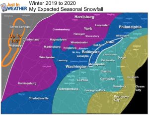
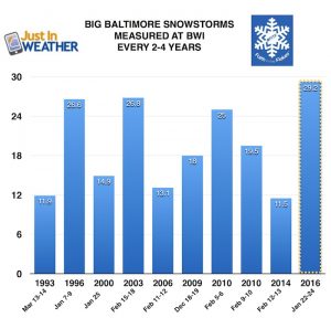
Baltimore history of snowless February(s) and winters when March brought the most snow:
Click here to see more: March Snow After Winter Has Been Slow
Part 1: More Snow This Winter Supported By Stats
Part 2: Solar Minimum- Low Sunspots May Mean High Snow Totals This Winter
Part 3: Tropical Systems In East Asia and Atlantic Basin Hint At Winter Storm Tracks
Snowy Winters Following A Hot and Dry September
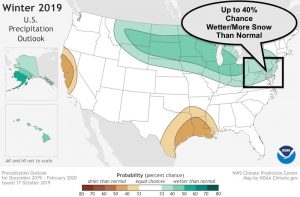
NOAA Winter Outlook Leaves Room For More Snow With Mild ‘Seasonal Average’ Temperatures
Baltimore Weather At BWI May Not Be As Hot As Reported
Construction at the airport close to the weather station may be added artificial heat. Click here or the image for the details.
Atmospheric Memory Shaped The US East Coast
Atmospheric Memory Of Hurricanes Over Thousands Of Years Shaped The Coast
Maryland Trek Cycle Jerseys From Hill Killer
All proceeds will go to the Maryland Trek 6 total and Just In Power Kids programs
Thank you to our Title Sponsor for Maryland Trek 6
Shining on with Smyth and their contribution, our team has raised over $95,000 for Just In Power Kids to provide free programs for kids in and post cancer treatment.
Just In Power Kids:
Proceeds go to our programs Providing FREE holistic care for kids in cancer treatment and up to 5 years post treatment and caregivers.

Shine On
Proceeds from all sales go to Just In Power Kids. Click the image to shop and show your support.


