Wednesday Evening February 26
A strong system is moving through tonight. At first glance, it’s easy to see we remain on the warm side, while there is now to the west. This contrast of air masses is one force to make a line of storms strong. That is what we expect to pass through the region tonight. But there has already been lightning with the main cold front and there is a slight chance for storms to turn severe.
What follows will be colder air along with 40 to 50 mph winds Thursday. Western Maryland gets in on the snow and may receive up to 6 inches by Friday. The NAM 3 Km brings back the chance for snow showers into Central Maryland Friday night. I’ll show that below.
Wednesday Evening Weather

Severe Storm Potential
The area of Low Pressure that formed along the cold front was something the Storm Prediction Center was suggesting earlier today. The spin aloft is what can help increase the energy with the storm, even after dark and in cool temps.
- Highlighted area includes Maryland, Virginia, and WV just west of Baltimore and Washington.
- Timing is now through midnight.
- Threat: Damaging wind gusts 50 to 60+ mph

Evening Doppler Radar
At 7 PM this Doppler Radar snapshot shows the lightning strikes along the mountains. This is a signal of the energy in the storm line. The limit of this single radar site is why you can’t see all of the rain. I’ve added a regional loop below.
The cells are moving north, but the line is heading east…. See the timeline below.

Regional Radar Loop
(winter mode/snow is not identified here)
Severe Storm Parameters
K Index over 30 is a signal for thunderstorms. So rumbling may echo in metro areas between 11 PM and 1 AM as this opuses through.

Wind Gusts
This is a model simulation and does not account for the potential with individual cells.
The criteria for a storm to be considered severe is winds over 58 mph. This may be close.

Radar Simulation —> slider
Storm line timing in metro Baltimore will be within an hour of midnight (11 PM to 1 AM)
Snow will quickly follow in far Western Maryland. Some snow might mix in the western and northern suburbs after 2 PM. No stickage.


Get Forecasts By Email
Just in case you don’t get all posts on your social media feed, stay up to date with the latest info…
Click here to sign up for email alerts…. Be the first to hear any new weather
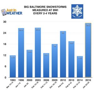
Baltimore history of snowless February(s) and winters when March brought the most snow:
Click here to see more: March Snow After Winter Has Been Slow
Please share your thoughts, best weather pics/video, or just keep in touch via social media
-
Facebook: Justin Berk, Meteorologist
-
Twitter: @JustinWeather
-
Instagram: justinweather
WEATHER WIFE COLLECTION
- Thanks to Shannon (weather wife) for hand picking items ‘she’ wants to wear
- The Yoga Pants have side leg pocket for your phone
- The Hoodie is extra soft and has the important ‘thumb holes’
Part 1: More Snow This Winter Supported By Stats
Part 2: Solar Minimum- Low Sunspots May Mean High Snow Totals This Winter
Part 3: Tropical Systems In East Asia and Atlantic Basin Hint At Winter Storm Tracks
Snowy Winters Following A Hot and Dry September
NOAA Winter Outlook Leaves Room For More Snow With Mild ‘Seasonal Average’ Temperatures
Baltimore Weather At BWI May Not Be As Hot As Reported
Construction at the airport close to the weather station may be added artificial heat. Click here or the image for the details.
Atmospheric Memory Shaped The US East Coast
Atmospheric Memory Of Hurricanes Over Thousands Of Years Shaped The Coast
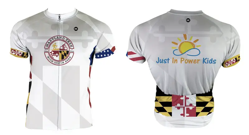
Maryland Trek Cycle Jerseys From Hill Killer
All proceeds will go to the Maryland Trek 6 total and Just In Power Kids programs
Thank you to our Title Sponsor for Maryland Trek 6
Shining on with Smyth and their contribution, our team has raised over $95,000 for Just In Power Kids to provide free programs for kids in and post cancer treatment.
Just In Power Kids:
Proceeds go to our programs Providing FREE holistic care for kids in cancer treatment and up to 5 years post treatment and caregivers.

Shine On
Proceeds from all sales go to Just In Power Kids. Click the image to shop and show your support.


