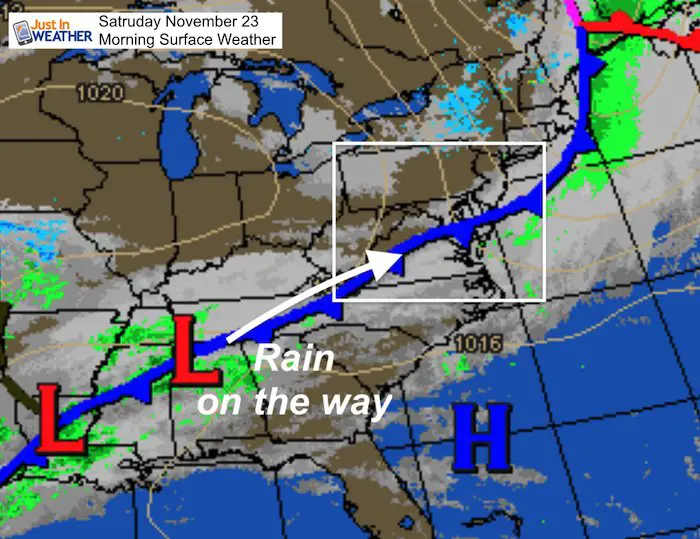
Saturday November 23 2019
It has been a cold start and as clouds increase this afternoon dimming the sun it will be a chilly day. Low Pressure will ride along the cold front that just passed by to bring in rain this evening. It may impact your plans tonight, but the heavy rain should time out overnight, and mostly end by morning. Some lingering showers on the north end Saturday morning. Western Maryland will wake up Sunday to fresh snow! FITF
The outlook for Thanksgiving weekend is taking shape. See the latest below.
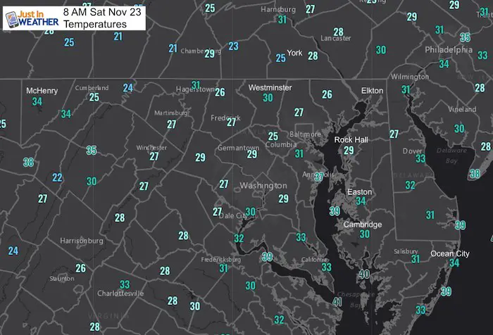
Morning Temperatures
Local Weather Stats:
Saturday November 23, 2019 in Baltimore
Average High: 53ºF
Record High: 74ºF in 1979
Average Low: 35ºF
Record Low: 16ºF in 1880
Sunrise: 6:58 AM
Sunset 4:46 PM
*Daylight = 1:37 shorter than yesterday
*Bay Water Temperature = 50ºF at Thomas Pt. Light House
Get Forecasts By Email
Just in case you don’t get all posts on your social media feed, stay up to date with the latest info…
Click here to sign up for email alerts…. Be the first to hear any new weather
Thank you to our Title Sponsor for Maryland Trek 6
Shining on with Smyth and their contribution, our team has raised over $95,000 for Just In Power Kids to provide free programs for kids in and post cancer treatment.

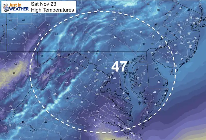
Saturday High Temperatures
Rain Timeline —> slider


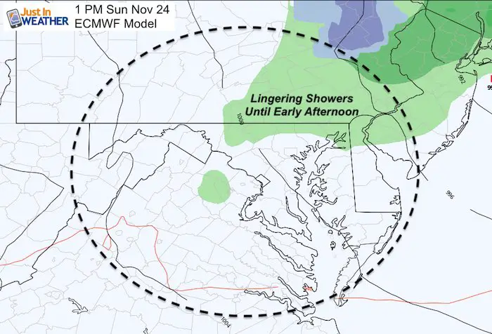
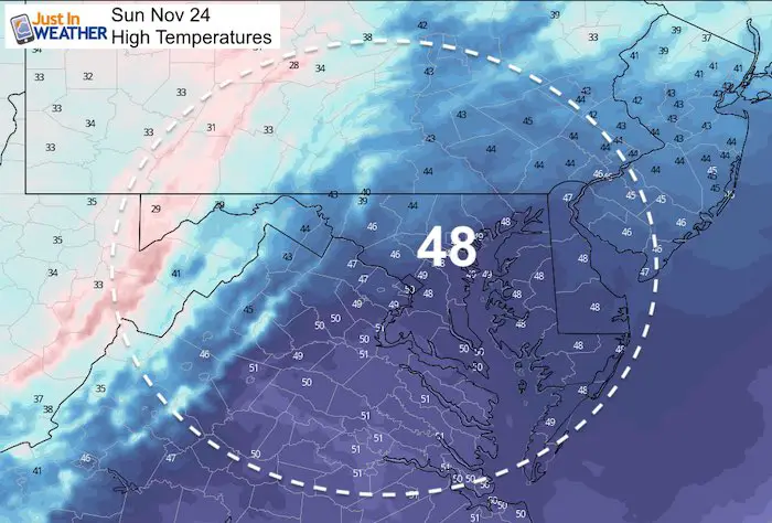
Sunday Weather
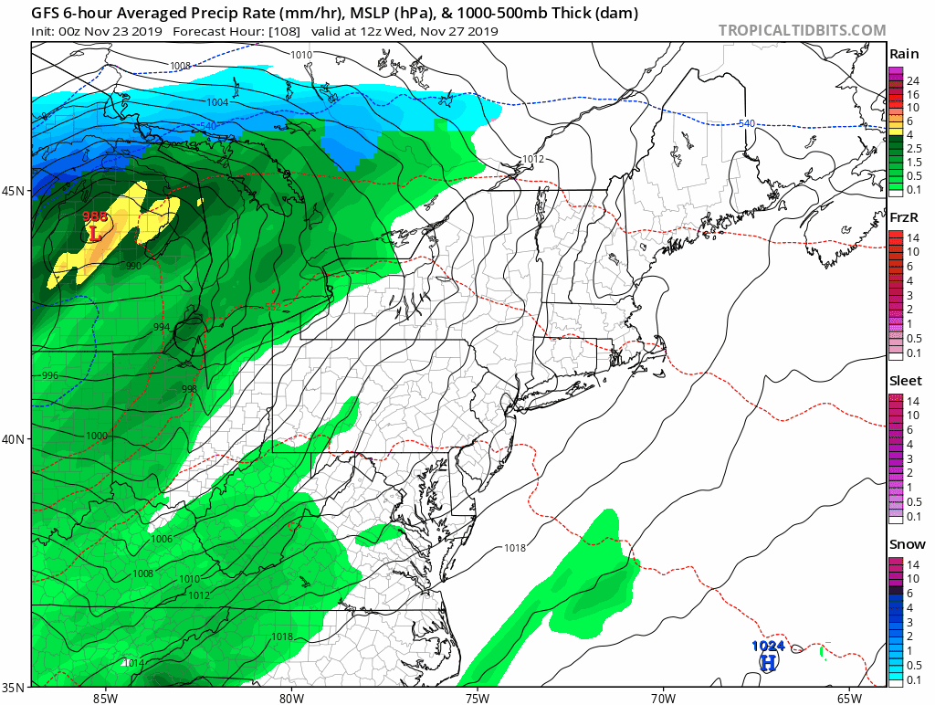
The Euro Model shows rain lingering on the north end through mid day
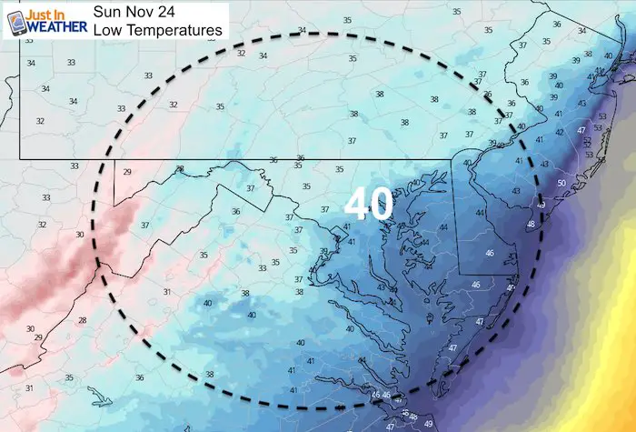
Low Temperatures
High Temperatures
NEW FITF GEAR THIS YEAR
- Thanks to Shannon (weather wife) who wanted to bring these hats to life. *Mustard is her favorite color
- The Maryland Hoodie is high quality and a new way to show off our love of Snow and State.
- The T-shirt… Something you may find familiar. Why just a T? Because many schools I visit have the heat on high for faculty and staff. But you can put a long sleeve underneath for cool look. I will have wifey model these soon 🙂

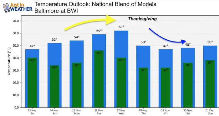
Looking Ahead To Thanksgiving Weekend
The Wednesday storm is looking less impressive and the rain for our region might be scattered showers if it holds together at all. We will have a surge of warm air Wednesday into the 60s, then cooler Thanksgiving Day into Friday into the weekend. We need to watch for the next storm to bring in a chance for rain on the return day Sunday. If it arrives earlier in the day, there could be an icy mix in southern and central PA.
Temperature Outlook
Please share your thoughts, best weather pics/video, or just keep in touch via social media
-
Facebook: Justin Berk, Meteorologist
-
Twitter: @JustinWeather
-
Instagram: justinweather
Winter Outlook Posts
Part 1: More Snow This Winter Supported By Stats

Part 2: Solar Minimum- Low Sunspots May Mean High Snow Totals This Winter

Part 3: Tropical Systems In East Asia and Atlantic Basin Hint At Winter Storm Tracks


Snowy Winters Following A Hot and Dry September

NOAA Winter Outlook Leaves Room For More Snow With Mild ‘Seasonal Average’ Temperatures


Baltimore Weather At BWI May Not Be As Hot As Reported
Construction at the airport close to the weather station may be added artificial heat. Click here or the image for the details.

Atmospheric Memory Shaped The US East Coast
Atmospheric Memory Of Hurricanes Over Thousands Of Years Shaped The Coast

Was Your County Not Included?
Click this map for more on the regional forecast zones

Maryland Trek Cycle Jerseys From Hill Killer
All proceeds will go to the Maryland Trek 6 total and Just In Power Kids programs

Just In Power Kids:
Proceeds go to our programs Providing FREE holistic care for kids in cancer treatment and up to 5 years post treatment and caregivers.
![]()
Shine On
Proceeds from all sales go to Just In Power Kids. Click the image to shop and show your support.
