Monday November 4 2019
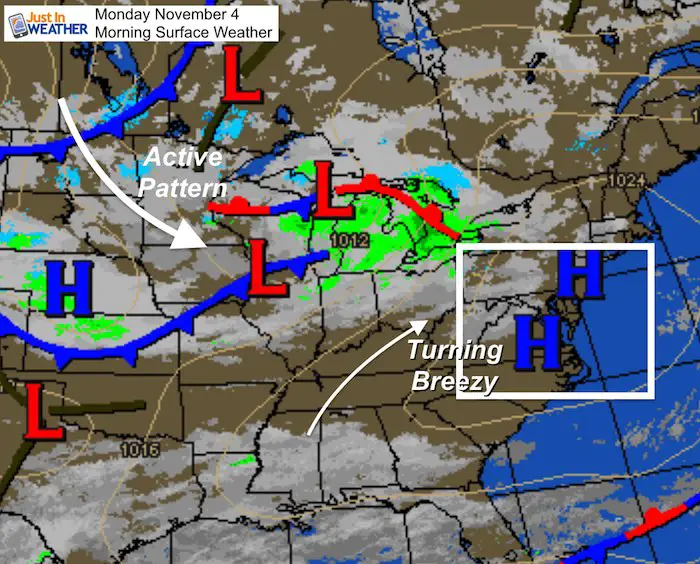
We start off this work week with many areas in the freeze as we feel the clock change with our scheduled. Soon, it will feel like winter is knocking on the door. But first, with High Pressure shifting the winds from the south, a breeze will warm us up a little today and tomorrow. Scattered rain showers on Tuesday more likely on the bookends in wetter Maryland and the Lower Eastern Shore. Then each weather system gets progressively colder into next week.
Headlines
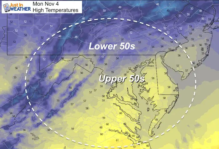
- Today: Breezy, Temps Back To Upper 50s
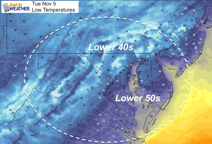
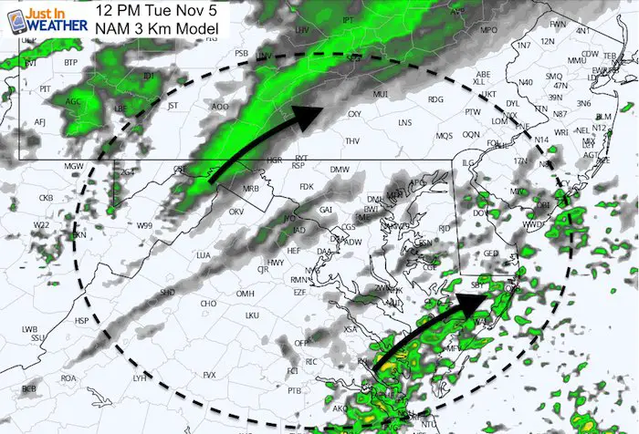
- Tuesday: Temps near 60ºF, Scattered Showers
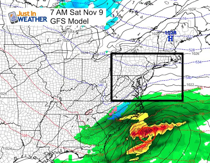
- Storm Thursday Into Friday Brings Snow Nearby
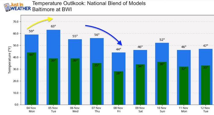
- Turning Much Colder Through Next Week
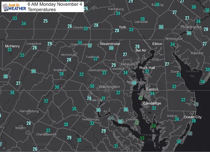
Morning Temperatures
Local Weather Stats:
Monday November 4, 2019 in Baltimore
Average High: 61ºF
Record High: 83ºF in 1974
Average Low: 40ºF
Record Low: 22ºF in 1951
Sunrise: 6:37 AM
Sunset 5:02 PM
*Daylight = 2:12 shorter than yesterday
*Bay Water Temperature = 59ºF at Thomas Pt. Light House
Get Forecasts By Email
Just in case you don’t get all posts on your social media feed, stay up to date with the latest info…
Click here to sign up for email alerts…. Be the first to hear any new weather
Thank you to our Title Sponsor for Maryland Trek 6
Shining on with Smyth and their contribution, our team has raised over $95,000 for Just In Power Kids to provide free programs for kids in and post cancer treatment.

Monday Afternoon Temperatures
Tuesday Morning Temperatures
Tuesday Afternoon Temperatures
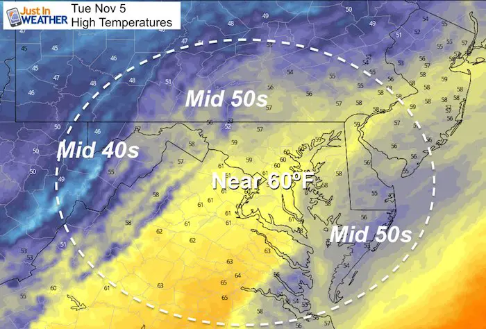
Tuesday Showers
The best chance for any rain showers will be in the mountains and on the lower Eastern Shore.
Looking Ahead
The end of week storm appears to be following the notes I shared with you. It is trending earlier and farther north. The European ECMWF Model shows that notion bring us rain, with potentially steady snow in far western Maryland and central PA. The cold air that follows, might bring snow showers to the northern suburbs.
ECWMF Model —> slider


Please share your thoughts, best weather pics/video, or just keep in touch via social media
-
Facebook: Justin Berk, Meteorologist
-
Twitter: @JustinWeather
-
Instagram: justinweather
ALL FITF Apparel Available


New Colors
We are giving 10% of each sale to Just In Power Kids: Providing FREE holistic care to pediatric oncology patients and FREE healthy meals to local hospitals.

Also See:
NOAA Winter Outlook Leaves Room For More Snow With Mild ‘Seasonal Average’ Temperatures

Many areas inland from the cities should drop into the 30s by tomorrow morning. This could do it.
See the maps for when we normally expect the first frost in this link.

Snowy Winters Following A Hot and Dry September

Baltimore Weather At BWI May Not Be As Hot As Reported
Construction at the airport close to the weather station may be added artificial heat. Click here or the image for the details.

Other Links:
Atmospheric Memory Shaped The US East Coast
Atmospheric Memory Of Hurricanes Over Thousands Of Years Shaped The Coast

Was Your County Not Included?
Click this map for more on the regional forecast zones

Maryland Trek Cycle Jerseys From Hill Killer
All proceeds will go to the Maryland Trek 6 total and Just In Power Kids programs

Just In Power Kids:
Proceeds go to our programs Providing FREE holistic care for kids in cancer treatment and up to 5 years post treatment and caregivers.
![]()
Shine On
Proceeds from all sales go to Just In Power Kids. Click the image to shop and show your support.
