Friday September 6 2019
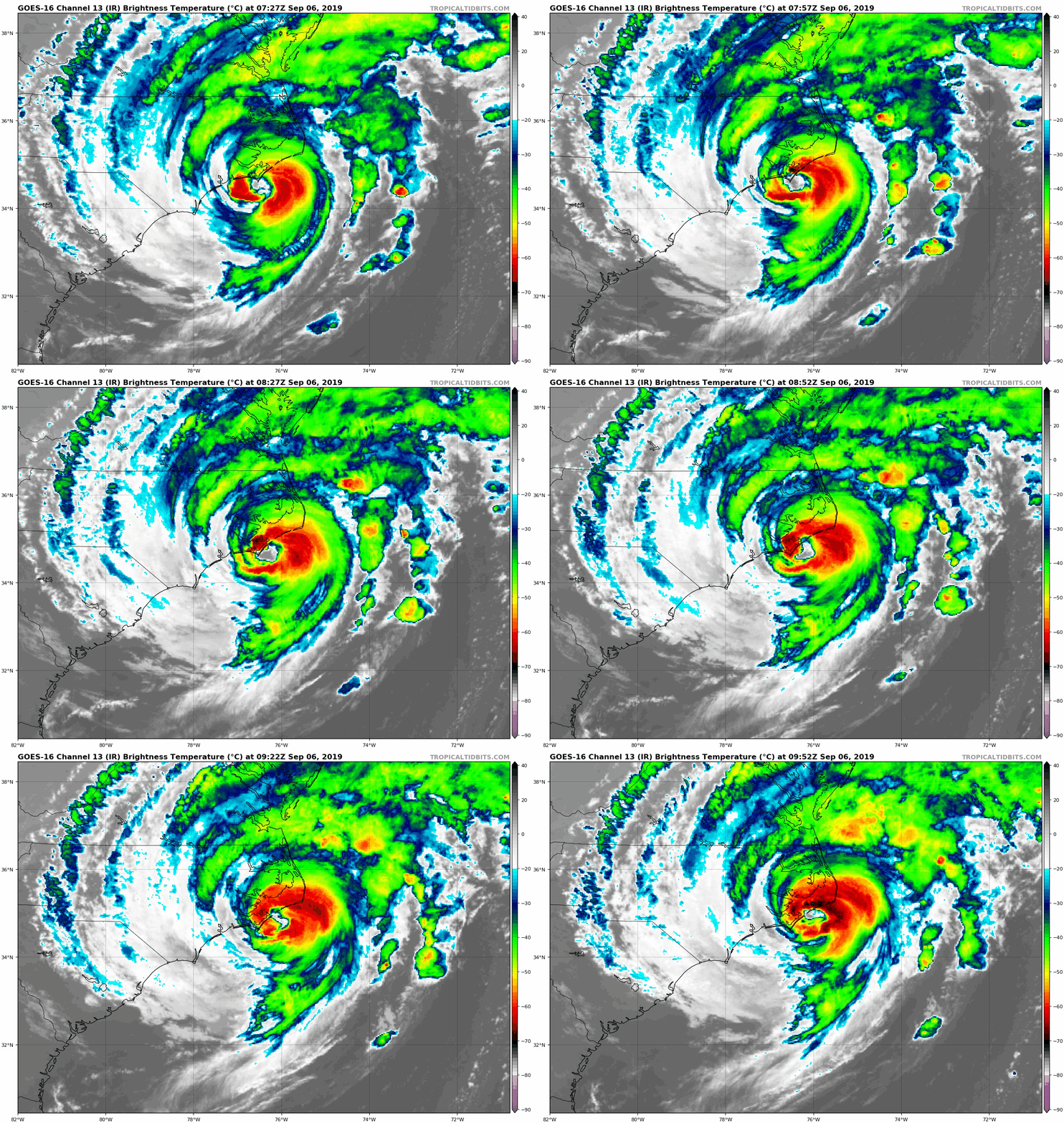
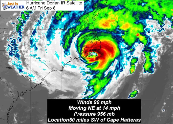
Hurricane Dorian has winds down to 90 mph. The eye of this now Category 1 storm has been scraping North Carolina between Cape Lookout and Hatteras. The Outer Banks are getting hit hard! The northern edge of rain with gusty winds have reached Ocean City. The track will continue to push it out into the Atlantic today, but the strongest winds will be felt this afternoon.
Hurricane Dorian IR Satellite
In central Maryland, the winds have led to restrictions on the Bay Bridge and Coastal Flood Advisory in Anne Arundel County. It will feel like a Nor’easter is nearby, but only a few rain showers could reach to metro areas this afternoon and evening. The weekend will be nicer for all of us.
Let’s take a few views of the storm, then the forecast maps:
Hurricane Dorian IR Satellite Loop
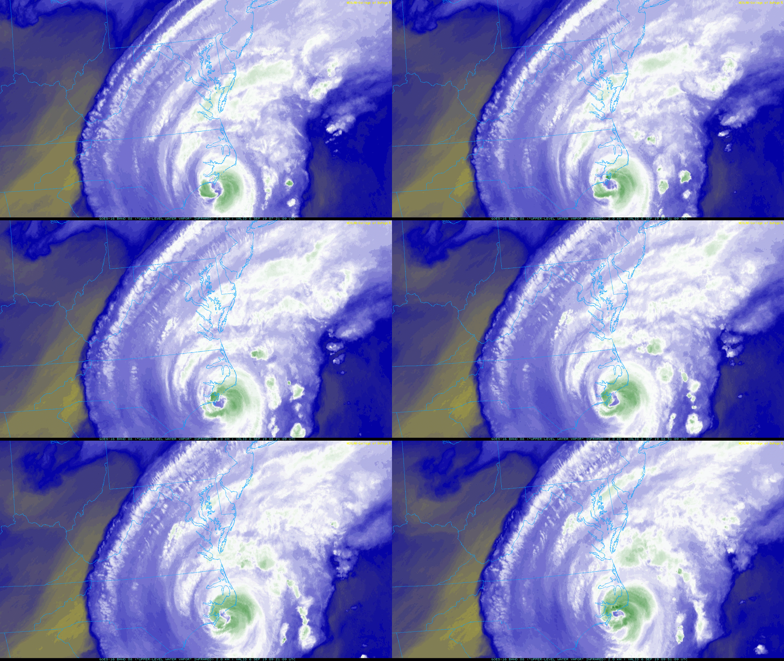
Water Vapor Satellite Loop
Our cloud cover today is from Dorian.
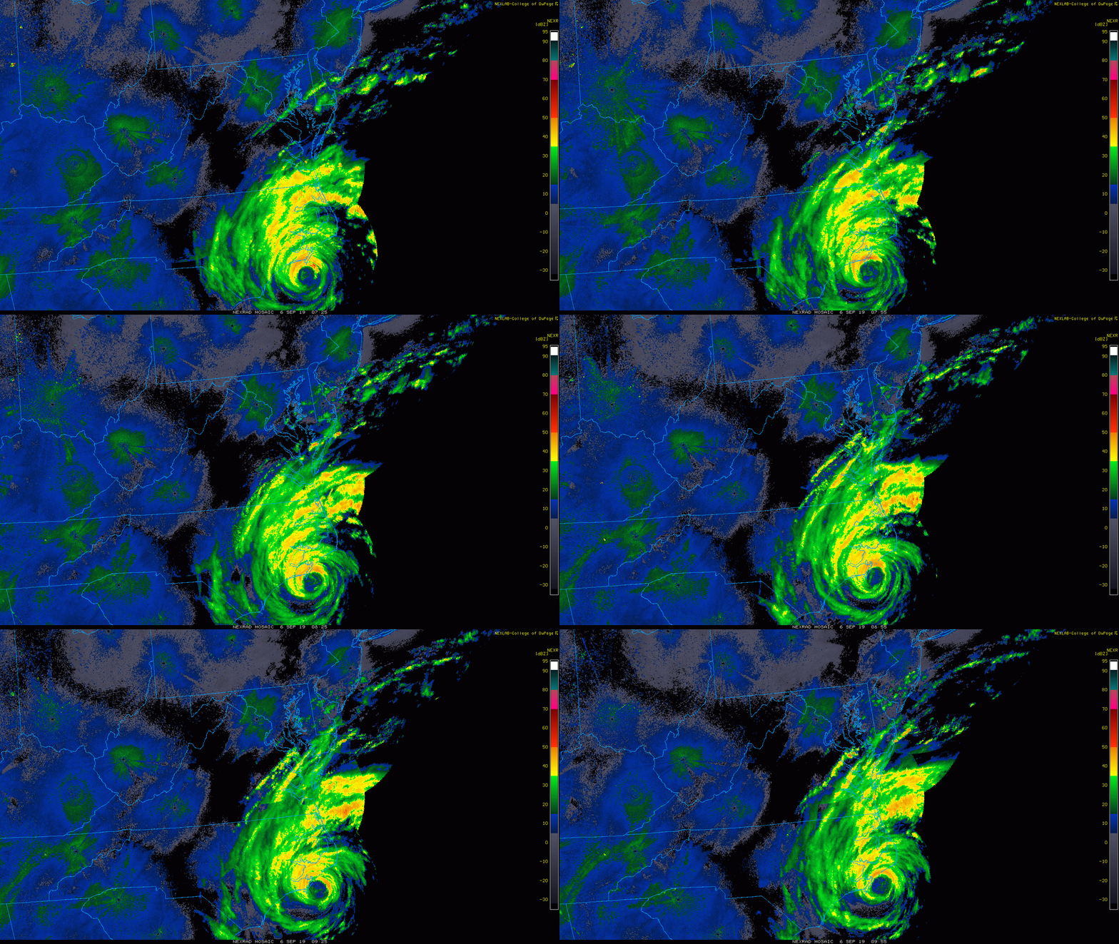
Hurricane Dorian Radar Loop
The northern edge of rain showers has barely reached Kent Island so far, but fading. It will get a little farther north today.
But the best chance for heavier rain bands will be in southern Maryland and to the beaches. There still is a chance for isolated tornadoes in one of these bands in the Tropical Storm Warning zone.
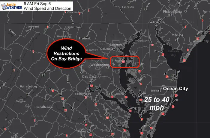
Morning Winds
Gusts over 20 mph on the Bay Bridge has restrictions today.
Gusts up to 40 mph in southern Maryland in the Tropical Warning Zone
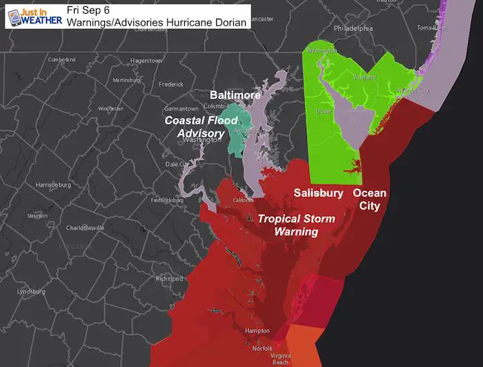
Dorian Warnings and Advisories
Flooding on Bay areas in AACo this morning but the winds shift this afternoon will drain south and lower water levels.
Isolated tornadoes in heavy rain bands possible in the Tropical Storm Warning Zone.
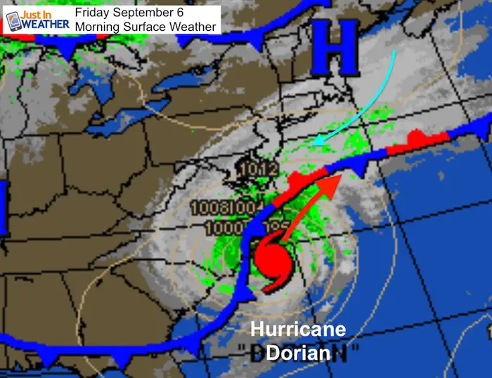
Friday Morning Surface Weather
Steering currents will continue to force Dorian out to the Atlantic and keep the northern edge just into Maryland
Forecast Track European Model –> slider
[metaslider id=79805]
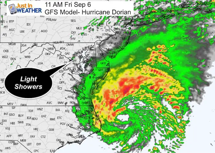
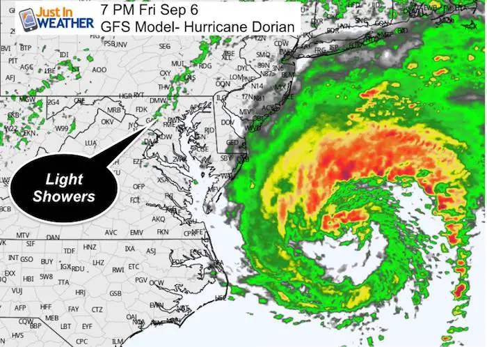
Rain in Maryland
It looks like only light showers into metro areas… and might be more likely this evening as the storm pulls away. Rain in Ocean City only expected to be 1 to 2 inches
Wind Forecast Maps –> slider
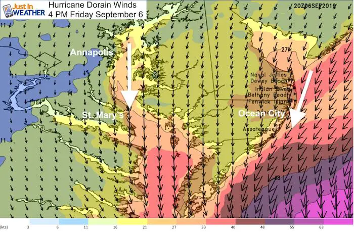
As we had discussed, the direction will shift from the Northeast this morning, to the North this afternoon. Saturday winds from the Northwest as the storm moved away. This will make for a nice and dry weekend.
[metaslider id=79828]
Stronger Winds During The Afternoon: Wind direction shifts to the north, draining water out of the Bay
Waves Forecast —> slider
[metaslider id=79747]
Find tides for your location on the Bay: Click here
Also see: Atmospheric Memory Of Hurricanes Over Thousands Of Years Shaped The Coas
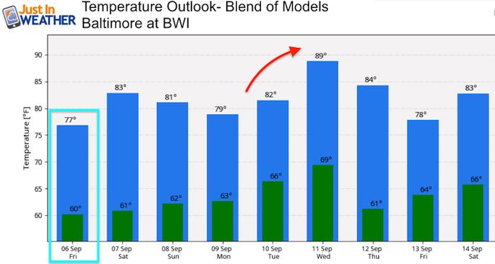
Temperature Outlook
Keep In Touch Every Day
Just in case you don’t get all posts on your social media feed, stay up to date with the latest info…
Click here to sign up for email alerts…. Be the first to hear any new weather
Thank you to our Title Sponsor for Maryland Trek 6
Shining on with Smyth and their contribution, our team has raised over $95,000 for Just In Power Kids to provide free programs for kids in and post cancer treatment.
Please share your thoughts, best weather pics/video, or just keep in touch via social media
-
Facebook: Justin Berk, Meteorologist
-
Twitter: @JustinWeather
-
Instagram: justinweather
Maryland Trek Cycle Jerseys From Hill Killer
All proceeds will go to the Maryland Trek 6 total and Just In Power Kids programs
Just In Power Kids:
Proceeds go to our programs Providing FREE holistic care for kids in cancer treatment and up to 5 years post treatment and caregivers.

Shine On
Proceeds from all sales go to Just In Power Kids. Click the image to shop and show your support.
Love Maryland Shirts and Hoodies
This shirt was designed by my ‘bonus’ daughter Jaiden. The hoodie has been the biggest hit, so our promotion has been extended until the end of this week.
|
||
|
Show your love for Maryland and make this 14 year old artist and her mom extra proud
|
Related Links:

