Sunday May 26 2019
We continue in a pattern of strong and severe storms. In similar fashion to yesterday, we will have a nice day with the chance of strong storms in the evening and overnight. This time a cold front will give an added boost and some storms may turn severe. I have included to model simulations to compare for the likely timeline of arrival.
The best chance for these storms will be between sunset until after midnight. This means any thunderstorm has the potential for:
- Winds over 58 mph
- Hail over 1 inch diameter
- Tornados (isolated)
- Lightning will be frequent
- Flooding in local downpours
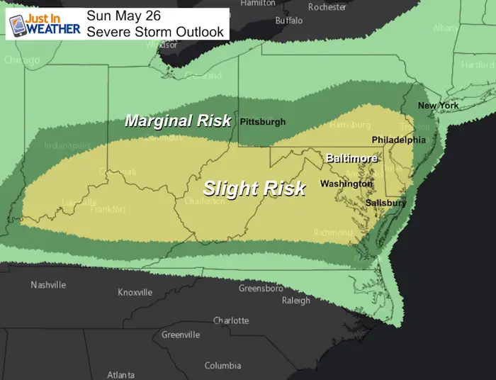
Severe Storm Outlook
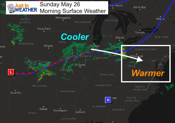
Morning Surface Weather
Again, today will mostly be nice. Temperatures will get a boost into the upper 80s and neat 90ºF. The arrival of the storms will be in the evening and through Sunday morning with this cold front.
Local Weather Stats For May 26, 2019 in Baltimore
Average High: 77ºF
Record High: 94ºF in 1914
Average Low: 55ºF
Record Low: 41ºF in 1967
Sunrise: 5:45 AM
Sunset 8:24 PM
*Daylight = 1:26 longer than yesterday
*Bay Water Temperature = 68ºF at Thomas Pt. Light House
Keep In Touch Every Day
Just in case you don’t get all posts on your social media feed, stay up to date with the latest info…
Click here to sign up for email alerts…. Be the first to hear any new weather.
Forecast Today
High Temperatures

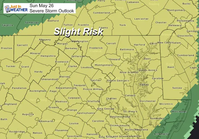
Severe Storm Outlook
Our ‘Slight Risk’ is for storms arriving this evening and lasting overnight. This includes all local counties shaded in yellow. We may have some strong storms through Monday morning
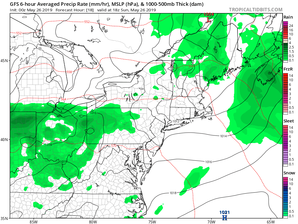
Radar Simulation Computer Models
HRRR Model —> slider
[metaslider id=76854]
Reminder: Storms will be MOST LIKELY between this evening and Monday morning
NAM 3 Km —> slider
[metaslider id=76873]
Looking Ahead
We will be in a pattern with a chance of showers almost every day next week. We will be in the storm track which also keeps us out of the main heat. We will get a couple of hit days, but June will start cooler.
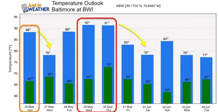
Temperature Outlook
We will get a couple of hot days, but the cooler pattern will dominate into the start of June.
Maryland Trek 6
Our look got an upgrade, but we have the same purpose. Please click the logo take a look at our new page.
- Consider joining our team for the week, a single day, or even as a sponsor.

Support Our Nonprofit:
Proceeds go to our programs Providing FREE holistic care for kids in cancer treatment and up to 5 years post treatment and caregivers.
![]()
Shine On
Proceeds from all sales go to Just In Power Kids. Click the image to shop and show your support.

Love Maryland Shirts and Hoodies
This shirt was designed by my ‘bonus’ daughter Jaiden. The hoodie has been the biggest hit, so our promotion has been extended until the end of this week.
|
||
|
Show your love for Maryland and make this 14 year old artist and her mom extra proud
|


Please share your thoughts, best weather pics/video, or just keep in touch via social media
-
Facebook: Justin Berk, Meteorologist
-
Twitter: @JustinWeather
-
Instagram: justinweather
Related Links:
Was Your County Not Included?
Click this map for more on the regional forecast zones
