Thursday May 23 2019
Today is our day to pay close attention to developing weather. The Storm Prediction Center has much of Pennsylvania and central Maryland in the Enhanced Risk for Severe Storms. The prime time wil be between 3 PM and 7 PM. It does not promise you will get storms that turn severe, but it is likely to be nearby.
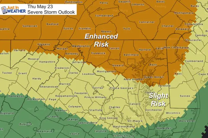
Severe Storm Qualifier:
- Winds over 58 mph
- Large hail over 1 inch diameter
- Isolated Tornados
Please note that as we get closer, these are potential alerts to be issued.
Severe Thunderstorm Watch: A broad area and window with a 4 to 6 hour time frame. This means it MIGHT happen.
Severe Thunderstorm Warning: A focused area like a county usually with a 30 to 60 minute time frame. This means it IS HAPPENING NOW.
Tornado Warning: A focused area and time frame. This would list towns in a likely path within a 15 to 45 minute window.
After today, we should get a break into the holiday weekend, with a little cool down. Temperature will build back up with afternoon storms Sunday and Memorial Day.
Local Weather Stats For May 23, 2019 in Baltimore
Average High: 76ºF
Record High: 98ºF in 1925
Average Low: 54ºF
Record Low: 39ºF in 1961
Sunrise: 5:46 AM
Sunset 8:20 PM
*Daylight = 1:33 longer than yesterday
*Bay Water Temperature = 66ºF at Thomas Pt. Light House
Weather Forecast Below
Keep In Touch Every Day
Just in case you don’t get all posts on your social media feed, stay up to date with the latest info…
Click here to sign up for email alerts…. Be the first to hear any new weather.
Maryland Trek 6
Our look got an upgrade, but we have the same purpose. Please click the logo take a look at our new page.
- Consider joining our team for the week, a single day, or even as a sponsor.

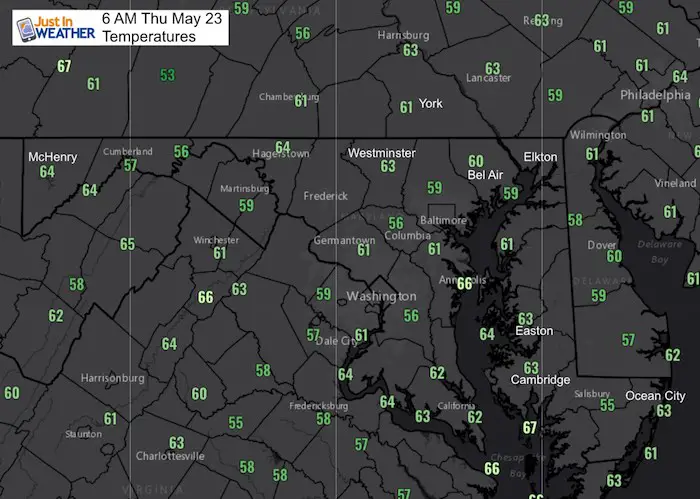
Temperatures
Morning Temperatures
It’s warm, and this afternoon will turn hot and a little more humid.
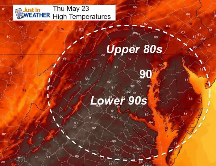
High Temperatures Today
Severe Storm Risk Today
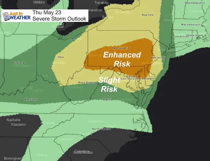
Here is the wider map view of the potential for severe storms today. It is shown to be more likely in PA for storms to form and then drop into Maryland. But the short range models actually show more risk with higher heat in central Maryland.
Storm Models Today
Morning Radar Loop (5 Hours up to 6:30 AM)
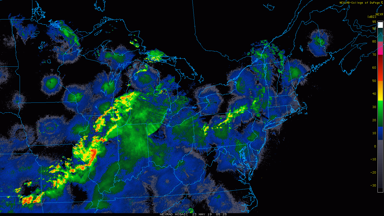
This morning
While not much is on the radar this morning, there is a hint of upper level energy to spark some showers along the MD/PA line between 9 AM and 11 AM.
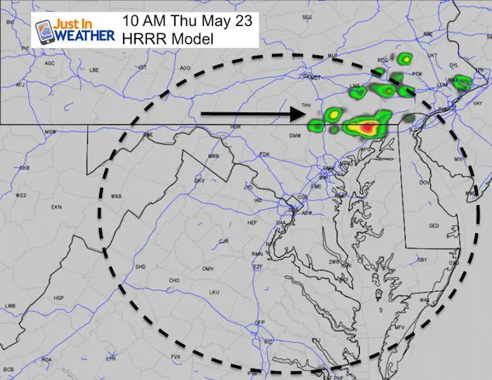
Afternoon Storm Simulation —> slider
This is the HRRR Model showing one possible scenario. Note the model are NOT perfect. Sometimes they miss activity or the timing can be off by an hour.
[metaslider id=76793]
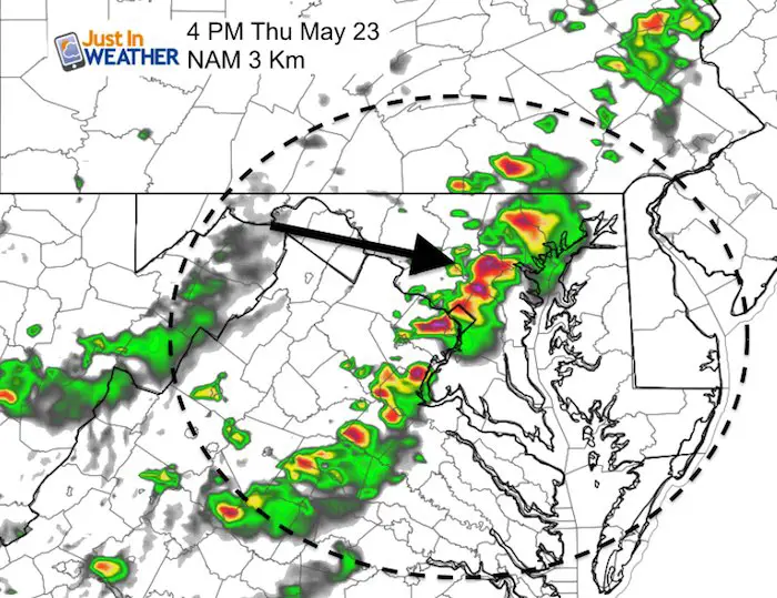
The NAM Model at 4 PM
This is just to compare a more defined line of storms crossing metro areas at 4 PM
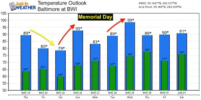
Temperature Outlook
A refreshing air mass arrives for the start of the weekend. Heat returns Sunday with some storms. Memorial Day may have some storms, but overall looks nice at this time.
Support Our Nonprofit:
Proceeds go to our programs Providing FREE holistic care for kids in cancer treatment and up to 5 years post treatment and caregivers.
![]()
Shine On
Proceeds from all sales go to Just In Power Kids. Click the image to shop and show your support.

Love Maryland Shirts and Hoodies
This shirt was designed by my ‘bonus’ daughter Jaiden. The hoodie has been the biggest hit, so our promotion has been extended until the end of this week.
|
||
|
Show your love for Maryland and make this 14 year old artist and her mom extra proud
|


Please share your thoughts, best weather pics/video, or just keep in touch via social media
-
Facebook: Justin Berk, Meteorologist
-
Twitter: @JustinWeather
-
Instagram: justinweather
Related Links:
Was Your County Not Included?
Click this map for more on the regional forecast zones
