Tuesday May 7 2019
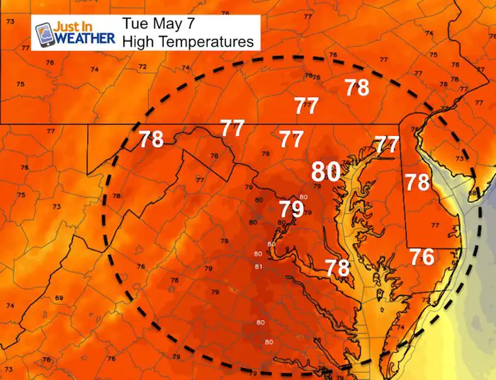
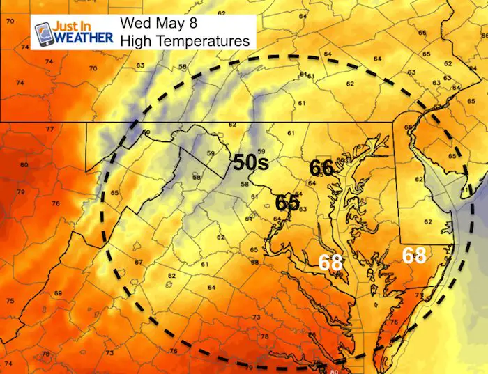
If you enjoyed the weather yesterday, you may really like today. We just have to get through some morning fog, but the sun will come out and warm us close to 80ºF this afternoon. Then the wet pattern beings to return. Showers will arrive in southern Maryland tomorrow and may creep north during the afternoon. But the outlook brings back something most of us would not like to see: Rain on Friday, and the weekend is looking more wet. This includes Sunday! Mothers Day rain is worth considering an indoor back up plan.
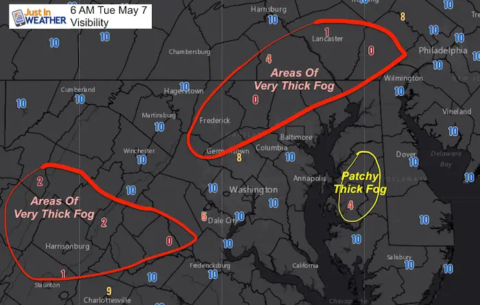
Morning Set Up
Fog is not everywhere, but some places like northern Maryland and southern PA it is very thick. As of 6 AM, the visibility at Westminster was near Zero! Be careful driving in Carroll, Frederick, and Northern Baltimore County on I-83 back and forth to York.
Temperatures
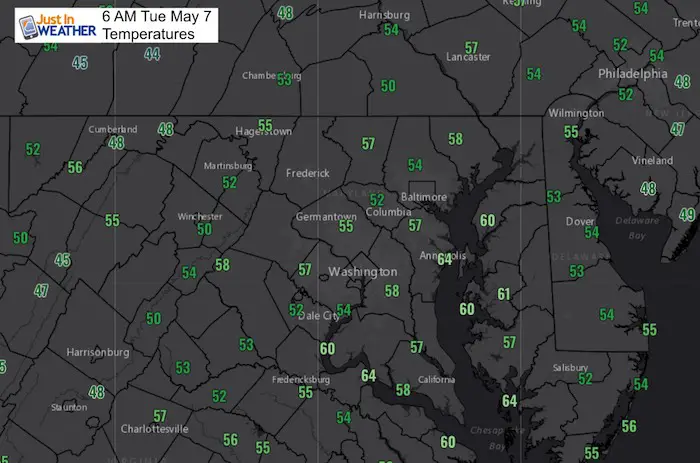
Local Weather Stats For May 7, 2019 in Baltimore
Average High: 71ºF
Record High: 96ºF in 1930
Average Low: 49ºF
Record Low: 33ºF in 1970
*Record Snow: None
Sunrise: 6:01 AM
Sunset 8:05 PM
*Daylight = 2:05 longer than yesterday
*Bay Water Temperature = 63ºF at Thomas Pt. Light House
Weather Forecast Below
Keep In Touch Every Day
Just in case you don’t get all posts on your social media feed, stay up to date with the latest info…
Click here to sign up for email alerts…. Be the first to hear any new weather.
Maryland Trek 6
Our look got an upgrade, but we have the same purpose. Please click the logo take a look at our new page.
- Consider joining our team for the week, a single day, or even as a sponsor.


New Partner
Buchanan Kia of Westminster is a supporter of Just In Power Kids and Maryland Trek 6 in August 2019.
Tuesday Afternoon Highs
Wednesday Afternoon Highs
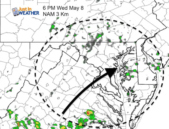
Wednesday Showers
Morning
Southern Maryland should get some rain starting in the morning.
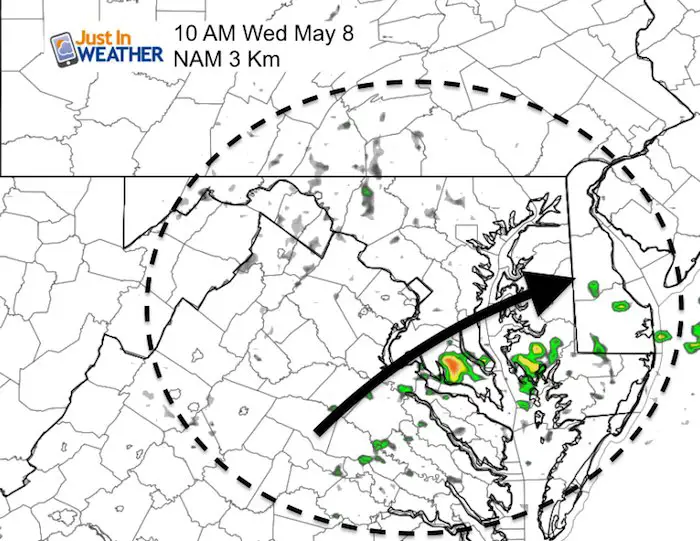
Afternoon
Showers will be scattered later in the day, but short up the Eastern Shore and northern Maryland into souther PA.
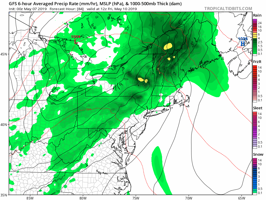
Looking Ahead:
This rain animation is between Friday morning and Sunday evening.
- Friday: Rain
- Saturday: Scattered afternoon showers
- Sunday Mothers Day: Rain
Temperature Trending Cooler
With the weekend rain, colder air will settle in. The jet stream shows that colder pattern (blue) through next week.
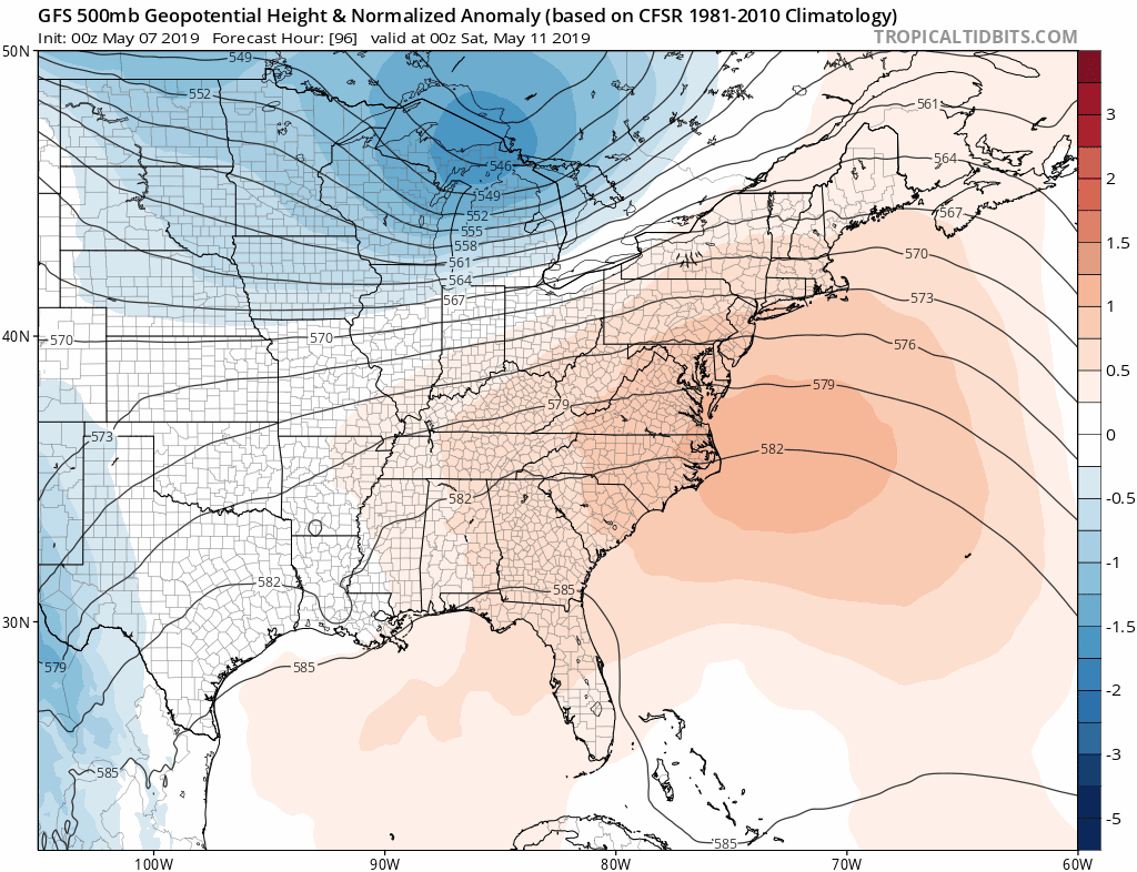
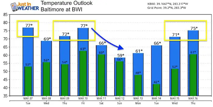
Temperature Outlook
At this point, Sunday looks similar to last Sunday with rain and temps into the 50s. The low temperatures are worth a focus early next week. This model bottoms out Tuesday morning at 42ºF at BWI. That means 30s are likely (with frost) inland).
Please share your thoughts, best weather pics/video, or just keep in touch via social media
-
Facebook: Justin Berk, Meteorologist
-
Twitter: @JustinWeather
-
Instagram: justinweather
Related Links:
Was Your County Not Included?
Click this map for more on the regional forecast zones
