Sunday February 10 2019
Snow will arrive tonight and impact much of our area Monday morning. The cold temperatures have chilled the ground enough to allow for stickage. The first wave tonight should be light, but enough to impact travel Monday morning. The storm is still developing and may enhance on top of us, making for some pushing of moderate snow in the morning. But also some warming during the day, then a second push of snow and ice Monday night and Tuesday.
A Winter Weather Advisory has been issued for:
- Much of central Maryland, including metro DC/Annapolis to the PA line.
- northern Virginia, northern Delaware, metro Philadelphia, southern New Jersey.
- Southern PA: No Advisory yet??? NWS State College PA should issue an advisory or Winter Storm Warning soon. It is up to them, not me.

Due to the confusion from NWS, I am showing my call first to elaborate. See the forecast maps below
My Call For Snow and Ice
Southern PA and northern Maryland will be in the cold zone the longest. This includes snow tonight into Monday morning. Then snow Monday night to wintry mix to ice lasting into Tuesday afternoon or evening. This is where I expect the most snow and ice. As of this time, the area encircled in the white line are most likely to get over 5 inches of snow.

Storm Notes:
The snow will be a minor impact on Monday morning.
The transition zone will be between Washington and Baltimore. This region will be within one to two degrees of freezing. That will make or break if there is impact on the roads.
The biggest impact will be snow and icing Monday night into Tuesday morning!
Faster change to rain along and south of I-95
Longer snow and ice impact northwest of the big cities.
- Nearby NW suburbs likely 2″ to 4″ snow is expected. Farther northwest encircled in white could get 5″+. That is potential, not a promise.
- In Maryland: Northern Harford, northern Baltimore, Carroll, western Howard, Frederick, and Washington Counties
- Southern Pennsylvania: including Adams, York, and Lancaster Counties.
Forecast Maps are below, first here is the set up
Keep In Touch Every Day
Just in case you don’t get all posts on your social media feed, stay up to date with the latest info…
Click here to sign up for email alerts…. Be the first to hear any new weather.
New Partner
Buchanan Kia of Westminster is a supporter of Just In Power Kids and Maryland Trek 6 in August 2019.
Morning Maps
Temperatrues
Many teens and 20s helped to chill the ground to support stickage later

Surface Weather
The storm is still forming, but looking more like an event with snow and ice across the nation’s midsection.

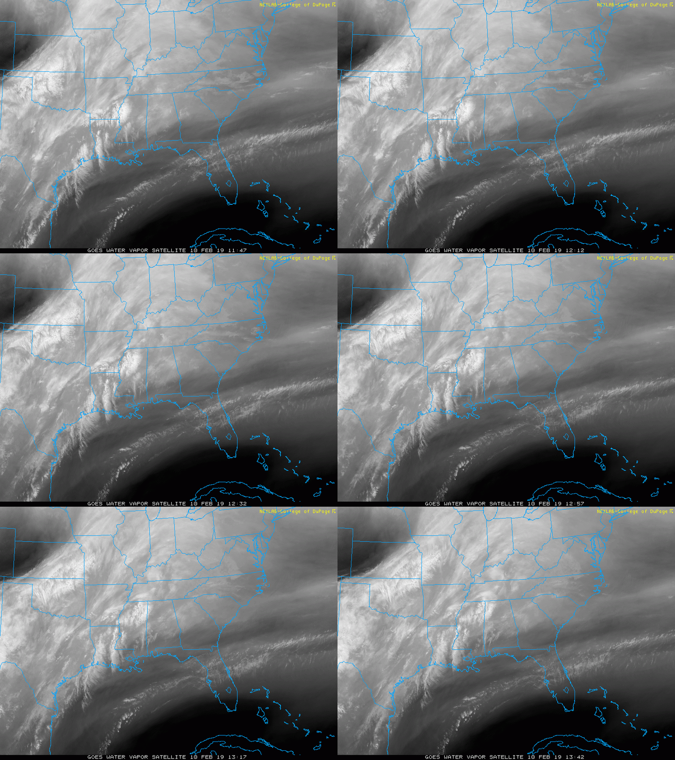
Satellite Loop
When Will The Snow Arrive?
HRRR Model- First Flakes
- Northern zones may get the snow after 8 PM
- Central Maryland more likely after 10 PM

NAM 3 Km Model —-> slider
[metaslider id=72839]
Temperatures Monday Morning

Snow from Round 1
Notice much of central Maryland south of Baltimore don’t show much. This is where a slushy mix is expected and should rise to freezing before dawn.
The surge of 2″+ as this moves east from Baltimore, Harford, and Cecil Co in Maryland… into DE and Southern NJ.

FITF and SnowStix
Complete Storm Tracking
European (ECWMF) —-> slider
[metaslider id=72868]
My Call Again

Please share your thoughts, best weather pics/video, or just keep in touch via social media
-
Facebook: Justin Berk, Meteorologist
-
Twitter: @JustinWeather
-
Instagram: justinweather
New Colors
We are giving 10% of each sale to Just In Power Kids: Providing FREE holistic care for pediatric oncology patients.
Related Links:
Winter Outlook
My Winter Outlook 2018-19: Multiple Nor’Easters and more snow
Interactive Snow Report
November 15 Snow Reports- Interactive Map Compared To My Forecast
Winter Snow And Top 5 Wet Years
Snowfall Seasons at Beginning and End of Top 5 Wet Years In Baltimore
Related Winter Outlooks
Solar Cycle: When Sun Spots Are Low We Get More Snow
El Nino Modoki May Enhance Snow Chances
Sweet Spot: Hitting 70ºF on Halloween is followed by more winter snow
Will A Wet Summer Bring A Snowy Winter?
NOAA Winter 2018-2019 Outlook Explained: This Actually Supports Snow
Winter Outlook From Two Different Farmers Almanacs


