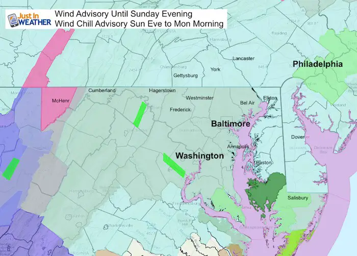
Noon Sunday January 20 2019
The freezing air is already reaching the northern and western parts of our area. Thew winds will pick up as the cold air arrives and falls rapidly. The Flash Freeze relates to anything wet that will ice in a hurry. However there will be some areas where the wind helps to dry out before that happens. I have some Flash Freeze notes I posted online to show below.
For now, here is a look at local temperatures at noon, then a slider showing the hourly temperature forecast timeline. This is a situation where you will not want to be outside regardless of ice or not.

Keep In Touch Every Day
Click here to sign up for email alerts…. Just in case you don’t get the post on your social media feed
Where is the Freeze Now?
Temperatures at Noon —> slider
Turn your phone sideways for a larger view
[metaslider id=71559]
Flash Freeze Notes
??❄️
- Anything still wet will freeze within minutes to an hour of dropping below 32°F.
- There will be spots that dry before then, but not all.
- There will be roads that are OK as a combination of some drying and GREAT WORK from road crews ?
- This will not be like the movie The Day After Tomorrow. But worth alerting for quick icing. It will be worse in northern counties where it’s more wet and freezes earlier.
- Ice will form on steps, sidewalks, and driveways. Decks, wet car doors, and windshield wipers will freeze too.
- It’s a big deal because usually the cooling is more gradual.
Hourly Temperature Timeline —> slider
See the Midnight and Morning Conditions below
[metaslider id=71535]
Midnight Conditions


Monday Morning


Looking Ahead:
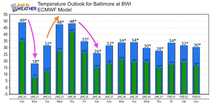
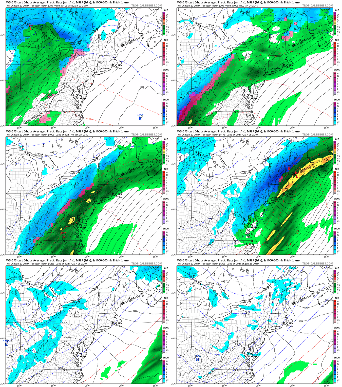
We may do this again during the week. The next storm appears to be on the same track with a warm up and rain Wednesday, followed by an arctic blast and maybe some snow to add to the freezing Thursday.
Temperature Outlook

Please share your thoughts, best weather pics/video, or just keep in touch via social media
-
Facebook: Justin Berk, Meteorologist
-
Twitter: @JustinWeather
-
Instagram: justinweather
Keep In Touch Every Day
Click here to sign up for email alerts…. Just in case you don’t get the post on your social media feed
Related Links:
Winter Outlook
My Winter Outlook 2018-19: Multiple Nor’Easters and more snow
Interactive Snow Report
November 15 Snow Reports- Interactive Map Compared To My Forecast
Winter Snow And Top 5 Wet Years
Snowfall Seasons at Beginning and End of Top 5 Wet Years In Baltimore
Related Winter Outlooks
Solar Cycle: When Sun Spots Are Low We Get More Snow
El Nino Modoki May Enhance Snow Chances
Sweet Spot: Hitting 70ºF on Halloween is followed by more winter snow
Will A Wet Summer Bring A Snowy Winter?
NOAA Winter 2018-2019 Outlook Explained: This Actually Supports Snow
Winter Outlook From Two Different Farmers Almanacs
Maryland Winters: Snowfall Maps and Baltimore Snow History


