 Saturday November 24 2018
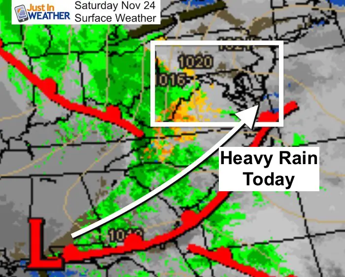
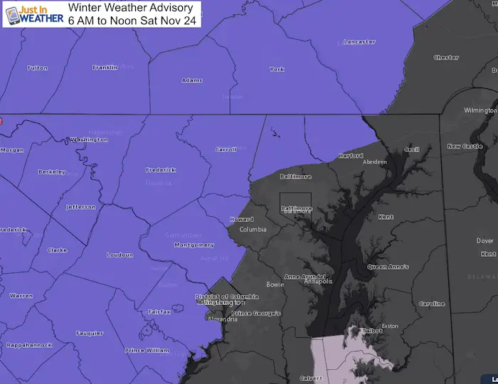
A Winter Weather Advisory is in place for many inland areas until noon, but the rain appears to be more of an impact in the mountains this morning. Temperatures are rising but the cold ground is the main reason for the concern. I think the arrival of the rain wil be late enough for many areas to thaw. The bigger issue will be the heavy rain this afternoon. Below is a look at the radar simulation.
Small Business Saturday
I do run a small business. In fact, I am partners in another, so essentially I am part of two. Faith in the Flakes products employs a small business in Carroll County, where the Maryland Print House makes my products. SnowStix is run with my partners Thatcher and Melita Brinton in Timonium. Today would be a great day to get your holiday gifts and support my local partnerships with other small businesses. Check out our products for the snow lover on your list.
A portion of proceeds as always will support Just In Power Kids– Free Holiday Care For Kids in cancer treatment
FITF Store Is Open And SnowStix
Local Weather Stats For November 24 in Baltimore
Average High: 53ºF
Record High: 73ºF in 1979
Average Low: 34ºF
Record Low: 17ºF in 1989
*Record Snow: 5″ in 19338
Sunrise: 6:59 AM
Sunset 4:46 PM
*Daylight = 1:34 shorter than yesterday
*Bay Water Temperature = 47ºF at Thomas Pt. Light House
Morning SnapShot
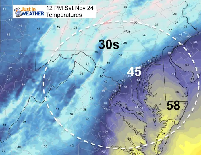
The Winter Weather Advisory goes until noon, and there may be isolated spots with drizzle and glaze, but check out the temps below…
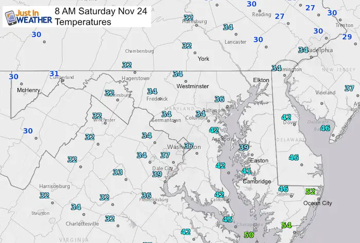
Temperatures
Radar Loop (2 Hours Ending 8 AM)
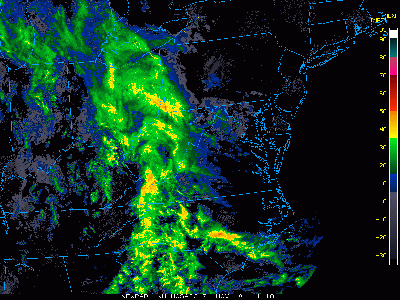
Radar Simulation —> slider
The heaviest rain will arrive mid afternoon. There could be a ruble of thunder mixed in…
[metaslider id=68781]
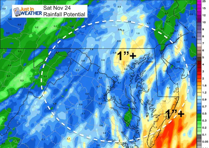
Rainfall Potential
Another 1 inch event
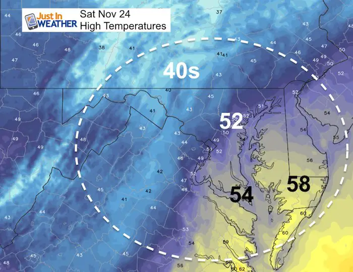
Temperatures
We should thaw quickly…
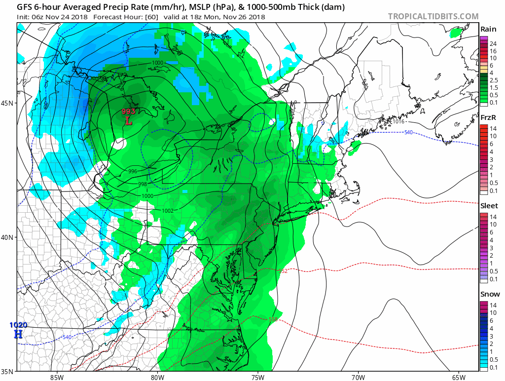
Storm Animation
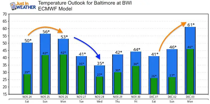
Temperature Outlook
We will have another cold snap next week, followed by a warm up at the end of next weekend. This surge of warm December air is a precursor to the next push of winter… Keep watching for the first week of December for the dramatic change.
Extended Outlook
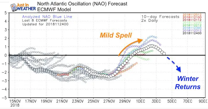
The NAO appears to be rising, but will crash again during the first week of December. The period after December 5 appears to be the timer frame to watch. Multiple storms are expected in the east and eventually the cold air will catch up in time.
Keep In Touch Every Day
Click here to sign up for email alerts…. Be the first to hear the big news over the weekend
Also- Just in case you don’t get the post on your social media feed
Please share your thoughts, best weather pics/video, or just keep in touch via social media
-
Facebook: Justin Berk, Meteorologist
-
Twitter: @JustinWeather
-
Instagram: justinweather
Keep In Touch Every Day
Click here to sign up for email alerts…. Just in case you don’t get the post on your social media feed
Related Links:
Winter Outlook
My Winter Outlook 2018-19: Multiple Nor’Easters and more snow

Interactive Snow Report
November 15 Snow Reports- Interactive Map Compared To My Forecast

Winter Snow And Top 5 Wet Years
Snowfall Seasons at Beginning and End of Top 5 Wet Years In Baltimore

Related Winter Outlooks
Solar Cycle: When Sun Spots Are Low We Get More Snow
El Nino Modoki May Enhance Snow Chances
Sweet Spot: Hitting 70ºF on Halloween is followed by more winter snow
Will A Wet Summer Bring A Snowy Winter?
NOAA Winter 2018-2019 Outlook Explained: This Actually Supports Snow
Winter Outlook From Two Different Farmers Almanacs
Maryland Winters: Snowfall Maps and Baltimore Snow History

FITF and SnowStix Stores are now OPEN

Snowstix- We Need You To Measure Snow Too
We are giving 10% of each sale to Just In Power Kids: Providing FREE holistic care for pediatric oncology patients.
