Friday November 23 2018
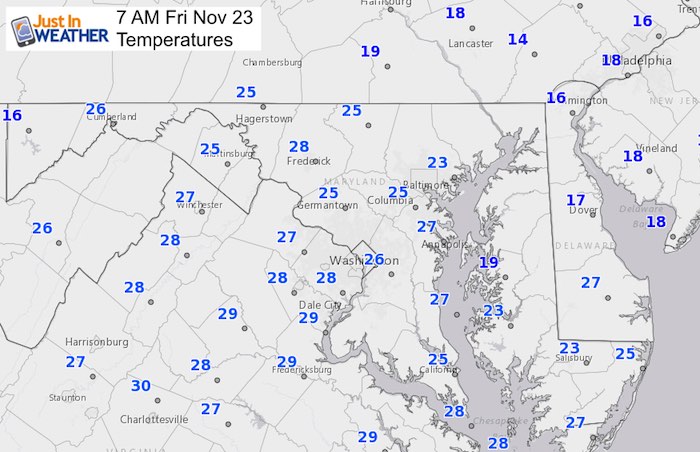
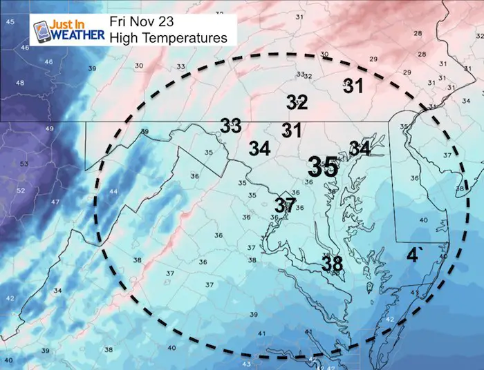
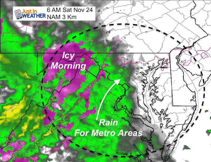
This current cold snap has bottomed out this morning. There will be some clouds today, but it will remain dry and cold. Saturday will bring in the next storm and it follows the trend of prior systems arriving a little sooner. That may link up with the morning cold air and produce some icy conditions in the mountains just before sunrise. But it will be rain much of the day for metro areas. That rain will be heavy at times, but end Sunday leaving a mild end to the weekend.
Local Weather Stats For November 23 in Baltimore
Average High: 53ºF
Record High: 74ºF in 1979
Average Low: 35ºF
Record Low: 16ºF in 1880
*Record Snow: 1.8″ in 1989
Sunrise: 6:58 AM
Sunset 4:46 PM
*Daylight = 1:36 shorter than yesterday
*Bay Water Temperature = 47ºF at Thomas Pt. Light House
Special Announcements And Keep In Touch Every Day
Click here to sign up for email alerts…. Be the first to hear the big news over the weekend
Also- Just in case you don’t get the post on your social media feed
Consider My Small Business: Great Holiday Gifts For Snow Lovers
A portion of proceeds will support Just In Power Kids- Free Holiday Care For Kids in cancer treatment

Just In: #FITF Hats

Snowstix- We Need You To Measure Snow Too
We are giving 10% of each sale to Just In Power Kids: Providing FREE holistic care for pediatric oncology patients.

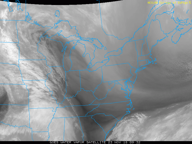
Morning
Satellite Animation
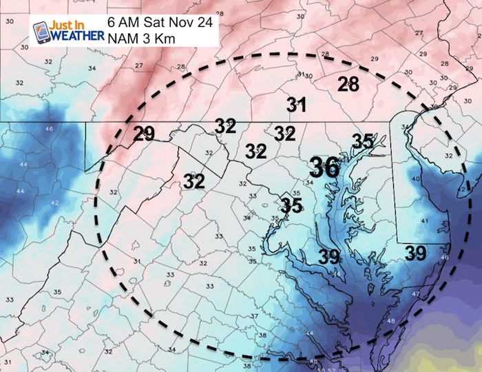
Temperatures
Afternoon
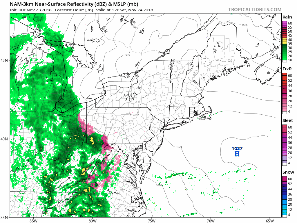
Saturday – Starting With Ice?
The precipitation will start as sleet or freezing rain in the mountains. There is a small chance it arrives early enough to impact parts of Frederick and Carroll County as well. I will update this later today. But warmer air will spread in with rain for metro areas most of the day.
Saturday Rain Animation
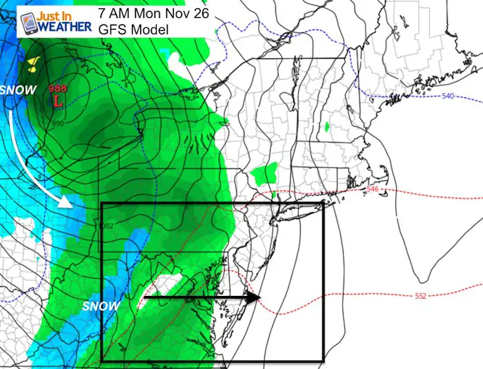
Monday Rain
This storm will be centered in the Great Lakes and bring us rain on the warmer side. But cold air will fall in place behind it.
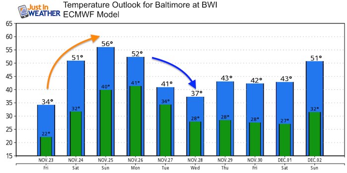
Temperature Outlook
Please share your thoughts, best weather pics/video, or just keep in touch via social media
-
Facebook: Justin Berk, Meteorologist
-
Twitter: @JustinWeather
-
Instagram: justinweather
Keep In Touch Every Day
Click here to sign up for email alerts…. Just in case you don’t get the post on your social media feed
The FITF Store Is Open With Gear And SnowStix
Related Links:
Winter Outlook
My Winter Outlook 2018-19: Multiple Nor’Easters and more snow

Interactive Snow Report
November 15 Snow Reports- Interactive Map Compared To My Forecast

Winter Snow And Top 5 Wet Years
Snowfall Seasons at Beginning and End of Top 5 Wet Years In Baltimore

Related Winter Outlooks
Solar Cycle: When Sun Spots Are Low We Get More Snow
El Nino Modoki May Enhance Snow Chances
Sweet Spot: Hitting 70ºF on Halloween is followed by more winter snow
Will A Wet Summer Bring A Snowy Winter?
NOAA Winter 2018-2019 Outlook Explained: This Actually Supports Snow
Winter Outlook From Two Different Farmers Almanacs
Maryland Winters: Snowfall Maps and Baltimore Snow History

FITF and SnowStix Stores are now OPEN

Snowstix- We Need You To Measure Snow Too
We are giving 10% of each sale to Just In Power Kids: Providing FREE holistic care for pediatric oncology patients.
