 Monday September 17 2018
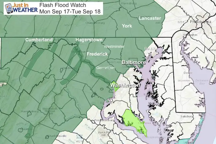
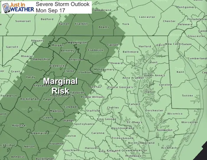
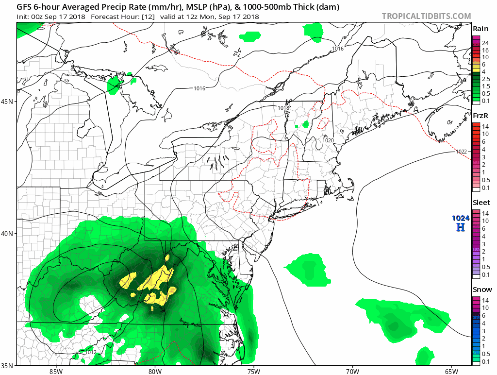
Florence is no longer a tropical storm, and the National Hurricane Center has stopped issuing advisories. But the remnant Low will bring us some rain today and tomorrow. The core of the storm and heavy rain will be just west of the big cities with the potential for 1 to 3 inches of rain. Light rain moves in this morning, then we increased the threat of storms this afternoon into Tuesday. Some may be heavy, but they will be spotty.
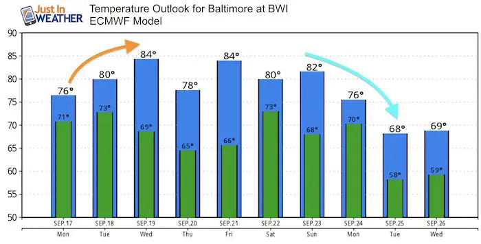
Considering the wet summer and soggy soil, our flood potential is similar to what we have already experienced, so that should limit the anxiety of this former hurricane. The outlook shows a big pattern change that will make it feel much more like autumn next week as temperatures will drop. But we have a few more muggy, wet days first. Here’s a look:
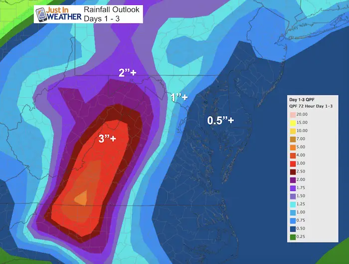
Rain Potential
The heaviest rain will bee inland from I-95 with 1 to 3 inches. The most will be in the mountains. The big cities to Delmarva expect a general 0.5″ to 1.0″. Any individual heavy cell could boost that.
Local Weather Stats For September 17 in Baltimore
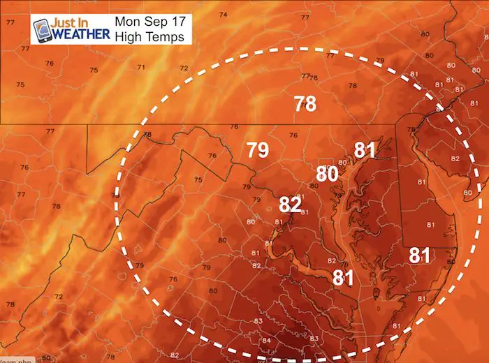
Average High: 78ºF
Record High: 98ºF in 1991
Average Low: 57ºF
Record Low: 44ºF in 1984
Sunrise: 6:49 AM
Sunset 7:15 PM
*Daylight = 2:32 shorter than yesterday
*Bay Water Temperature = 75ºF at Thomas Pt. Light House
Also see:
Winter Outlook From Two Different Farmers Almanacs
Now Scheduling School Assemblies
- Storm Smart – Severe Weather (September, October; March through May)
- FITF – Snow and ice (November through March)
Programs for K through Middle School
Choose flat fee or FREE along with a spirit wear shirt fundraiser that earns your school money.
Morning Snap Shot
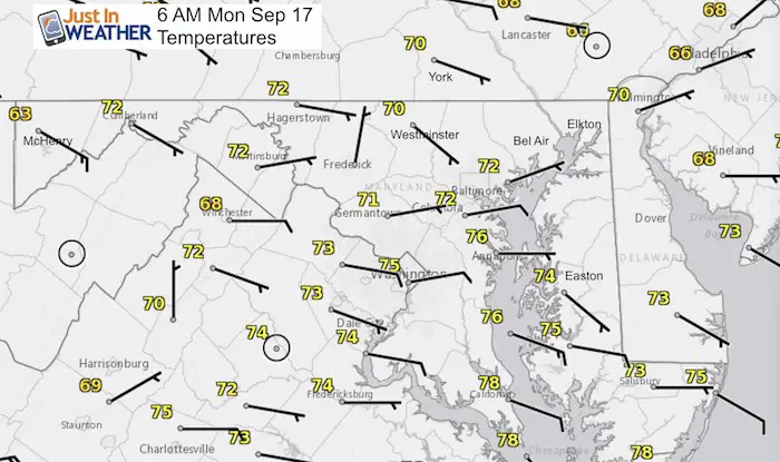
Temperatures/Wind:
It is warm and muggy again. The east wind will primarily be an issue with sloshing water on the Bay… piling on the western shore.
Radar Loop: Ending 6 AM

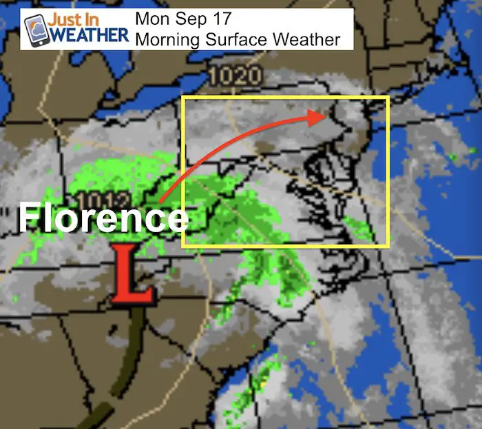
Surface Weather Map
Radar Simulation Today —> slider
Rain spreads in during the morning, then storms build intros afternoon. The heaviest storms may be mid afternoon through evening and tonight.
[metaslider id=65834]
Severe Storm Risk
High Temperatures
Rain Animation This Week
Temperature Outlook
Keep In Touch Every Day
Click here to sign up for email alerts…. Just in case you don’t get the post on your social media feed
Please share your thoughts, best weather pics/video, or just keep in touch via social media
-
Facebook: Justin Berk, Meteorologist
-
Twitter: @JustinWeather
-
Instagram: justinweather
Love Maryland Shirt Designed By Jaiden
 |
|
This shirt was designed by my ‘bonus’ daughter Jaiden. All proceeds will go to Just In Power Kids and free holistic therapy for kids in and post cancer treatment.
Show your love for Maryland and make this 14 year old artist extra proud
|
![]()
 Get the award winning Kid Weather App I made with my oldest son and support our love for science, weather, and technology. Our 3 year anniversary of the release and our contribution to STEM education is this November. It has been downloaded in 60 countries, and works in both temperature scales. With your support we can expand on the fun introduction to science and real weather.