Thursday September 13 2018
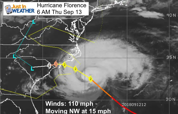
Hurricane Florence has weakened to a Category 2 overnight. Winds are now 110 mph and still very powerful. The lower category does not lower the threat to the east coast as there is still wave memory pushing water onshore and plenty of rain to dump as it slows to a crawl for the Carolinas. The outer clouds have reached Maryland as seen in the satellite loops below. Locally we will get showers, but not the main event. Our biggest impact will be on Friday with some areas seeing another round of showers Saturday afternoon. Overall a glancing blow and minor. See more details of the local impact below.
Local Weather Stats For September 13 in Baltimore
Average High: 79ºF
Record High: 97ºF in 1952
Average Low: 59ºF
Record Low: 42ºF in 1958
Sunrise: 6:45 AM
Sunset 7:18 PM
*Daylight = 2:32 shorter than yesterday
*Bay Water Temperature = 76ºF at Thomas Pt. Light House
Also see:
Winter Outlook From Two Different Farmers Almanacs
Video of Hurricane Hunter flying into the Eye and first call for track shifting
Wind and Storm Surge Expectations
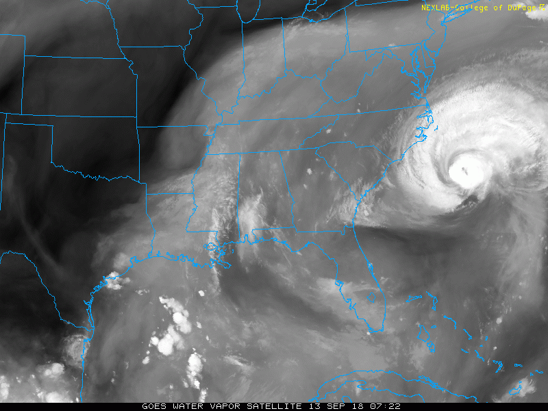
Hurricane Florence Satellite Loop
This is a better resolution view to show the high level moisture reaching southern Maryland and Delmarva… but the rain is still offshore.
Today:
Radar Simulation —> slider
There will be some showers southern PA this morning. Watch the movement of the next round this afternoon pushing east to west
[metaslider id=65601]
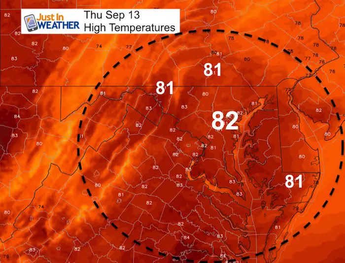
High Temperatures
It will be warm an muggy again
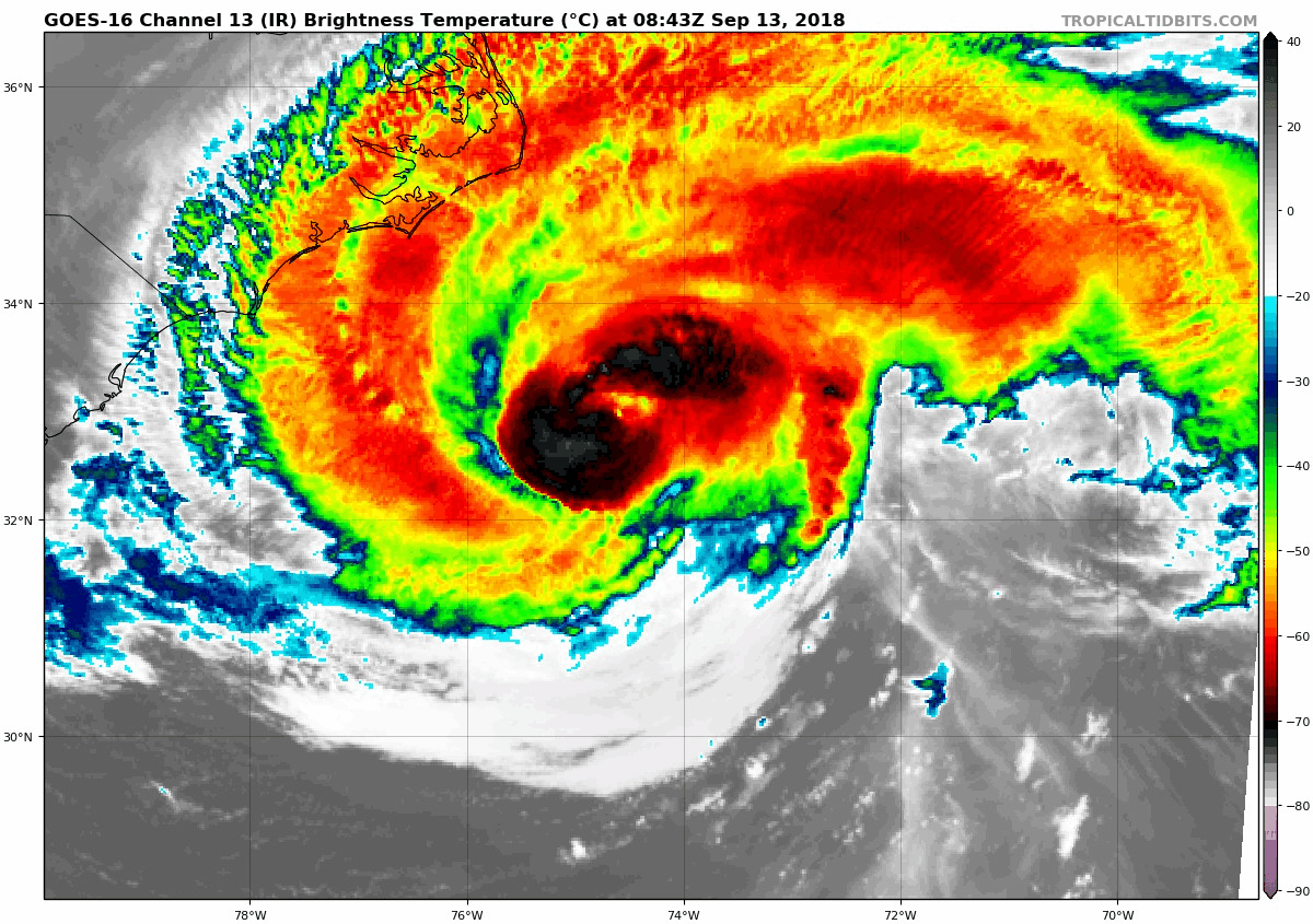
Hurricane Florence IR Satellite Loop
The outer rain bands have reached the North Carolina Outer Banks…
Dry air has wrapped in causing the weakening. It is expected to at least maintain intensity today and still produce life threatening flooding rain and storm surge in the path.
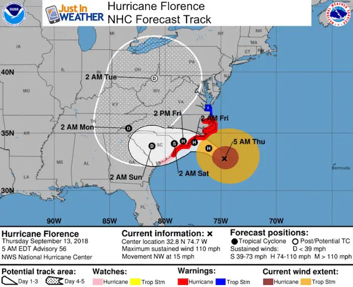
SUMMARY OF 500 AM EDT...0900 UTC...INFORMATION
----------------------------------------------
LOCATION...32.8N 74.7W
ABOUT 205 MI...325 KM ESE OF WILMINGTON NORTH CAROLINA
ABOUT 250 MI...405 KM ESE OF MYRTLE BEACH SOUTH CAROLINA
MAXIMUM SUSTAINED WINDS...110 MPH...175 KM/H
PRESENT MOVEMENT...NW OR 315 DEGREES AT 15 MPH...24 KM/H
MINIMUM CENTRAL PRESSURE...956 MB...28.23 INCHES
Forecast Track
Local Impact:
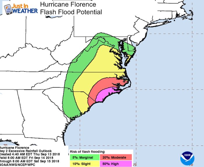
The Flash Flood potential in southern Maryland is 10% or less.
Impact On Maryland
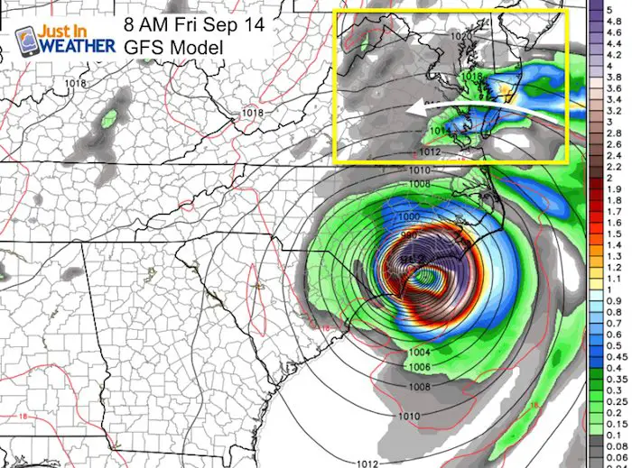
The GFS Model shows the heavier rain band reaching Ocean City Friday morning. But then the impact on our region will be more of an afternoon development. See the maps below.
Radar Simulation GFS —> slider
Rain bands will try to move through southern Maryland Friday morning. Then showers develop in the afternoon and again Saturday afternoon. Overall more dry hours. But in the showers winds can gust up to 35 mph. Water will remain high on the western shores.
Northern areas will have a nice weekend. Sunday will improve for southern Maryland.
[metaslider id=65622]
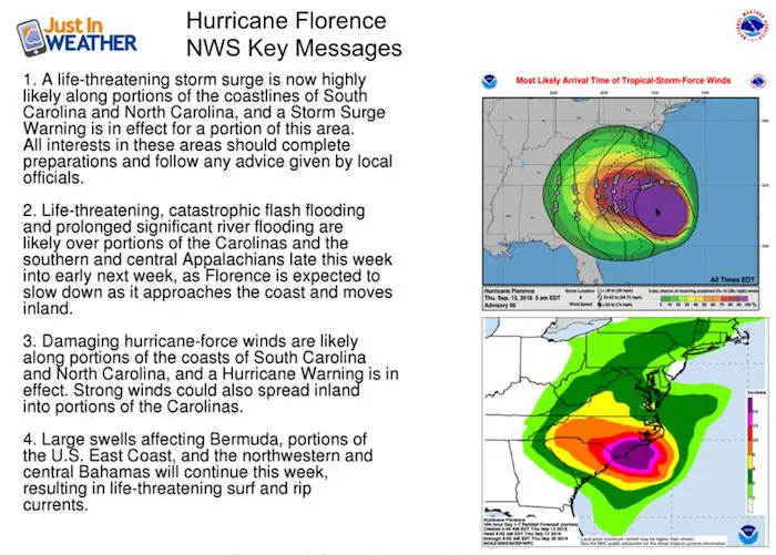
National Hurricane Center Notes
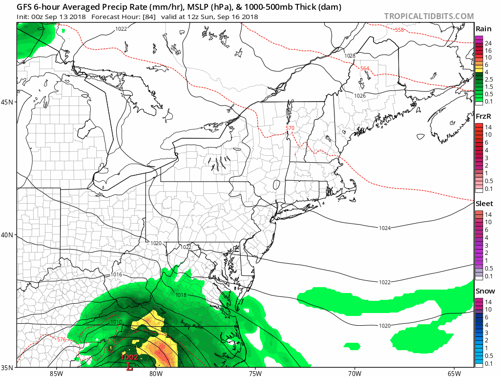
Rain Next Week?
Here is how the GFS Model shows the remnant Low of Florence track Sunday through Tuesday. Well to our north, but showers may arrive Tuesday
Keep In Touch Every Day
Click here to sign up for email alerts…. Just in case you don’t get the post on your social media feed
Please share your thoughts, best weather pics/video, or just keep in touch via social media
-
Facebook: Justin Berk, Meteorologist
-
Twitter: @JustinWeather
-
Instagram: justinweather
Love Maryland Shirt Designed By Jaiden
 |
|
This shirt was designed by my ‘bonus’ daughter Jaiden. All proceeds will go to Just In Power Kids and free holistic therapy for kids in and post cancer treatment.
Show your love for Maryland and make this 14 year old artist extra proud
|
Now Scheduling School Assemblies
- Storm Smart – Severe Weather (September, October; March through May)
- FITF – Snow and ice (November through March)
Programs for K through Middle School
Choose flat fee or FREE along with a spirit wear shirt fundraiser that earns your school money.
![]()
 Get the award winning Kid Weather App I made with my oldest son and support our love for science, weather, and technology. Our 3 year anniversary of the release and our contribution to STEM education is this November. It has been downloaded in 60 countries, and works in both temperature scales. With your support we can expand on the fun introduction to science and real weather.