Thursday June 28 2018
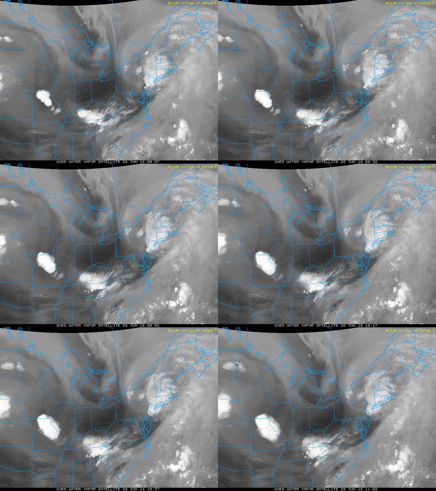
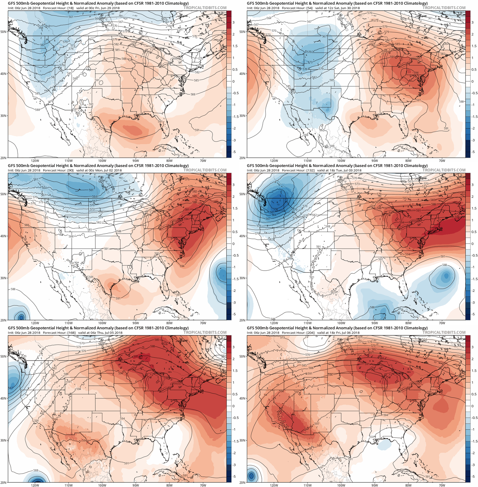
We still have a few showers today that will be of the popcorn variety, which I will show below. The sky should be clear enough this evening to view the Strawberry Moon. The full moon will be rising in Baltimore at 9:01 PM and brighten the summer night. This is not necessarily related to the weather, but it will mark a turning point for us. The jet stream is shifting and the heat in the nation’s heartland will be heading our way over the weekend and into the next. The abrupt change will switch not only to heat, but little to no rain over the next week. That may allow the soil to dry out a little and those on summer break to enjoy pool or boating time.
Stats For June 28 in Baltimore
Note: Full Moon rises at 9:01 PM in Baltimore. You might not see if by you for another 15 to 30 minutes depending on obstructions from trees, hills, or buildings to your east.
Average High: 86ºF
Record High: 99ºF in 2010
Average Low: 65ºF
Record Low: 51ºF in 1974
Sunrise: 5:42 AM
Sunset 8:37 PM
*Daylight = 0:24 shorter than yesterday
*Bay Water Temperature = 74ºF at Thomas Pt. Light House
Keep In Touch Every Day
Click here to sign up for email alerts…. Just in case you don’t get the post on your social media feed
Please Support Maryland Trek 5
329 miles hiking and biking in 7 days
To provide free integrated wellness programs for kids in and post cancer treatment
If you help my team get to $10,000 this week, you are eligible to win 1 of 10 Shine On Shirts
*If you want to join my team for a day, a few days, or the whole week, please ask me for more info.
Morning Set Up
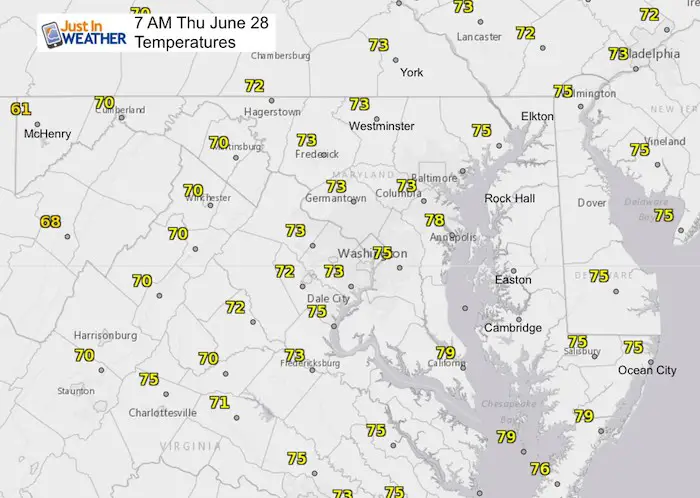
Temperatures
Satellite Loop
Radar Simulation —> slider
Popcorn showers on display. This type simply are scattered and pop up at any time. It’s almost like watching a movie to see where they form and move. They will be brief for a few hours this afternoon between noon and 6 PM
[metaslider id=63580]
High Temperatures Today
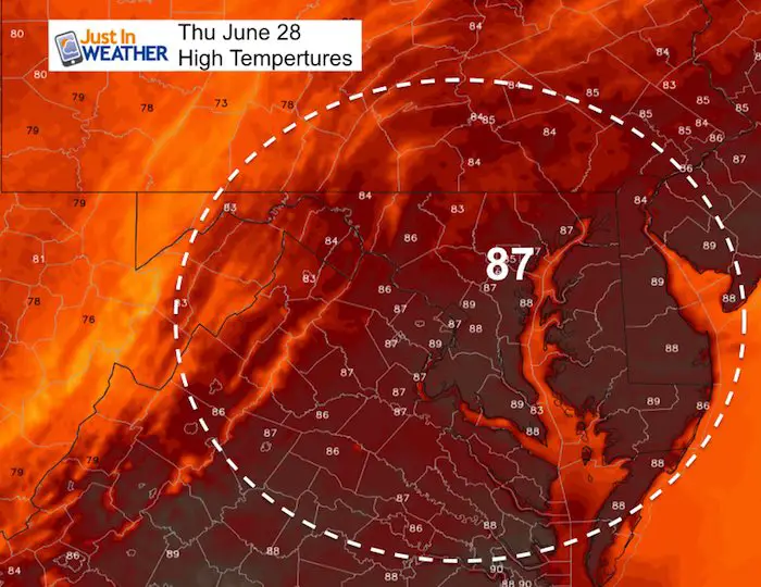
High Temperatures Friday
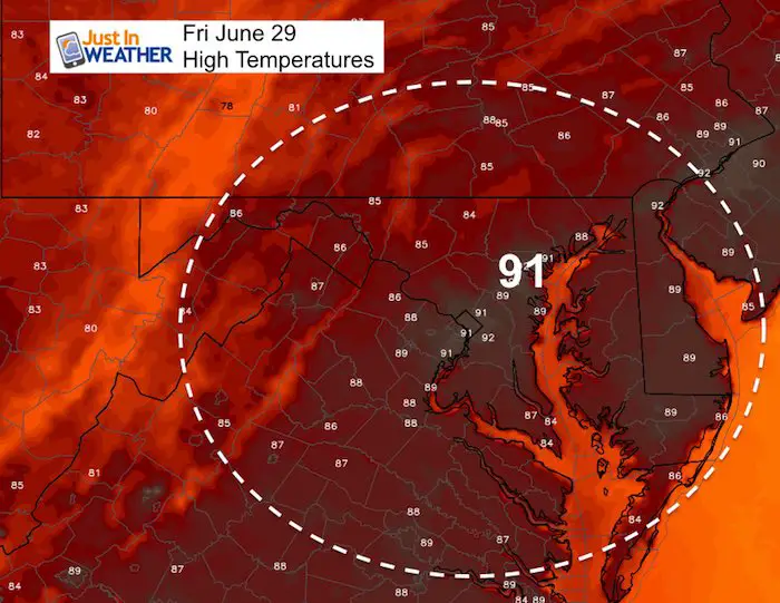
Heat Wave Building
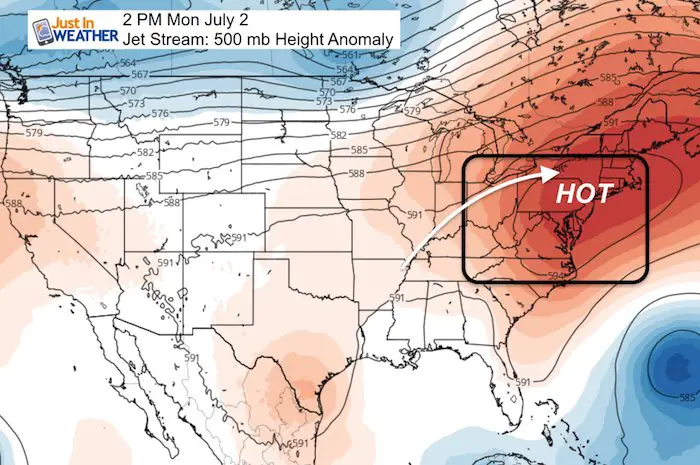
Jet Stream Animation
How Hot?
There has been some errors in the mid range modeling of temperatures lately. The European Model has been too cool and the GFS model too hot. The GFS has us over 100ºF for. few days, and I don’t buy it right now.
I would plan on three to five days of mid to upper 90s between Saturday and mid next week. Heat Index values are likely to top 100ºF making it dangerous for some afternoon outdoor activities. Just another side of summer we haven’t had to deal with yet this year. But we will…
Please share your thoughts, best weather pics/video, or just keep in touch via social media
-
Facebook: Justin Berk, Meteorologist
-
Twitter: @JustinWeather
-
Instagram: justinweather
Keep In Touch Every Day
Click here to sign up for email alerts…. Just in case you don’t get the post on your social media feed
Shine On
Proceeds from all sales go to Just In Power Kids. Click the image to shop and show your support.

 Get the award winning Kid Weather App I made with my oldest son and support our love for science, weather, and technology. Our 3 year anniversary of the release and our contribution to STEM education is this November. It has been downloaded in 60 countries, and works in both temperature scales. With your support we can expand on the fun introduction to science and real weather.

