 Saturday June 23 2018
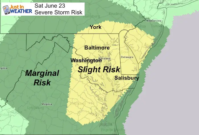
We have a slight risk for severe storms to erupt today. The morning is filled with low clouds and fog, but only an isolated shower. Any breaks of sun through the clouds will ignite the atmosphere with storms that can produce winds over 60 mph, large hail over quarter size, dangerous lightning, and a possibility of flooding. The prime focus will begin in the mountains orly afternoon, then shift to the east with metro areas watching storms near Frederick around 4 PM and central Maryland through 9 PM. See the timeline below.
Sunday should see an improvement, so get through today and the rest of the weekend will be salvageable.
Stats For June 23 in Baltimore
Note: Summer Begins at 6:07 AM Thursday June 21
Average High: 85ºF
Record High: 97ºF in 2010
Average Low: 64ºF
Record Low: 48ºF in 1992
Sunrise: 5:40 AM
Sunset 8:36 PM
*Daylight = 0:06 longer than yesterday
*Bay Water Temperature = 74ºF at Thomas Pt. Light House
Keep In Touch Every Day
Click here to sign up for email alerts…. Just in case you don’t get the post on your social media feed
Morning Set Up
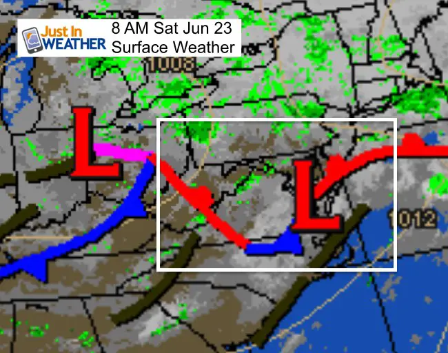
A stationary front is draped to our south keeping us on the cool side again. This will try to drift north and help spawn multiple showers and storms today. But we need sunlight and heat of the day to ignite the action…
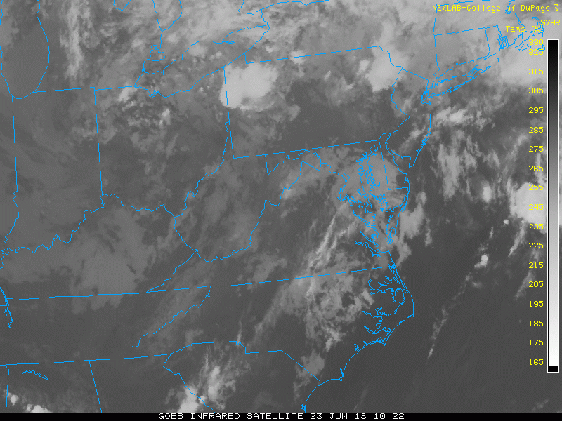
Satellite (2 Hour loop ending 8:17 AM)
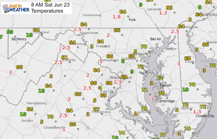
Temperatures
Foggy areas have low visibly marked with red numbers.
Now let’s talk about the rain
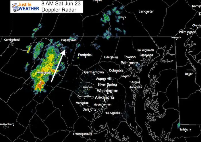
Doppler Radar at 8 AM shows this cluster of rain along Skyline Drive and I-81, moving to the north.
Radar Simulation –> slider
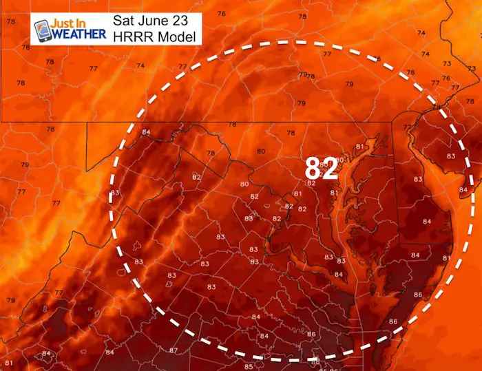
I started this at 8 AM to show that it is NOT perfect, but it is our best gauge. Here we can see the HRRR Model was showing a weaker cell, which means it may miss some of the smaller showers today. The timeline below should be considered with a 1 hour cushion for timing. There may be some wiggle room in the location as well. Just wanted to get you an idea:
One round of shows might arrive west of Baltimore around noon… this will be moving to the north.
The cluster near Hagerstown and Frederick around 4 PM, then reaching metro Baltimore between 6 PM and 10 PM. This will be moving to the east.
[metaslider id=63459]
High Temperatures
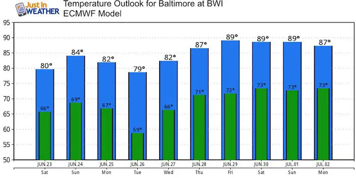
Temperature Outlook
Want summer heat? It looks like we should get into that pattern by next weekend.
Please share your thoughts, best weather pics/video, or just keep in touch via social media
-
Facebook: Justin Berk, Meteorologist
-
Twitter: @JustinWeather
-
Instagram: justinweather
Keep In Touch Every Day
Click here to sign up for email alerts…. Just in case you don’t get the post on your social media feed
Shine On
Proceeds from all sales go to Just In Power Kids. Click the image to shop and show your support.

![]()
 Get the award winning Kid Weather App I made with my oldest son and support our love for science, weather, and technology. Our 3 year anniversary of the release and our contribution to STEM education is this November. It has been downloaded in 60 countries, and works in both temperature scales. With your support we can expand on the fun introduction to science and real weather.